
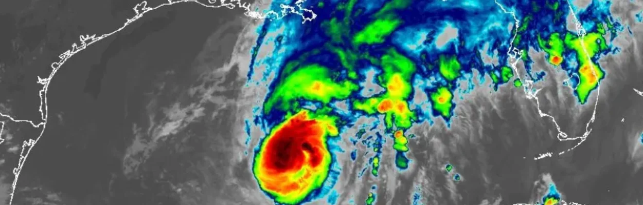
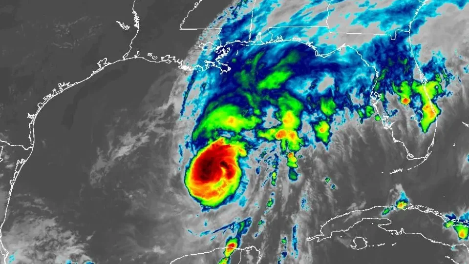
Satellite photo of Hurricane Isaias on Friday, Oct. 9, 2026. | NOAA
Published on October 9, 2026 at 9:28 am
Free local news and info, in your inbox at 6 a.m. M-F. Sign up for the Jacksonville Today newsletter.
As the core of Hurricane Isaias approaches the Alabama-Florida border, the potential for tornado activity is expected to increase across the eastern Florida Panhandle and portions of North Florida, where atmospheric conditions could support numerous rotating thunderstorms.
Typically, during a landfalling tropical cyclone, the chance of tornadic activity is elevated, but atmospheric conditions this time around are expected to be even more favorable and could resemble a pattern produced by Hurricane Milton in 2024.
Jacksonville Today thanks our sponsors. Become one.
During Milton, National Weather Service meteorologists issued 126 tornado warnings across the state and surveyed 45 tornadoes.
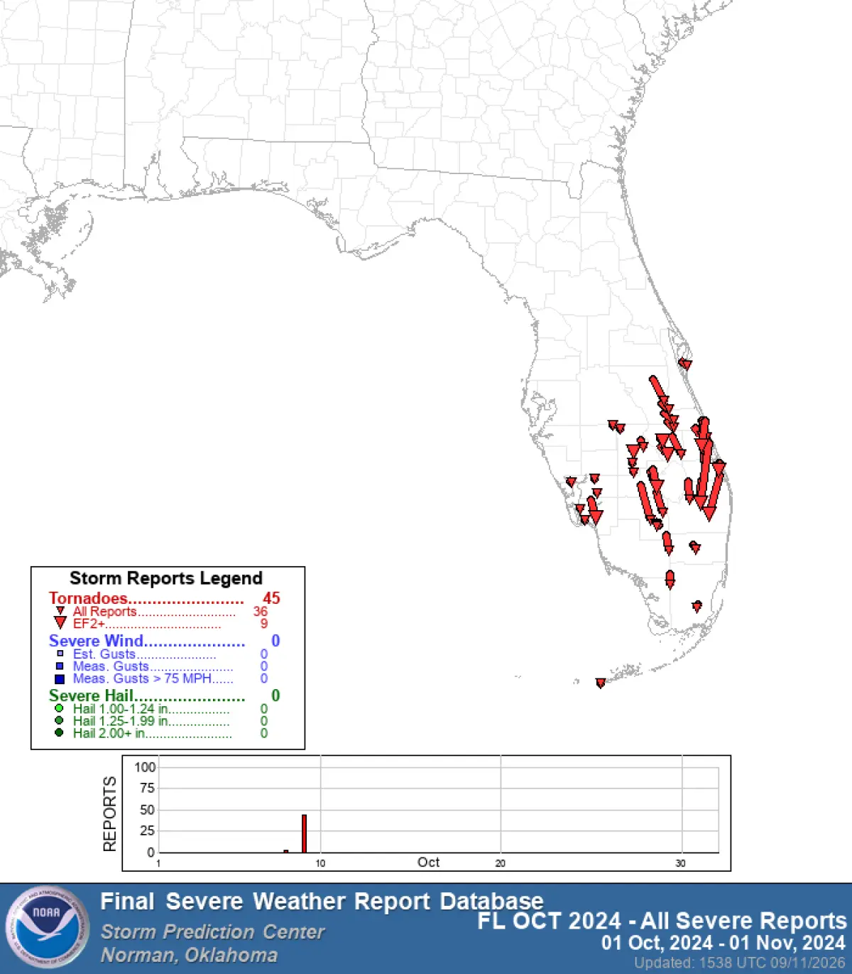
The outbreak was the largest in Florida’s history, doubling the previous record held by Tropical Storm Debby, which impacted the state back in June 2012.
The Milton outbreak was prolific because of strong wind shear, daytime heating and supercells located far away from the center of circulation — a scenario that could unfold again with Isaias along the Interstate 10 corridor between Pensacola and Jacksonville.

Jacksonville Today thanks our sponsors. Become one.
Forecast models show the greatest threat for tornadoes developing after sunset Friday and lasting through much of Saturday.
The tornadoes are expected to occur in the classic zone — the cyclone’s right semicircle.
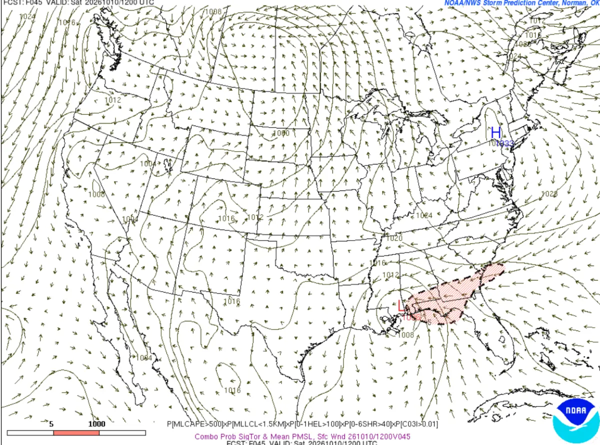
According to previous research, upwards of 80% of tornadoes occur in or around the right sector of a hurricane.
Most tornadoes produced during tropical cyclones are on the weaker end of the Enhanced Fujita Scale, but occasionally, an EF3 tornado can occur, as happened during Milton.
Hurricane Milton produced three EF3 tornadoes, which contributed to the deaths of at least six people across southern Florida.
Many of those tornadoes occurred during the day and were not rain-wrapped — a scenario that may not happen with Isaias.
Tornadoes associated with Isaias’ bands could occur during nighttime hours and be rain-wrapped, adding to the difficulty meteorologists face issuing accurate alerts.
Complicating matters are the cells’ forward speeds, which can be much faster than that of a typical Florida thunderstorm, meaning there may be little time to prepare for each individual cell.
Counties stretching from the Alabama-Florida border through the Suwannee Valley to areas near the First Coast will likely be placed under a tornado watch ahead of the inclement weather.
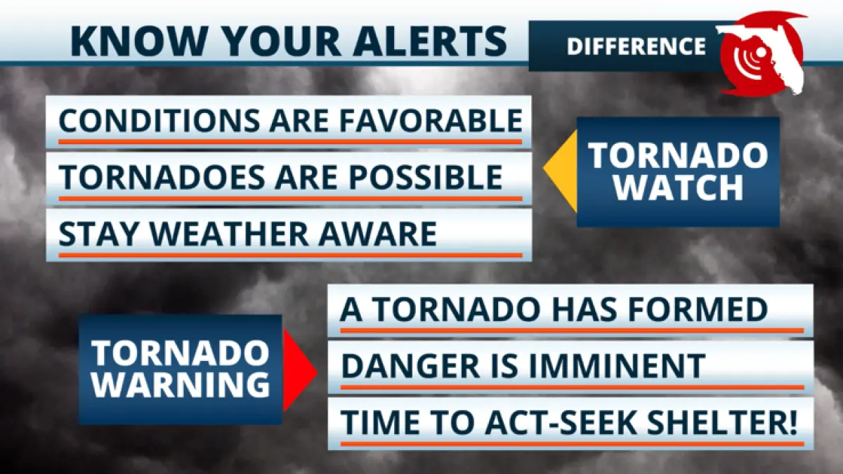
A tornado watch means weather conditions are favorable for tornadoes to develop and is usually issued hours before the commencement of a severe weather event.
If a tornado is spotted or detected by Doppler radar, National Weather Service meteorologists issue a tornado warning.
At the warning point, you should seek immediate shelter in an interior room on the lowest floor and stay away from windows.
Because tornadoes can develop frequently during tropical systems, there may be little time to protect yourself once a warning is in effect.
In rare occasions, a tornado emergency can be issued, which is the agency’s most critical level of alert.
The alert is issued only when a confirmed, violent tornado is moving through a populated area and significant damage is occurring.
Since the implementation of the tornado emergency alert system in 1999, none of the more than 200 emergencies have occurred in Florida.
Residents near and east of Isaias’ path across Florida and the Southeast should remain alert and be prepared to take immediate action in the event of a tornado over the next 72 hours.
Very few communities across the Sunshine State have tornado sirens to alert residents to the presence of a twister, so residents are always advised to have a battery-powered radio capable of receiving weather alerts.
Forecast models show bands of potentially hazardous weather from Isaias decreasing from late Saturday into Sunday, with drier skies arriving across the region on Monday.
Copyright © 2026 Storm Center