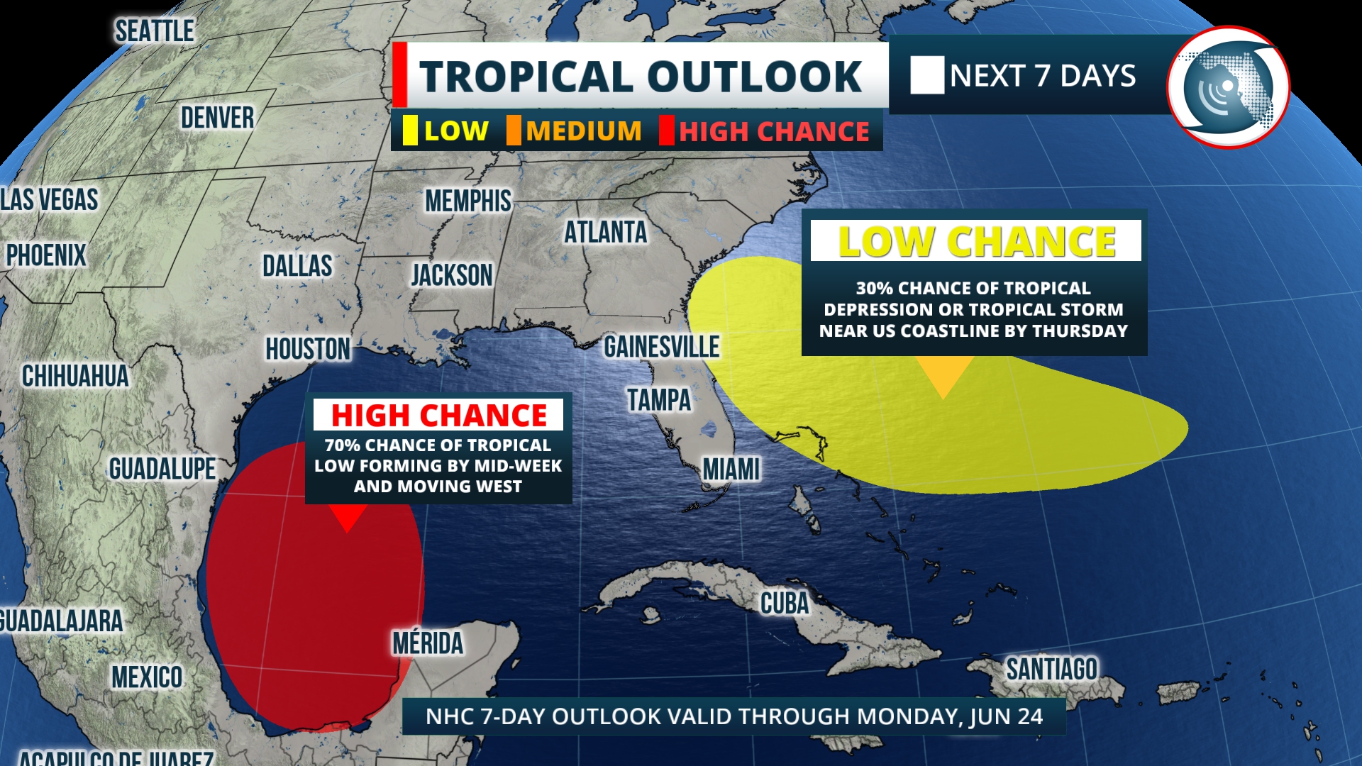
The National Hurricane Center is tracking an area just northeast of the Bahamas where a tropical depression may develop later this week.
Global forecast models have been showing an area of low pressure forming in the area north of the Bahamas in the early part of this week before moving inland toward the Florida peninsula and/or the southeastern United States by the weekend.
The National Hurricane Center says that there is a 10% chance that a tropical depression develops in this area within the next 48 hours and a 30% chance that a tropical depression develops within seven days.
At this time, there are a couple of areas of uncertainty regarding this storm. Run-to-run variations in the models vary in the location and intensity of an area of low pressure that forms by mid-week. At this time, it looks likely that either a tropical low-pressure system or a broad area of showers and embedded thunderstorms will approach the coast before the end of the week.
Regardless of tropical organization, this system is expected to affect some portion of the US coastline by the weekend in an area from Melbourne to Wilmington, North Carolina, by Thursday. Later this week, this potential tropical system is likely to bring heavy rain, possible flooding and gusty winds to parts of the southeastern U.S.
Residents of Florida, coastal Georgia, South Carolina and North Carolina are urged to follow the progress of this potential tropical system. At this time, before the actual formation of a storm, and several days before a potential landfall, there could be many changes to the predicted path and intensity of this possible storm.
This is just one of two areas of interest being tracked by the National Hurricane Center. The other system is forming in the Gulf of Mexico in the Bay of Campeche. The Hurricane Center says the environment is favorable for some development and a tropical depression or tropical storm may form in the southwest Gulf of Mexico by Wednesday before moving westward into Mexico and the Texas Gulf coast.


