
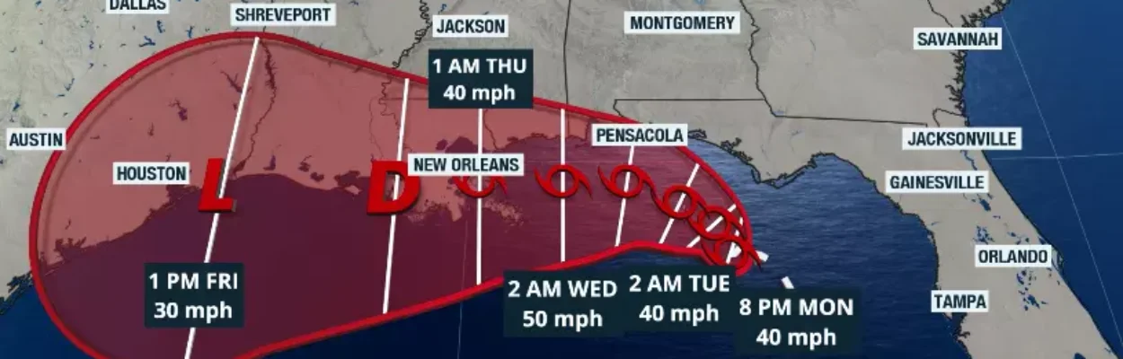
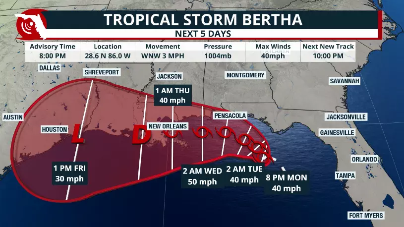
Official track by the National Hurricane Center issued on Monday, July 20, at 8 pm EDT.
Published on July 21, 2026 at 9:33 am
Free local news and info, in your inbox at 6 a.m. M-F. Sign up for the Jacksonville Today newsletter.
The National Hurricane Center is issuing warnings about Tropical Storm Bertha after Hurricane Hunters found the system strengthened Monday afternoon.
As of Tuesday morning, Bertha had maximum sustained winds of 52 mph and was moving west-northwest at 5 mph.
Jacksonville Today thanks our sponsors. Become one.
Although Bertha has strengthened into a tropical storm, its overall organization remains limited. Dry air wrapping into the circulation and strong wind shear of around 25 knots (and increasing over its east and northeast) are expected to prevent rapid intensification as the storm drifts slowly across the northeastern Gulf.
Hurricane Hunters also observed the center wobbling throughout the day as the storm remains trapped between two areas of high pressure, resulting in weak steering currents and an erratic motion. Additional reconnaissance flights are scheduled through Wednesday, and slight adjustments to the forecast track remain possible.

Bertha is expected to continue moving very slowly through Tuesday before gradually turning more westward later this week.


Jacksonville Today thanks our sponsors. Become one.
The National Hurricane Center continues to forecast a track toward southeastern Louisiana on Wednesday, although the cone of uncertainty still allows for the center to remain offshore. If Bertha spends more time over the warm Gulf waters, some additional strengthening is possible despite the unfavorable environment.
Watches in the Panhandle
Tropical storm watches remain in effect for the Florida Panhandle, with a tropical storm warning westward to Louisiana. A storm surge watch extended from the Alabama-Florida border to the mouth of the Mississippi River.
By Tuesday night, stronger wind gusts are expected near southeastern Louisiana. While no changes were made to the watches in the evening advisory, additional watches or warnings could be issued Tuesday.

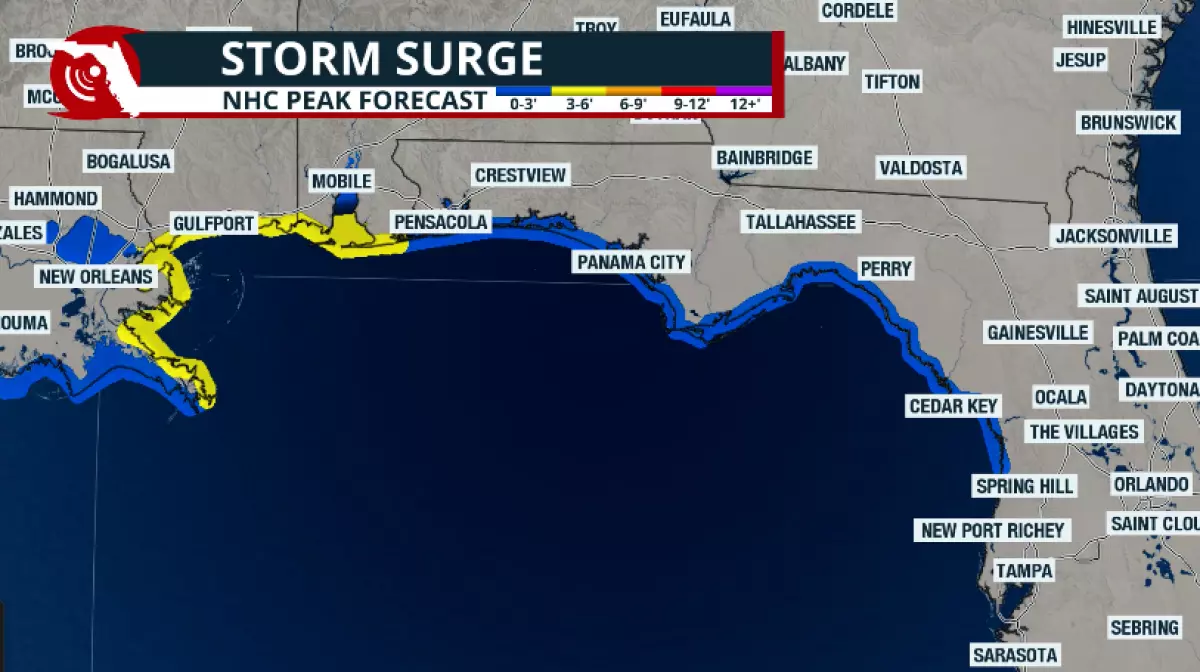
Bertha’s slow movement will prolong impacts across the northern Gulf Coast. Persistent onshore winds could produce up to 3 feet of storm surge from the Florida Panhandle through the central Gulf Coast, including Mobile Bay, while dangerous surf and rough marine conditions continue through midweek.
Heavy rainfall will also become an increasing concern, with isolated totals exceeding 6 inches possible. The heaviest rain is expected to shift from the Florida Peninsula into the Florida Panhandle, coastal Alabama and Mississippi, and southern Louisiana as Bertha slowly tracks westward.
Rain chances are still possible on Tuesday across the western portion of the Peninsula, but much lower than previously anticipated as Bertha moves away and the wind shear is keeping its deepest storms closer to the Central Gulf.

Copyright © 2026 Storm Center