Scattered severe storms will cross North Florida on Monday morning and afternoon.
Published on March 16, 2026 at 10:03 am
Free local news and info, in your inbox at 6 a.m. M-F. Sign up for the Jacksonville Today newsletter.
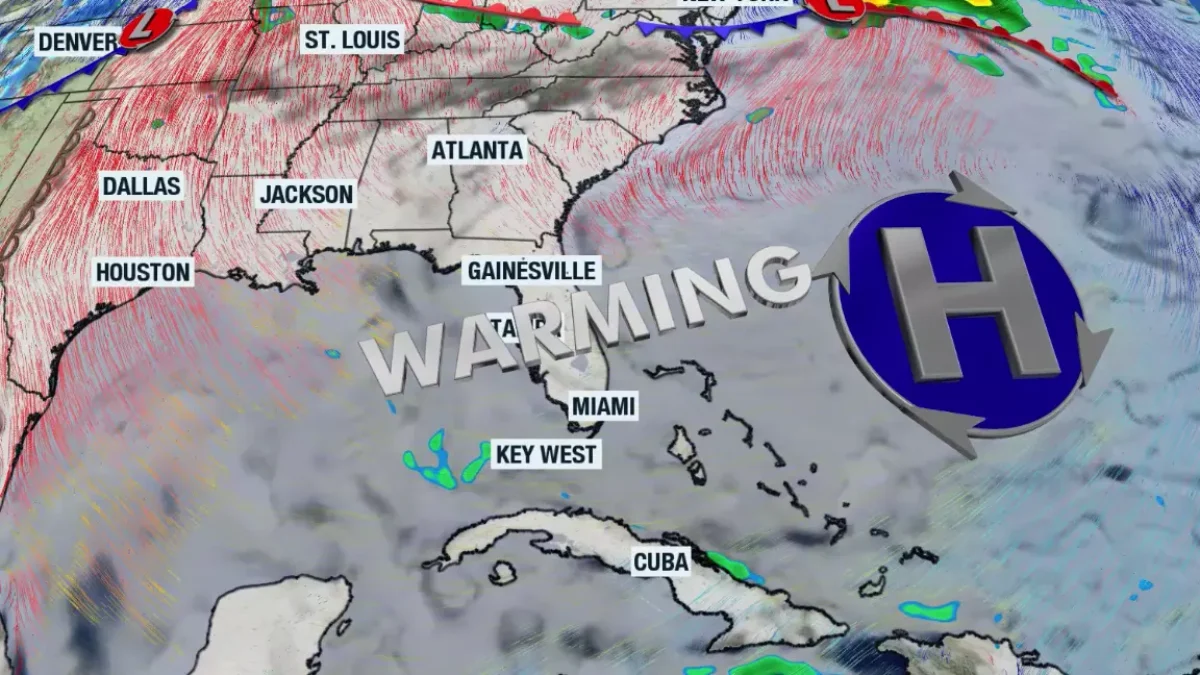
It’s going to be a wet Monday across much of Florida with isolated to scattered severe thunderstorms that bring the risk for tornadoes, damaging winds of at least 58 mph and hail.
The cold front will push across North Florida on Monday morning through late Monday morning. Central Florida can expect an increase in some isolated severe thunderstorms by the early afternoon hours onward. South Florida could experience the heaviest downpours and isolated storms overnight Monday, going into Tuesday morning. Let’s break down the forecast region by region.
Jacksonville Today thanks our sponsors. Become one.
The Panhandle must be ready and have at least three ways to receive weather alerts early Monday morning. A line of strong to severe thunderstorms will cross Pensacola moving eastward between midnight and Monday early afternoon.
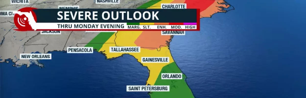
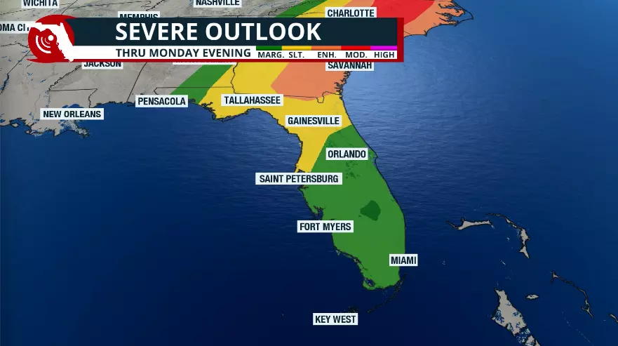
Keep in mind that according to the Storm Prediction Center, the western portion of the Panhandle is under a slight risk for severe weather. This is category two out of five. Residents west of Tallahassee should monitor the front closely.
The main threat of the severe thunderstorms will be tornadoes. There’s plenty of moisture that will continue to feed over the peninsula through North Florida and the Panhandle during the early start of Monday. All this moisture is prepping the atmosphere for numerous downpours across the peninsula throughout the day.


Jacksonville Today thanks our sponsors. Become one.
Across the Panhandle, temperatures will drop sharply on Monday night. By Monday afternoon, temperatures from Pensacola to Tallahassee will be in the 50s. By Monday night, temperatures will be quickly falling as the skies try to clear. Low temperatures on Tuesday morning will be around the mid-upper 30s from Tallahassee through Panama City to Pensacola.
North Florida risks
North Florida is also at a slight risk for severe storms, especially on Monday. The main threat with these storms will continue to be tornadoes developing across North Florida during the morning hours on Monday.
Damaging winds of at least 58 mph will also be possible in any storms that develop tall enough well into the atmosphere, producing the strong gusts. Hail will also be a possibility as storms push through the region.

Once the cold front pushes through, expect the night to try to clear across North Florida on Monday night. There is still a very low chance of a brief passing shower on Monday night as the front pushes south. But by Tuesday morning, the winds will be mainly out of the north and gusty, and much colder temperatures will fill across the region.
Tuesday morning temperatures across North Florida will be between the upper 30s and low 40s. By Tuesday afternoon, expect a cool day with breezy conditions and highs in the upper 50s.
Temperatures on Tuesday night into Wednesday morning will be around the low 40s. And as a wind change starts in the middle of the week, temperatures will slowly increase, bringing them back into the 70s starting Thursday.

Marine hazards
Strong gusts from the south across the Peninsula will make the seas dangerous. As the cold front pushes through Florida, the winds will shift and mainly arrive from the north between Tuesday and late Wednesday. But they will shift on Thursday, mainly from the east, with temperatures gradually increasing.
Please check the flags that may be up at your local beaches; there may also be a high risk of rip currents.
Copyright © 2026 Storm Center