Published on April 10, 2024 at 3:49 pm
Free local news and info, in your inbox at 6 a.m. M-F. Sign up for the Jacksonville Today newsletter.
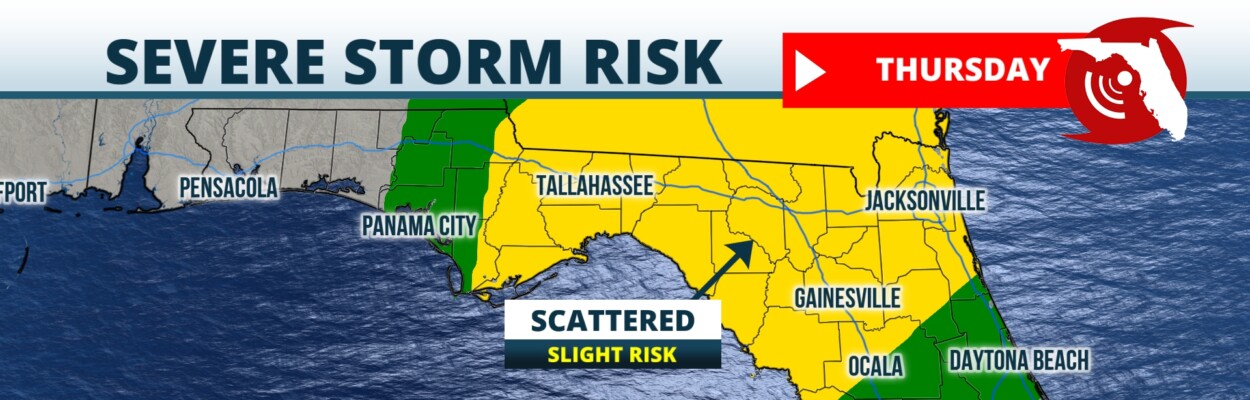
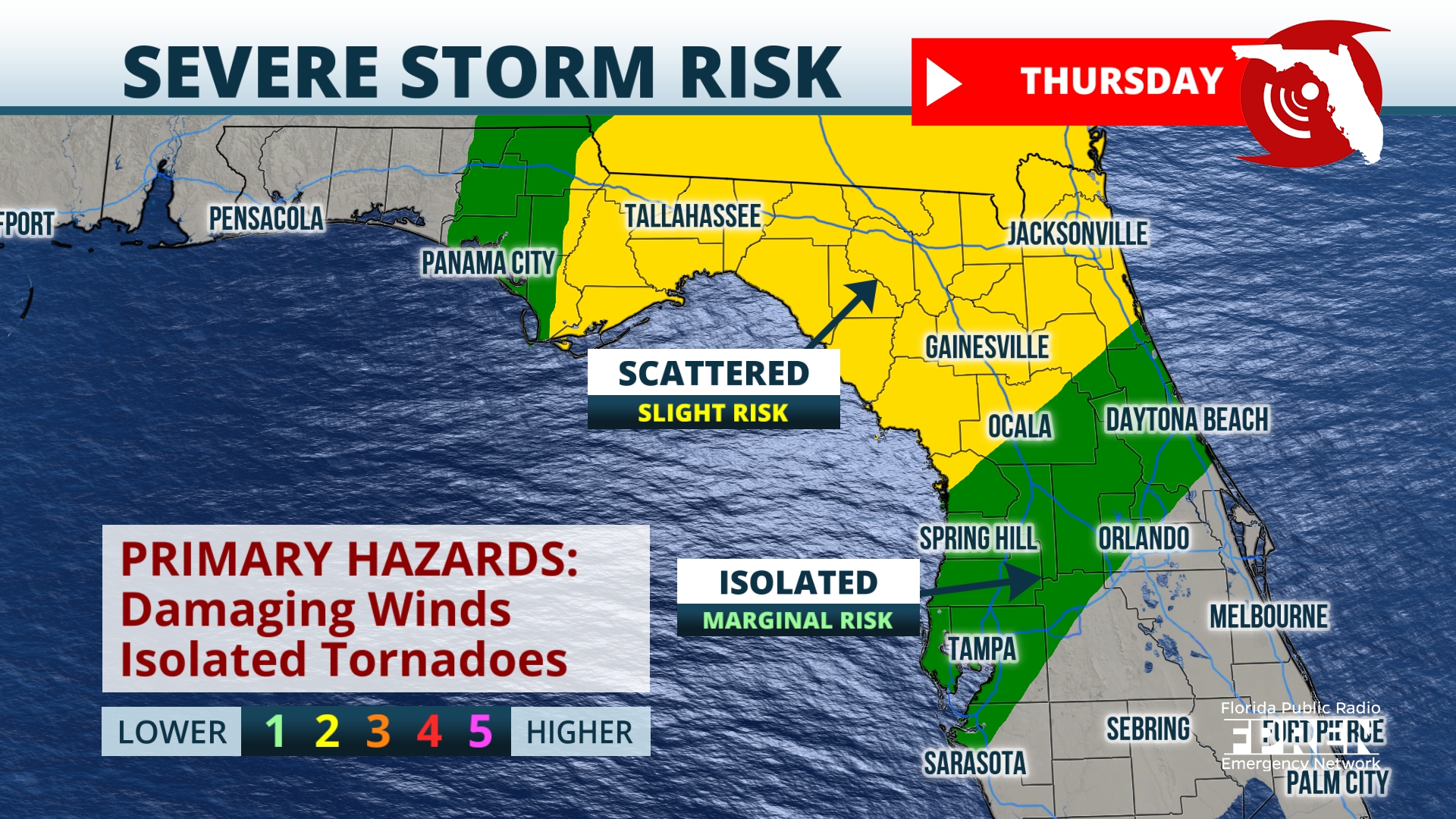
Potentially severe storms will move into Northeast Florida after sunrise Thursday.
A powerful storm system moving through the South triggered tornado warnings across Louisiana and Texas early Wednesday, including early reports of damage in Port Arthur, Texas, and Cameron Parish, Louisiana.
Jacksonville Today thanks our sponsors. Become one.
Areas of eastern Texas including parts of Tyler, Jasper and Newton counties picked up over 8 inches of rain from the storms, leading to flash flood emergencies and road closures.
As storms arrive in Florida on Wednesday evening, they are expected to be arranged in a line of intense thunderstorms with damaging wind gusts over 60 mph, torrential rains and frequent lightning.
The biggest concern is for damaging straight line wind gusts within this line of storms, but these winds embedded in this line could spin up a tornado.

Jacksonville Today thanks our sponsors. Become one.
Any storms can form ahead of the primary squall line of storms; they will have a higher potential to be rotating and very intense. Any rotating supercell storm that forms ahead of the line would be capable of a generating a strong tornado or very large hail.
The Storm Prediction Center placed much of the central Florida Panhandle, including Tallahassee, in a slight risk area for severe storms Wednesday night.
Flooding also was a concern. The Weather Prediction Center designated much of the Panhandle in an area of moderate risk for flash flooding. Jacksonville was considered a marginal risk for flash flooding Wednesday.

Storms in the Panhandle will be at their most intense Wednesday night. After sunrise Thursday, the line of storms will move into the Florida Penisula.
As the storms track across the state Thursday, the potential for rotating supercells will not be as high. However, the squall line will still be capable of generating damaging wind gusts of 60 mph or more, and an isolated tornado will still be possible.
Thursday evening, the severe threat will end as storms move offshore. Cooler and drier air will return to the state for the weekend.
Copyright 2024 Storm Center. To see more, visit Storm Center.9(MDEwNzczMDA2MDEzNTg3ODA1MTAzZjYxNg004))