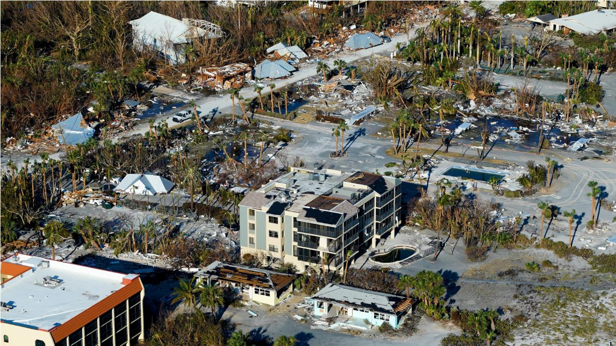
As the 2023 hurricane season starts, memories are still fresh of Hurricane Ian causing billions of dollars in damage and pushing water across Southwest Florida barrier islands.
The National Oceanic and Atmospheric Administration is forecasting a “near-normal” 2023 hurricane season, which will begin Thursday. One positive sign is that forecasters say odds are improving that a potentially significant El Nino weather phenomenon will form soon, which typically means weaker hurricane formations in the Atlantic.
But pointing to lessons learned from last year’s Hurricane Ian and the devastating Hurricane Michael in 2018 in Northwest Florida, emergency-management officials believe they must do more to communicate the risks of approaching storms.
Part of that involves the risks of storm surge and flooding. As of early this month, the National Flood Insurance Program had paid nearly $4 billion to policyholders because of damage from Hurricane Ian — and that doesn’t take into account damage sustained by numerous property owners who didn’t have flood insurance.
“It does not take a lot of moving, surging water to be life-threatening, especially for the little ones like your kids or your pets,” Mark Wool, a meteorologist with the National Weather Service, told The News Service of Florida. “If you try to drive through three or four feet of moving water, you are not going to make it very far. It is going to cut off your evacuation options, and it really does pose a threat to life. So, when we put those storm surge watches and warnings up, that means we feel there is going to be enough inundation to pose a threat to life.”
Florida Division of Emergency Management Director Kevin Guthrie said one change will involve informing people about potential differences between storms coming straight off the ocean or Gulf of Mexico and storms that encounter natural barriers. That could affect storm surge.
“We have got to tell people what nature is going to do, not just the storm, … but what the land-based nature is going to do to that storm in advance of it hitting their area,” Guthrie said. “That way, people can make better decisions, more informed decisions, and we can, you know, help obviously save more lives in the future.”
Guthrie said as future watches and warnings are issued, the potential paths of storms will help shape the impacts.
He said many people in Southwest Florida went through Hurricane Irma in 2017, which was a Category 4 storm, and were under the belief they could handle another major storm as Ian approached. But Irma was different from Ian, which made landfall Sept. 28 in Southwest Florida barrier islands before causing damage across the state.
Guthrie said a difference is that Irma encountered mangroves and vegetation throughout the Everglades.
“Those mangroves and the things of the Everglades laid that storm surge down,” Guthrie said. “Whereas on Hurricane Ian, it came straight in off the Gulf. It had no mangroves. No-natural based solutions in front of it. And then it hit that Fort Myers Beach area. And it was a solid 12 to 18 feet of storm surge. So again, we got to do a better job of communicating not just what the storm-surge watches and warnings are, but what they mean based upon the approach of a storm.”
Meanwhile, the National Oceanic and Atmospheric Administration, or NOAA, this summer plans to make a series of upgrades to expand the capacity of its supercomputing system, increasing the computing capability of forecast models.
As an example, one of the upgrades will get what is known as the Hurricane Analysis and Forecast System operational in late June. That is expected to improve forecast tracks by 10 percent to 15 percent.
Last week, NOAA forecast that the six-month hurricane season would 12 to 17 named storms, with winds of 39 mph or higher. That total is forecast to include five to nine storms topping 74 mph and being designated as hurricanes. One to four of the hurricanes are predicted to be in Category 3 or higher, with sustained winds of at least 111 mph.
The 2022 season featured 14 named storms, with eight reaching hurricane strength. Two systems were major hurricanes.
But Guthrie cautioned about the forecast numbers, referring to Ian hitting the Fort Myers area and Hurricane Andrew causing massive damage in Miami-Dade County in 1992.
“It doesn’t matter if we have 13 storms. All it takes, just as Fort Myers Beach, is just one. It only takes one,” Guthrie said. “Hurricane Andrew was in an easy season. It was supposed to be really, really inactive. Andrew was the first storm coming from the season in August. There was catastrophic damage to the state of Florida. So, again, be prepared. It only takes one.”
Repairs from Ian are still years from being completed in parts of Southwest Florida, while storm hardening and clean-up continues five years after Michael.
Lawmakers this spring approved such things as $75.2 million for bridge repairs in Lee County and $17.6 million for hurricane damage to the Lee County school district.
9(MDEwNzczMDA2MDEzNTg3ODA1MTAzZjYxNg004))


