Published on May 3, 2022 at 9:32 pm
Free local news and info, in your inbox at 6 a.m. M-F. Sign up for the Jacksonville Today newsletter.
In honor of National Bike Month, The Jaxson has five Jacksonville bicycle history facts and sites:
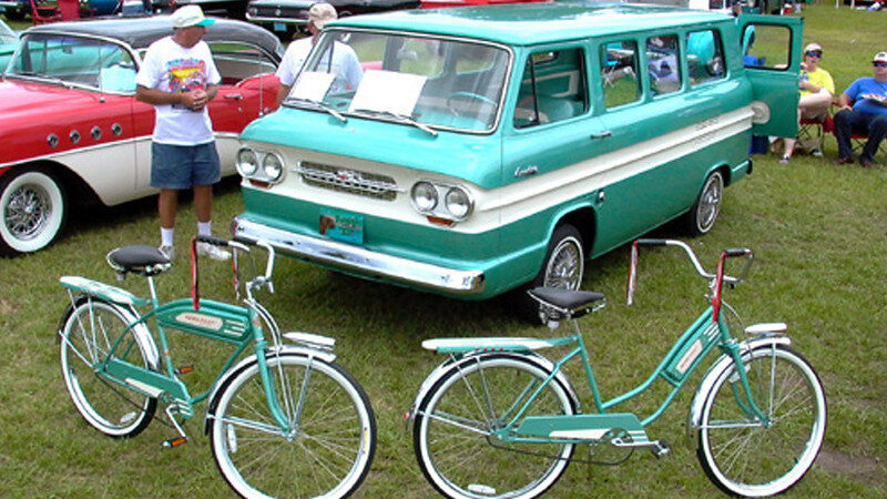
- The beach cruiser
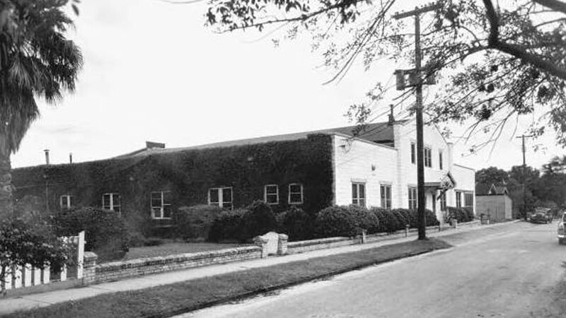
Built in 1925 for E.L. Green’s Sunshine Potato Chip Company, this rusticated concrete block building on the Eastside became home to the Ambrosia Cake Bakeries Corp. in 1928. Operated by Earle P. Colby, the bakery’s business model consisted solely of the baking of cakes and the sale of these to bakeries, which distributed them, along with bread, to merchants. Highly perishable and becoming stale and unfit for food after about two days, Ambrosia’s cakes were priced between 5 cents and 39 cents.
Jacksonville Today thanks our sponsors. Become one.
In 1954, Ambrosia was acquired by Kansas City-based Interstate Bakeries Corporation (IBC). The purchase was IBC’s first move into the South. Interstate organized Ambrosia as a separate cake division with annual sales of $1.5 million, using the brand names Dolly Madison and Ambrosia, with Colby’s heading as president an area stretching from Key West to Washington, D.C., and from Arkansas to the Atlantic. The business would go on to eventually become Hostess Brands, owning brands such as Hostess, Wonder Bread, Nature’s Pride and Dolly Madison. However, growth of the company involved abandoning the aging Danese Street bakery.
In 1956, brothers Clayton and Willard Smith acquired the property and relocated their bicycle business into the building in 1956. Founded by the Smith brothers in Miami in 1944, Clayton-Willard Bicycles relocated to Jacksonville in 1948. In 1976, the company started making the Emory bicycle at this location, establishing itself as the country’s first manufacturer of the beach cruiser. Eventually, Clayton-Willard Bicycles was rebranded as the Emory Manufacturing Company. Today, Emory continues its bicycle operation within this historic, architecturally unique urban core industrial property.
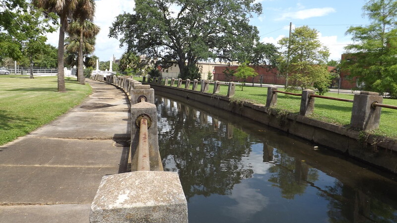
2. Hogans Creek Greenway
Today a favorite path for cyclists, Hogans Creek forms Downtown’s north and east borders as it stretches from the St. Johns River to the medical campus of UF Health Jacksonville in Springfield. Once known as Jacksonville’s “Grand Canale,” the creek is named after the Hogans family. In 1823, the Spanish government validated John Hogans’ claim to the Springfield area, which was then known as Hogans’ Donation. The adjacent Eastside neighborhood was a part of the 225-acre Spanish land grant provided to Daniel Hogans. If not for the creek and its marshes’ stopping the Great Fire of 1901 from extending north and east of Downtown, the 19th Century suburbs of East Jacksonville, Fairfield, Oakland and Springfield would have also likely been destroyed by the fire.
Jacksonville Today thanks our sponsors. Become one.
Because of flooding problems in early 20th Century, Jacksonville approved a $500,000 bond issue in 1927 to finance the construction of the Hogans Creek Improvement Project. When completed in 1929, the Henry John Klutho-led design transformed the space into a scenic Venetian-style promenade with decorative balustrades, light fixtures, six vehicular bridges, three footbridges and two lakes to serve as flood water reservoirs.
3. Jacksonville-Baldwin Trail
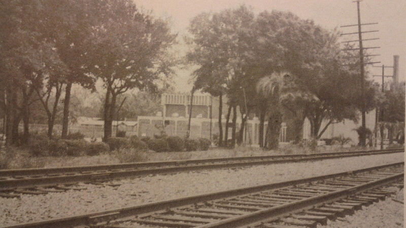
Another local cyclist heaven is the Jax-Baldwin Trail. The Jacksonville and Southwestern Railroad (J&SW) was built in 1899 between Jacksonville and Newberry. Built by Wellington W. Cummer, the purpose of the original railroad was to transport timber near Newberry to Cummer’s massive sawmill along the St. Johns River in Panama Park. In 1904, it became a part of the Atlantic Coast Line railroad. For many years, the line served as the main route for passenger trains running between Jacksonville and St. Petersburg. Under the ownership of the Seaboard Coast Line Railroad, most of the railroad west of Pickettville Road was abandoned between 1968 and 1972.
In August 1990, the city of Jacksonville applied to the Department of Environmental Protection for acquisition of the abandoned railroad corridor. Obtained from CSX Transportation in December 1992 through the Florida Greenways and Trails Program, the former railroad was then converted into a “linear park” under the federally initiated “Rails to Trails” program.
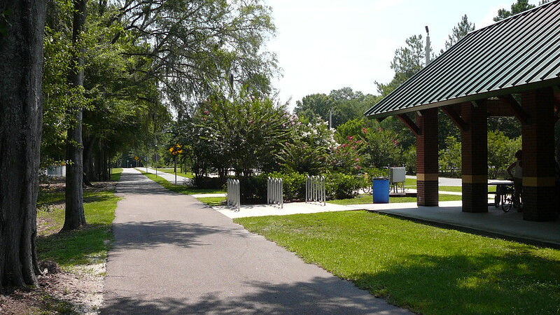
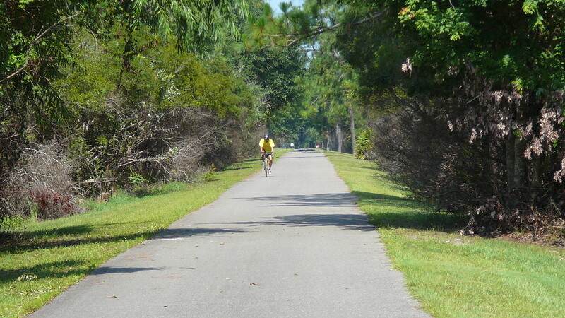
Today, the Jacksonville-Baldwin Rail Trail is a 100-foot-wide right-of-way extending approximately 14.5 miles from Imeson Road in Jacksonville to the town of Baldwin. Passing through rural areas abundant with trees, wildlife and plant life, the trail features a 12-foot-wide paved trail for hikers, bicyclists and inline skaters and an equestrian trail running parallel to the paved trail.
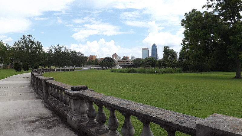
4. Metropolitan Park System
Jacksonville’s Metropolitan Park System is a story of an opportunity that failed to materialize. The Great Depression hit Jacksonville and Florida hard. New construction had virtually stopped and officials warned that 24,000 Jacksonville residents faced starvation. Shortly after being elected, President Franklin D. Roosevelt instituted the Works Progress Administration (WPA) in 1933. The WPA was the largest and most ambitious New Deal agency, employing millions of unskilled workers to carry out public works projects, including the construction of public buildings and roads. It also operated large arts, drama, media and literacy projects during the Great Depression.
It fed children and redistributed food, clothing and housing. Almost every community in the U.S. had a park, bridge or school built by the agency between 1935 and 1943. In 1934, to put Jacksonville citizens back to work, the WPA offered to develop a 14-mile, 3,500-acre metropolitan park system for the city. The urban green space would have connected the mouth of the Ribault River, moving west until reaching Cedar Creek. From that point, the park would have followed Cedar Creek and the Ortega River, ending where the Ortega meets the St. Johns, forming a greenbelt around urban Jacksonville. A major part of this plan would have been to connect the Ribault and Ortega Rivers at their headwaters, thus virtually converting urban Jacksonville into an island with miles of driveways, walks, bridle paths and picnic shelters.
The WPA saw this urban park system as something that would stimulate economic development throughout Jacksonville. It was its belief that the newly created waterway would drain vast areas of the Westside while also stimulating development along the park borders, which would repay the park’s capital cost investment. This line of thinking was supported by Jacksonville financier Ed Ball, who claimed it would generate $30 million to the city annually in economic impact. Ninah Holden Cummer promoted its development as well, telling the City Council that a city without a vision would perish. To entice the city to move forward with the park plan, the WPA offered to purchase the land needed to construct the urban greenbelt.
However, what could have been Jacksonville’s version of San Diego’s Balboa Park or New York’s Central Park would not happen. Jacksonville’s elected leaders at the time did not see the value of spending money on 14 miles of parkland when residents could already visit the woods any time on their own.
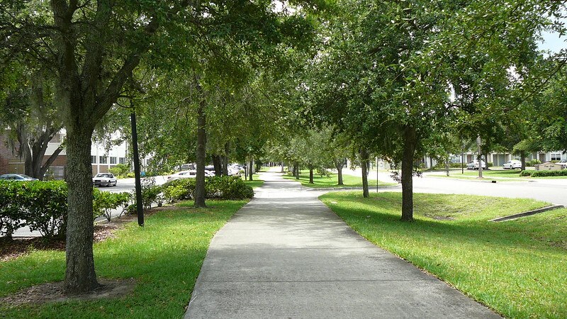
5. S-Line Urban Greenway
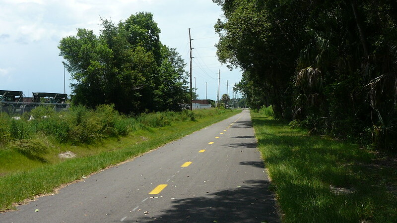
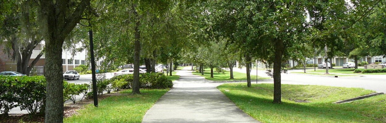
Linking the neighborhoods of New Town and Durkeeville with Springfield and Brentwood near Gateway Town Center, the 4.8-mile S-Line Urban Greenway was completed in 2008. Jacksonville’s first dedicated urban bike trail is built on a corridor that was originally known as the Jacksonville Belt Railroad.
To bring several early railroads into a common terminal, the Jacksonville Belt Railroad was constructed in 1886 around the Northside of Jacksonville to connect the Fernandina and Jacksonville Railroad with the Florida Railway and Navigation Company depot at the foot of Hogan Street in Downtown. By 1900, the railroad was owned and operated by the Seaboard Air Line Railroad (SAL). In 1967, the SAL merged with its longtime rival, the Atlantic Coast Line Railroad (ACL), to form the Seaboard Coast Line Railroad. Former SAL routes became known as the S-Line, while former ACL routes became recognized as the A-Line. With a network of duplicate routes through Jacksonville’s urban core, the S-Line was abandoned during the 1980s between Norwood and the former Jacksonville Terminal in LaVilla.
During the early 2000s, the opportunity to create this multi-use trail through the Rails-to-trails Conservancy’s Urban Pathways Initiative came as a result of the city of Jacksonville’s gaining possession of the abandoned railroad right-of-way. The Urban Pathways Initiative links community-based advocates and professionals across the nation who are working to encourage physical activity, transportation and recreation options in neighborhoods surrounding urban pathways. Partners of the project included the Parks and Recreation Department, the Blue Foundation for a Healthy Florida and the Durkeeville Historical Society. Funding was provided by the Blue Foundation for a Healthy Florida and the Kresge Foundation.