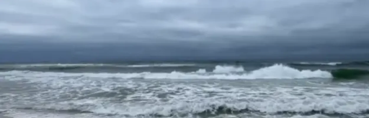
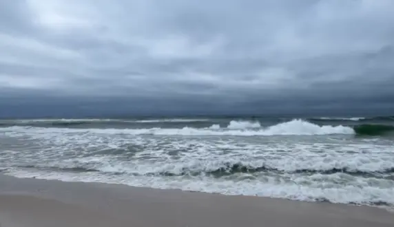
Rough surf ahead of Hurricane Isaias along the Gulf Coast. | City of Orange Beach
Published on October 8, 2026 at 9:29 am
Free local news and info, in your inbox at 6 a.m. M-F. Sign up for the Jacksonville Today newsletter.
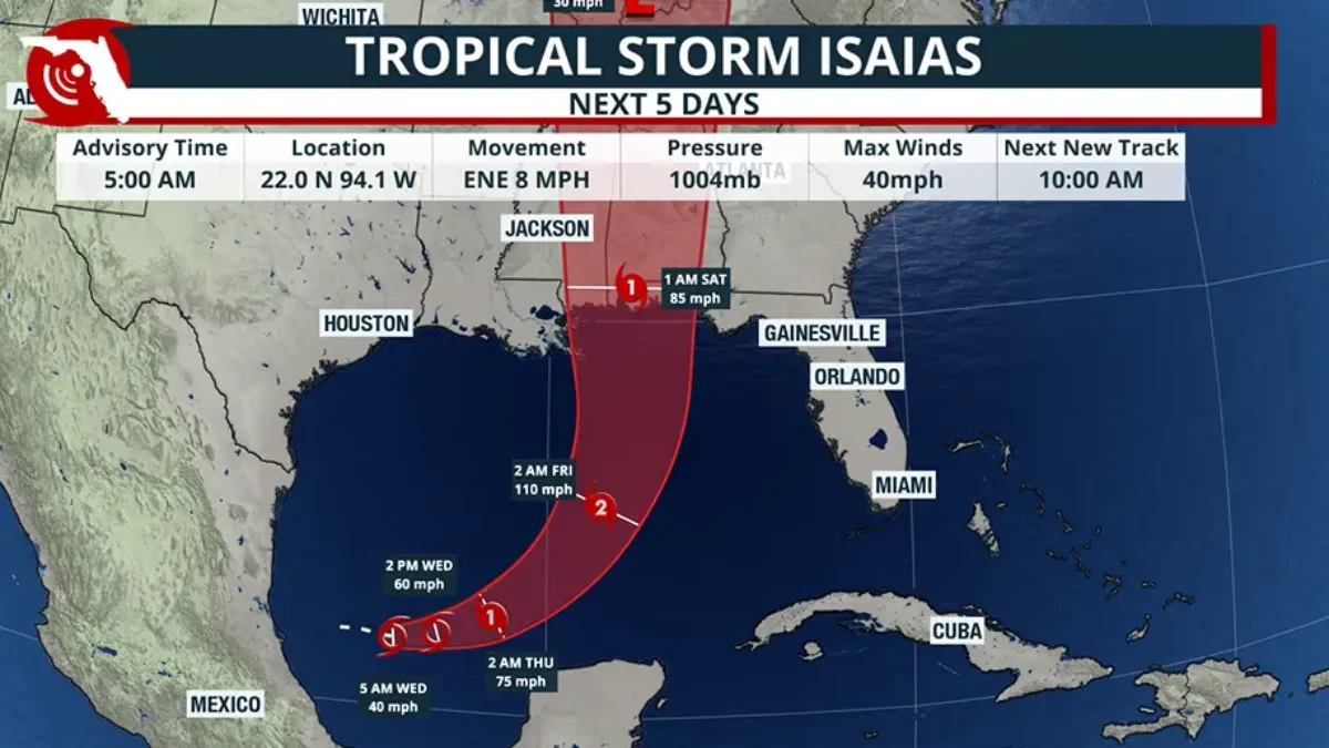
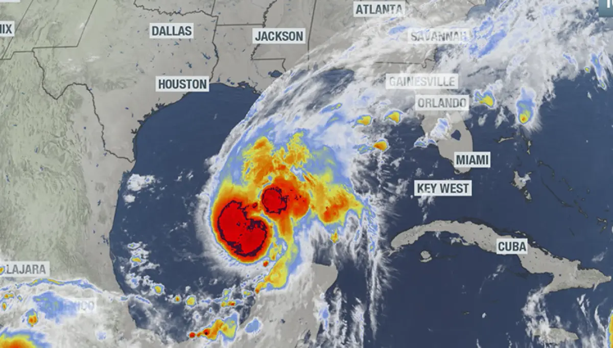
Being months overdue, the first hurricane of the 2026 season formed in the southwestern Gulf late Wednesday, with its eye set on the northern Gulf.
Due to the threat, numerous warnings and alerts are in place from the mouth of the Mississippi River in southeastern Louisiana all the way to Florida’s Big Bend.
Jacksonville Today thanks our sponsors. Become one.
According to the National Hurricane Center, Isaias was last reported to be about 400 miles off the Louisiana coastline, with an eventual expected landfall near the Florida-Alabama border.
Due to the effects from a nearby stationary boundary, most of the Southeast will continue to experience squally weather, with those closer to the forecast cone in store for direct effects from the tropical cyclone.
Forecast for Hurricane Isaias
The ninth cyclone of the year is over warm water, with ocean temperatures in the range of 84 to 87 degrees, but influences such as dry air and wind shear are expected to take a bite out of the system before it makes landfall.


Jacksonville Today thanks our sponsors. Become one.
Officially, forecasters are calling for Isaias to reach Category 2 strength with maximum sustained winds of 110 mph, but only a slight increase in speed would send the cyclone into Category 3 status.
Despite the impressive wind speeds, no major reliable weather model has Isaias making landfall at full strength — it is a question of how much strength the system will lose before landfall.
Some models show the hurricane losing quite a bit of steam before landfall, while others are more modest with the weakening trend.
Officially, the Hurricane Center has the cyclone coming ashore as a minimal Category 1 hurricane, which could be stronger or weaker depending on how much time the hurricane is exposed to hostile conditions.
By Saturday evening, the storm should be no more, as it will quickly be absorbed by a trough over the Tennessee Valley.
Expected effects
Gusty winds, heavy rainfall and tornadic activity have the potential to have the greatest impacts from the storm.
All three effects are expected to be greatest along and east of the center of circulation.
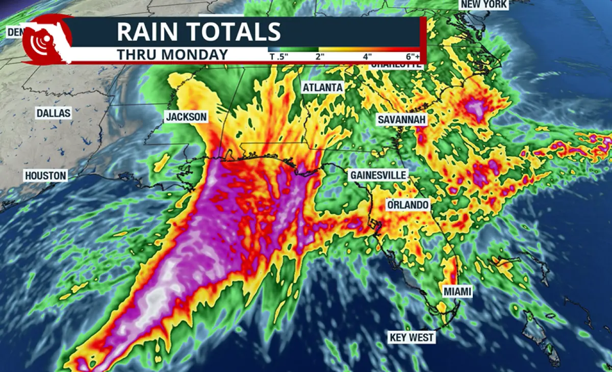
The Hurricane Center has highlighted an area from Mobile, Alabama, through Tallahassee as being in the greatest rainfall zone.
Forecast models show a widespread 3 to 6 inches along the Gulf Coast, with isolated higher amounts.
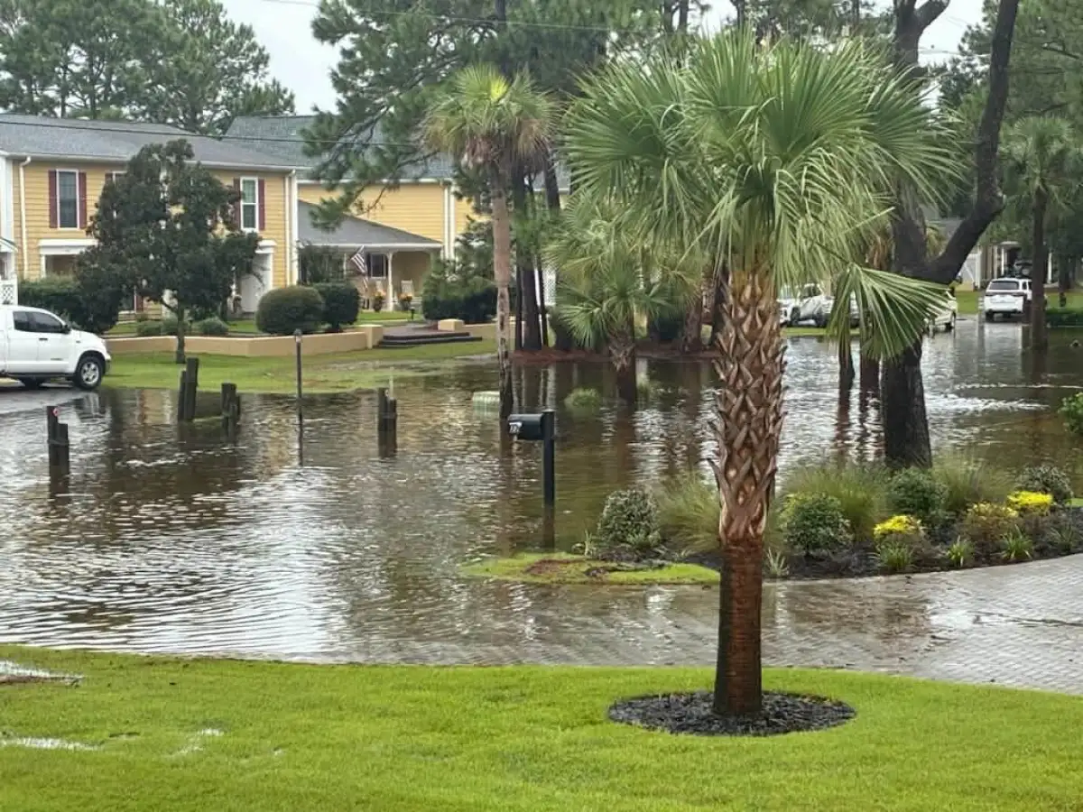
Where heavier rainfall occurs, flooding could become problematic, especially in neighborhoods that saw heavy rain over the past weekend.
In addition to the heavy precipitation, bands with isolated tornadoes will be likely from Alabama eastward through the Florida Panhandle and into southern Georgia.
Most of the region will find itself in the front-right quadrant of the tropical cyclone, which is usually the highest-producing area for spin-ups.
Most tornadoes will be rain-wrapped and have a quick forward speed, so there may not be significant advance warning.
Storm surge along the coast is also expected to be problematic in spots.
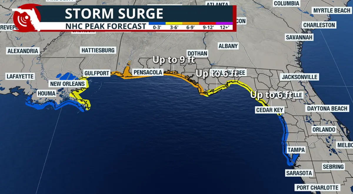
A water level rise of 5 to 7 feet was expected for the coastline of Alabama and into the western Florida Panhandle.
More modest rises of 1 to 3 feet were expected to affect communities from Morgan City, Louisiana, to north of Tampa.
Due to the expected surge, a storm surge warning was in effect from the mouth of the Mississippi River to the Steinhatchee River in Florida, with a storm surge watch in effect for the Florida Big Bend.
Preparations rushed to completion
Florida Gov. Ron DeSantis signed a state of emergency in 25 counties across the state ahead of the worst of the storm, including Baker County.
The measure allows agencies more flexibility in preparing and responding to disasters.
School districts in at least three states announced closures, including Florida State University’s campus in Panama City.
FSU said the closure affected all classes and events scheduled Thursday and Friday in the Panama City area.
Operations at the university’s main campus in Tallahassee were operating normally, but officials advised everyone to continue to monitor for weather updates.
Long lines were reported at grocery stores and fuel stations in the Pensacola area on Wednesday, as residents rushed preparedness efforts to completion.
For much of the Gulf Coast, even though rain was in the forecast ahead of the storm, conditions aren’t expected to start going downhill until later on Friday.
Copyright © 2026 Storm Center