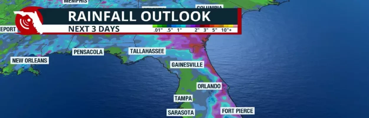
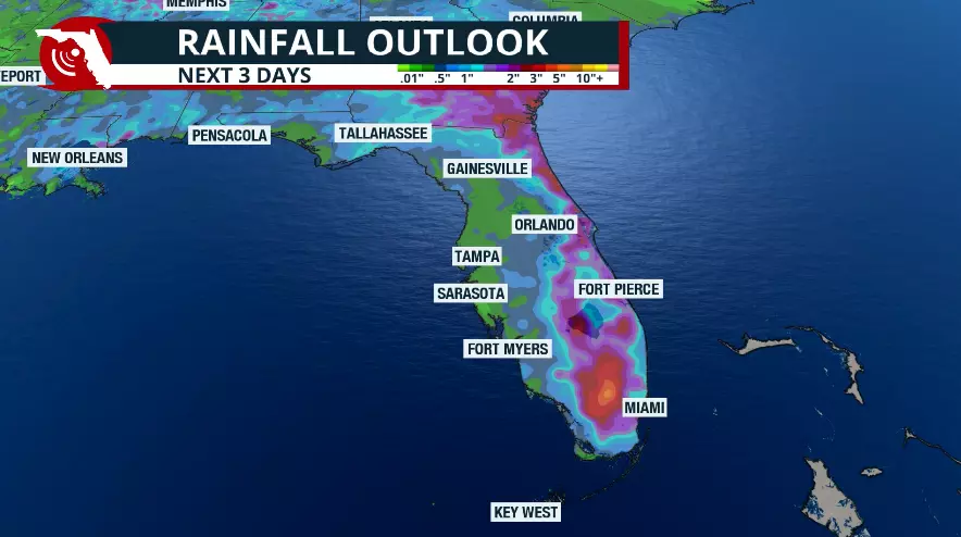
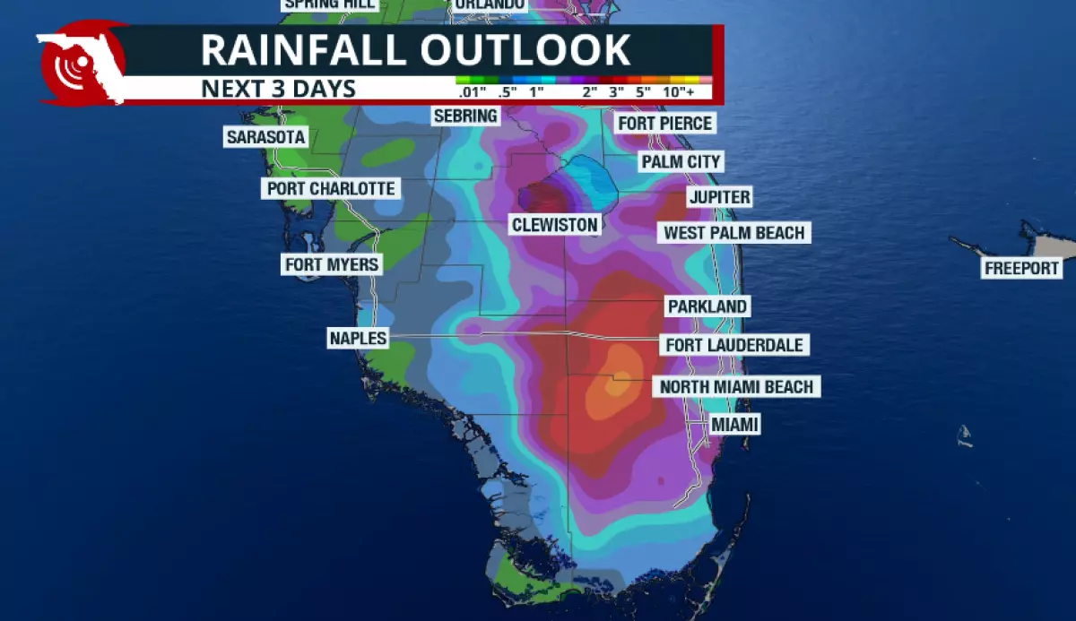
The rainfall outlook across Florida.
Published on May 28, 2026 at 11:28 am
Free local news and info, in your inbox at 6 a.m. M-F. Sign up for the Jacksonville Today newsletter.
Deep tropical moisture will continue to arrive in Florida, interacting with a warm air mass. In some areas, daytime heating will also contribute to the development of the strongest thunderstorms during the afternoon.
Thursday will be a wet day across most of Florida. Showers have lingered near the coast and just offshore of southeast Florida since the early morning hours. Rainfall totals between 1 and 2 inches have been recorded in just a few hours since sunrise in coastal Miami-Dade, while heavier downpours have also stretched along Interstate 95 through Palm Beach County.
Jacksonville Today thanks our sponsors. Become one.
Southwest Florida also woke up to downpours after a very stormy Wednesday afternoon. However, today’s rainfall totals, measured between midnight and 8 a.m., range from 0.25 to 1.25 inches.
More rain is on the way
Although most of Florida will experience rain and storms, the threat of flash flooding will remain focused across southeast Florida and the western portion of the Panhandle.
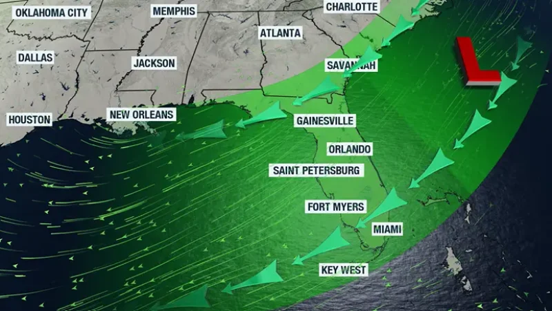
A pocket of moisture will continue to ignite showers and push them mainly from west to east across South Florida through the latter part of the morning.

Jacksonville Today thanks our sponsors. Become one.
By the afternoon hours, an impulse of energy will bring additional moisture across the Panhandle. When combined with any sunshine that breaks through, the atmosphere becomes more unstable, allowing strong downpours and thunderstorms to develop.
The primary storm movement will be from west to east, but keep in mind that some of these storms will move slowly and could produce heavy rainfall in a short amount of time, leading to localized flooding.
This evening, thunderstorms will likely persist across Central and South Florida, and by then, storms are expected to move from north to south.
This is one reason South Florida is more vulnerable to flash flooding: The region is likely to experience multiple rounds of storms, many of which could become intense at different times throughout the day.

The western Panhandle has been soggy for several days. While this has helped improve drought conditions, it also increases the risk of flash flooding because the ground has become compacted, making it more difficult for rainwater to drain properly.
The heaviest rainfall during the next three days will likely focus over the eastern portion of the Panhandle. The Jacksonville area could receive between 2 and 4 inches of rain.

Could this rain help the drought?
Many residents have wondered why the drought has not improved despite all this rain. The reality is that this is a severe drought that, for many areas, began during the last rainy season and only worsened throughout the dry season.
It takes more than one or two heavy downpours to bring meaningful drought relief. Instead, several rounds of rainfall — preferably steady light-to-moderate rain — are needed to gradually penetrate the compacted ground and provide lasting improvement.
The good news is that Florida is now in the rainy season, and long-range models continue to show a steady stream of moisture that will keep rain chances elevated across the state.
Copyright © 2026 Storm Center