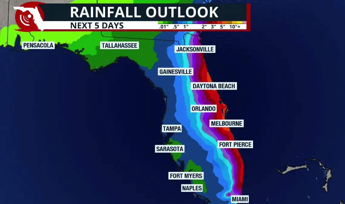
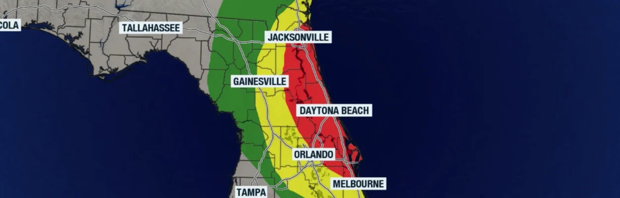
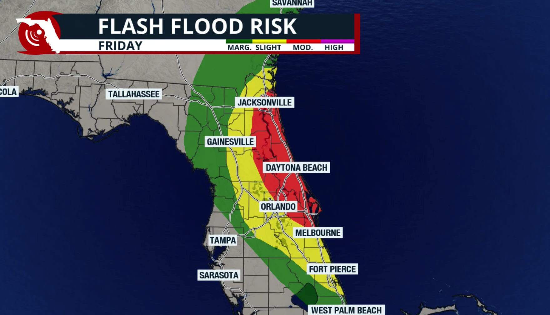
Map shows moderate flood risk for much of the Jacksonville area. | Florida Storms
Published on November 19, 2026 at 4:23 pm
Free local news and info, in your inbox at 6 a.m. M-F. Sign up for the Jacksonville Today newsletter.
The National Weather Service in Jacksonville has issued flood watches for several counties, warning that repeated rounds of intense rainfall could produce significant flooding across Duval, St. Johns, Flagler, Clay, and Putnam counties through Friday.
Northeast Florida is facing a substantial rainfall threat, especially along the Interstate 95 corridor, where repeated downpours could overwhelm drainage systems and flood roads. Deep tropical moisture, persistent onshore winds, and a developing low-pressure system will keep conditions unsettled for several days, according to meteorologists at Florida Storms.
Jacksonville Today thanks our sponsors. Become one.
St. Johns and Flagler counties are among the areas of greatest concern. Slow-moving, repeatedly developing showers could deliver substantial rainfall in short periods, increasing the potential for flash flooding. The flooding threat may become particularly pronounced during high tide, when elevated coastal water levels can slow rainfall runoff and drainage. This could worsen flooding in low-lying coastal neighborhoods and areas with poor drainage.
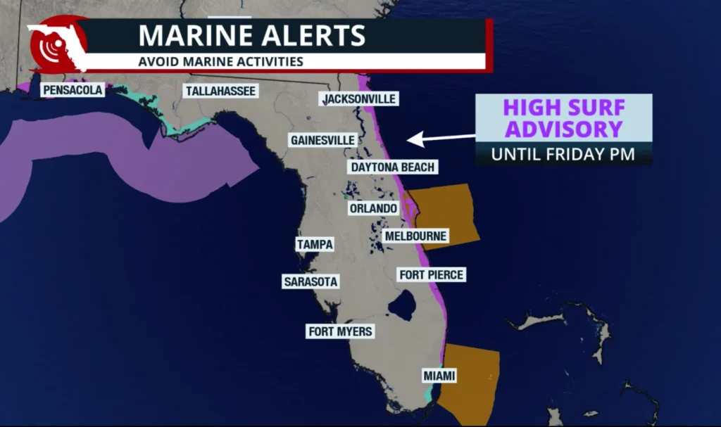
In addition to heavy rainfall, persistent easterly winds will create hazardous coastal conditions across much of Florida’s Atlantic shoreline. Winds will be 15 to 20 mph, with gusts of 25 to 35 mph and occasional gusts reaching 40 mph near the coast.
The winds will produce rough surf, dangerous rip currents, and potentially significant beach erosion. Large waves and elevated coastal water levels could also complicate drainage during periods of heavy rainfall.



Jacksonville Today thanks our sponsors. Become one.
On Wednesday, Gov. Ron DeSantis announced he was extending an executive order authorizing state response to heavy rains to Duval, Flagler, Putnam and St. Johns counties, as well as Broward and Monroe counties in South Florida.
Rains so far this week have flooded roads and led to the cancellation of schools in central and south Florida.
When will the weather improve?
Across northeast Florida, weather should improve by Sunday, Nov. 22, with generally dry conditions returning on Monday and Tuesday. However, residents near rivers and other flood-prone areas should remain cautious, as water levels could continue rising even after rainfall decreases.