Published on June 18, 2026 at 9:34 am
Free local news and info, in your inbox at 6 a.m. M-F. Sign up for the Jacksonville Today newsletter.
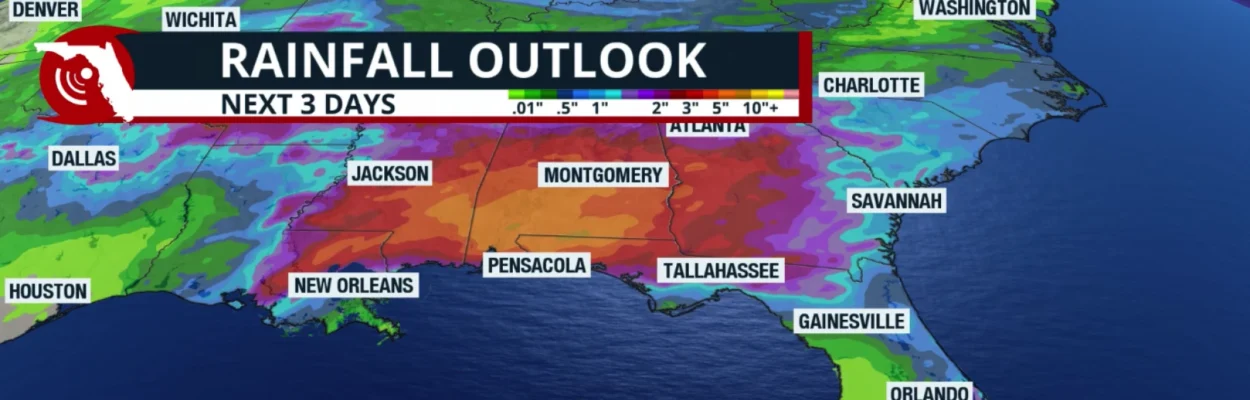
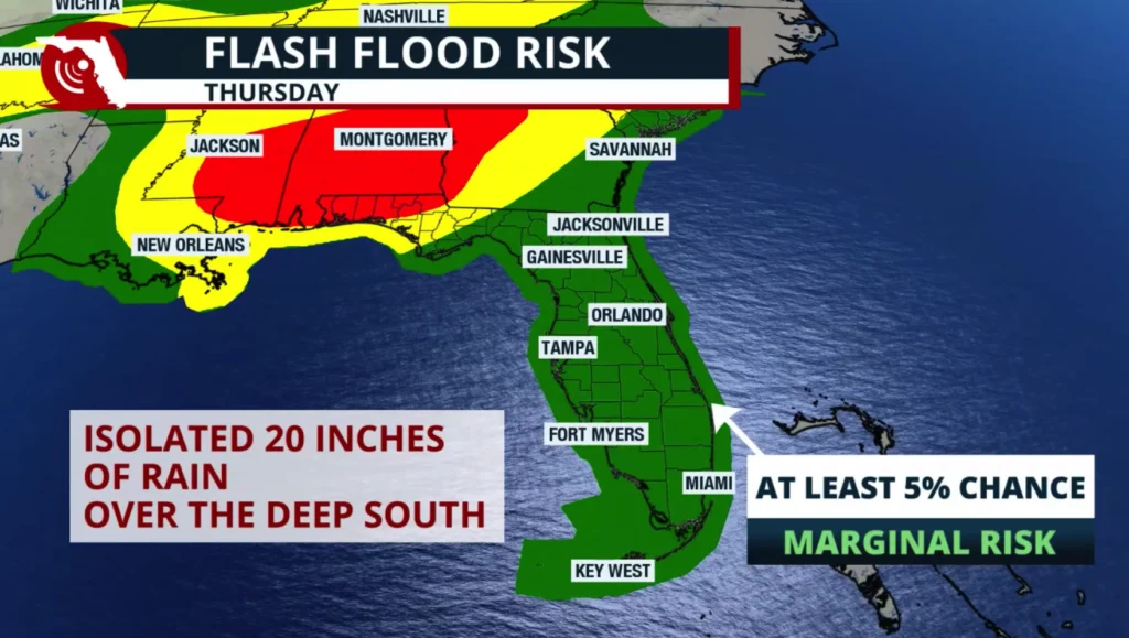
Tropical Storm Arthur was officially named Wednesday morning and then dissipated, but heavy rainfall is expected across portions of Louisiana, Mississippi, and Alabama, with widespread totals of 10 to 15 inches possible. Some isolated locations could receive up to 20 inches of rain.
Arthur was only a named tropical storm for about six hours. By 5 p.m. Wednesday, the center of Arthur was located over Matagorda County in southeast Texas. The system has continued to lose its tropical characteristics and weaken.
Jacksonville Today thanks our sponsors. Become one.
Although the center has become difficult to identify on satellite imagery, the heaviest precipitation remained over the northwestern Gulf of Mexico on Wednesday evening. Tropical moisture was expected to continue moving onshore across parts of the central Gulf Coast states on Thursday.
Rainfall will persist through much of the day and into the evening. As a result, Flood Watches remain in effect from Louisiana through western Georgia, including the western Florida Panhandle, where rain is expected to continue through the remainder of the week.
The western Florida Panhandle can expect between 3 and 6 inches of rain, with isolated higher totals of 8 to 12 inches. Dangerous and life-threatening flash flooding is possible where the highest rainfall amounts occur.


Jacksonville Today thanks our sponsors. Become one.
Keep in mind that this rain can fall very quickly over a short period, catching some people off guard. Avoid flooded roadways and low-lying areas, as water may be deeper than it appears.
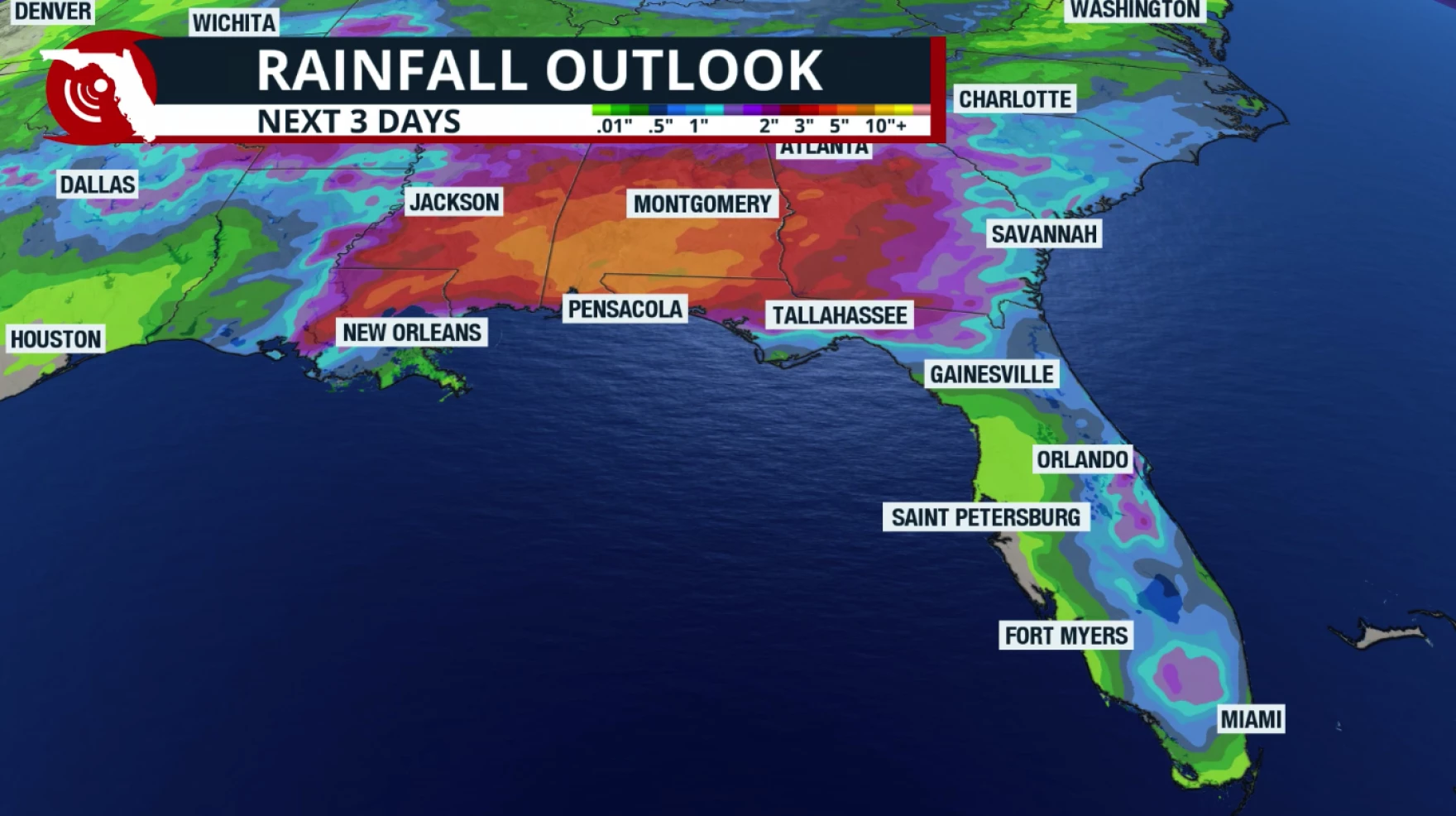
For the rest of Florida, the tropical moisture associated with Arthur is not expected to arrive. Much of the peninsula will remain under a southerly flow, which will continue to bring hot temperatures, especially across southeast Florida, where heat indices are expected to remain elevated throughout much of Thursday afternoon.
Once again, heat advisories may be needed, as the heat index could reach 107 degrees for a few hours in the afternoon.
We will continue to see the typical afternoon thunderstorm pattern, with storms mainly developing across the peninsula’s interior. As winds shift during the day, some of these thunderstorms could move toward the East Coast in the late afternoon and evening.