Published on October 9, 2025 at 10:01 am
Free local news and info, in your inbox at 6 a.m. M-F. Sign up for the Jacksonville Today newsletter.
While the king tides peaked on Wednesday for many areas across Florida’s East Coast, they will still continue to bring issues for the East Coast on Thursday and Friday.
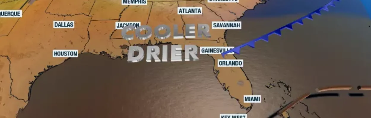
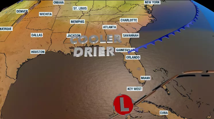
The good news is that changes are on the way. Not only will the winds shift, but we are also coming out of the gravitational pull as the sun, earth and moon are aligned, and the moon moves away from its full phase.
Jacksonville Today thanks our sponsors. Become one.
The real, noticeable changes will take a few more days to come. Thursday is expected to be a wet day across many areas in Florida. Still, the precipitation will be more focused across the Southeast, particularly through the Space Coast, as a low-pressure system slowly moves up from the northern Caribbean.
Jacksonville could experience downpours that, combined with the king tides and the strong winds, will create flooding, especially over the immediate coast.
The heaviest showers are expected to occur between Friday and Saturday, potentially bringing a risk of flash floods along the Space Coast and the northeast coast.


Jacksonville Today thanks our sponsors. Become one.
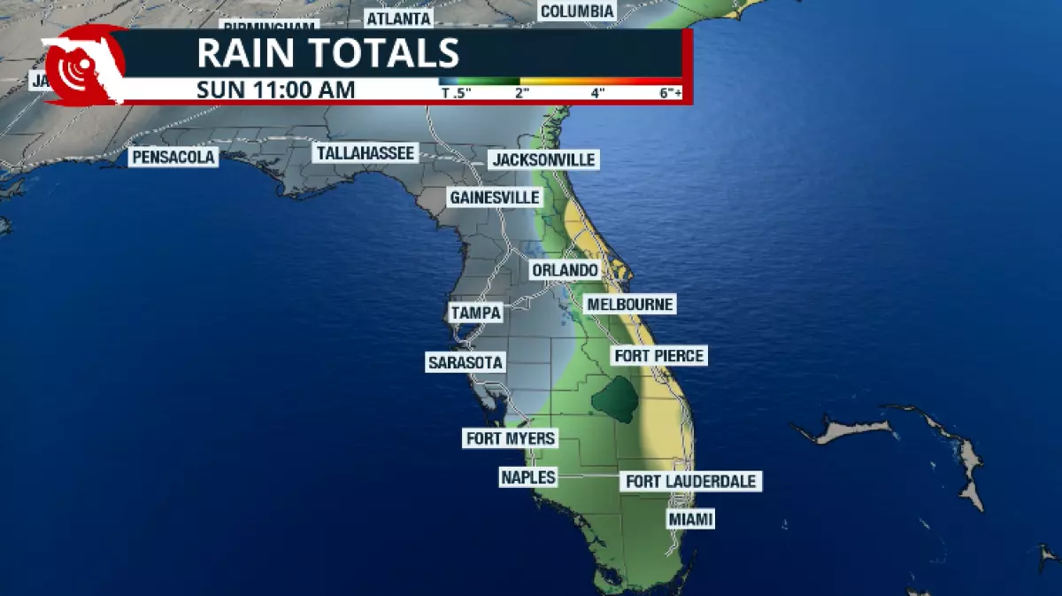
There will be a constant stream of showers over the Peninsula, thanks to the plentiful moisture coming in from the Atlantic waters. Through Saturday morning, there could be between 3 and 5 inches of rain, with some spots experiencing isolated amounts of up to 6 inches along the Interstate 95 corridor.
The winds will still be strong, which, combined with the rain and higher-than-normal tides during high tides, will create flooding.
Please stay away from flooded streets. Even in areas where it might not be raining, you may encounter flooding. Downtown Miami and the Brickell area are popular spots for “sunny day flooding.” Do not walk through these floods, as they are contaminated with salt and sewage waters.
The Panhandle’s forecast
Along Interstate 10 from Pensacola through areas just west of Jacksonville, there could be a few scattered showers, but don’t bet on heavy activity.
The cold front is expected to push through the Panhandle between Thursday and Friday. However, drier air will start to filter through on Friday morning and become more noticeable through the early weekend, remaining dry through early next week.
This will be a great taste of fall with dewpoints falling into the 40s, which means low humidity.
Temperatures on Sunday morning are likely to be the coolest of the weekend, with lows in the mid-to-upper 50s. Highs during the weekend will be in the upper 70s or low 80s.
Flood risk in Central Florida
The heaviest showers and storms will affect the Space Coast on Thursday and become more spread out over the Interstate 4 corridor on Friday.
Through Saturday morning, there could be between 3 and 5 inches of rain, with some spots experiencing isolated amounts of up to 6 inches along the Space Coast.
Saturday afternoon will become drier, and Sunday will be sunny, cooler, and much less humid.
The weather is expected to remain stable, with sunny skies and comfortable temperatures, and humidity will be high for much of next week.
South Florida still humid but improving
As it is usual, South Florida will wait the longest for the change in weather. Heavy rains are expected to continue through Thursday, Friday, and Saturday. The rains through the end of the week will be associated with the low-pressure system moving through the northern Caribbean through the Florida Keys.
There is the chance of flash floods that cover the mostly populated areas across Miami-Dade, Broward, Palm Beach and the northern Keys from Thursday into Friday morning. Overall, between 1 and 3 inches are possible, with a few spots along the southeast coast that could receive up to 4 inches.
Southwest Florida will experience a few showers that will persist, although rainfall will be less concentrated in this region, with amounts of up to 2 inches.
Keep in mind that the front will not reach all the way through South Florida until early Sunday morning, or possibly very late on Saturday night. Sunday will be mostly sunny, with the humidity dropping.
The closer to an authentic taste of fall, with lower humidity levels and crisp skies, won’t come until Wednesday, when the morning humidity levels, as indicated by the dewpoints, will be in the upper 50s.
Monday and Tuesday will be delightful, with dew points in the low 60s. It might not be sweater weather, but it will be a very welcome chance as we try to close the rainy season in Florida.