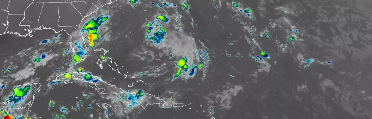
A satellite image shows the Atlantic Basin on Sept. 10, 2025, the peak of hurricane season.
Published on September 10, 2025 at 9:46 am
Free local news and info, in your inbox at 6 a.m. M-F. Sign up for the Jacksonville Today newsletter.
The 2025 Atlantic hurricane season has reached the statistical peak with little to track, marking one of the quietest Septembers in more than three decades.
Typically, the period surrounding Sept. 10 is the busiest of the entire hurricane season, with tropical storms and hurricanes swirling through the Atlantic, Caribbean and Gulf.
Jacksonville Today thanks our sponsors. Become one.
So far, the season has produced six named storms, with Erin becoming the only hurricane with maximum sustained winds of at least 74 mph.

An analysis of historical hurricane data conducted by the Florida Public Radio Emergency Network found the last time there wasn’t a cyclone or significant tropical wave to track during the peak week was all the way back in 1992, after the landfall of Hurricane Andrew and before the formation of Hurricane Bonnie.
The 1992 hurricane season was considered a “neutral” year on the El Niño–Southern Oscillation, meaning neither La Niña nor El Niño was in control.


Jacksonville Today thanks our sponsors. Become one.
This year also falls under a neutral status, but there are key differences that stand out, including warmer sea-surface temperatures and reduced wind shear, which are more favorable for tropical cyclone development compared to other neutral climate patterns.

What’s limiting hurricane activity?
There are several factors that could be leading to suppressed thunderstorm development and therefore a void of tropical activity during what is usually the busiest stretch.
Satellite data indicates an abundance of dry air has halted the development of significant tropical waves in the Main Development Region, where most major storms originate.
Another factor is the stability of the atmosphere itself.
A more stable environment prevents air from producing clouds for thunderstorms, which are key for the formation of cyclones.
Significant troughing across eastern North America, as well as the location of what is known as a tropical upper-tropospheric trough across the western parts of the basin, have prevented any tropical waves that survive the eastern Atlantic from developing or becoming a threat to the U.S.

Is the 2025 season over?
Despite the quiet start to September, forecasters at the National Hurricane Center caution that the season is far from over.
Climatologically, about 60% of significant tropical activity occurs after the peak through the end of the season on Nov. 30.
On average, three named storms form in October and one additional feature in November. Of those, two usually strengthen into hurricanes, and one becomes a major hurricane with winds of at least 115 mph.
Forecasters say the combination of warm water and the status of the Madden-Julian Oscillation should be enough to lead to additional tropical cyclone activity during the 2025 season.
Madden-Julian Oscillation is an eastward-traveling pulse of waves of enhanced moisture and dry air that affect areas along the equator and the subtropics.
With the upward pulse expected to be over the Gulf, Caribbean and Atlantic during the second half of September and early October, conditions are expected to be largely favorable for tropical cyclone activity.
October is also the second-most active month for impacts on the Sunshine State and includes hurricanes such as Milton (2024), Michael (2018), Wilma (2005) and Opal (1995).
If the Atlantic basin is unable to take advantage of what are expected to be more favorable conditions, September 2025 will go down in the history books as being the quietest peak month ever for tropical activity.
According to reliable historical records, there has never been a September without a tropical cyclone to track.
The last time there was only one tropical cyclone reported during the month of September was 1939, which could be an undercount due to a lack of technology, including satellites, that are used to track features across the basin.
