Snip20250712_4.png
Published on July 14, 2025 at 2:41 pm
Free local news and info, in your inbox at 6 a.m. M-F. Sign up for the Jacksonville Today newsletter.
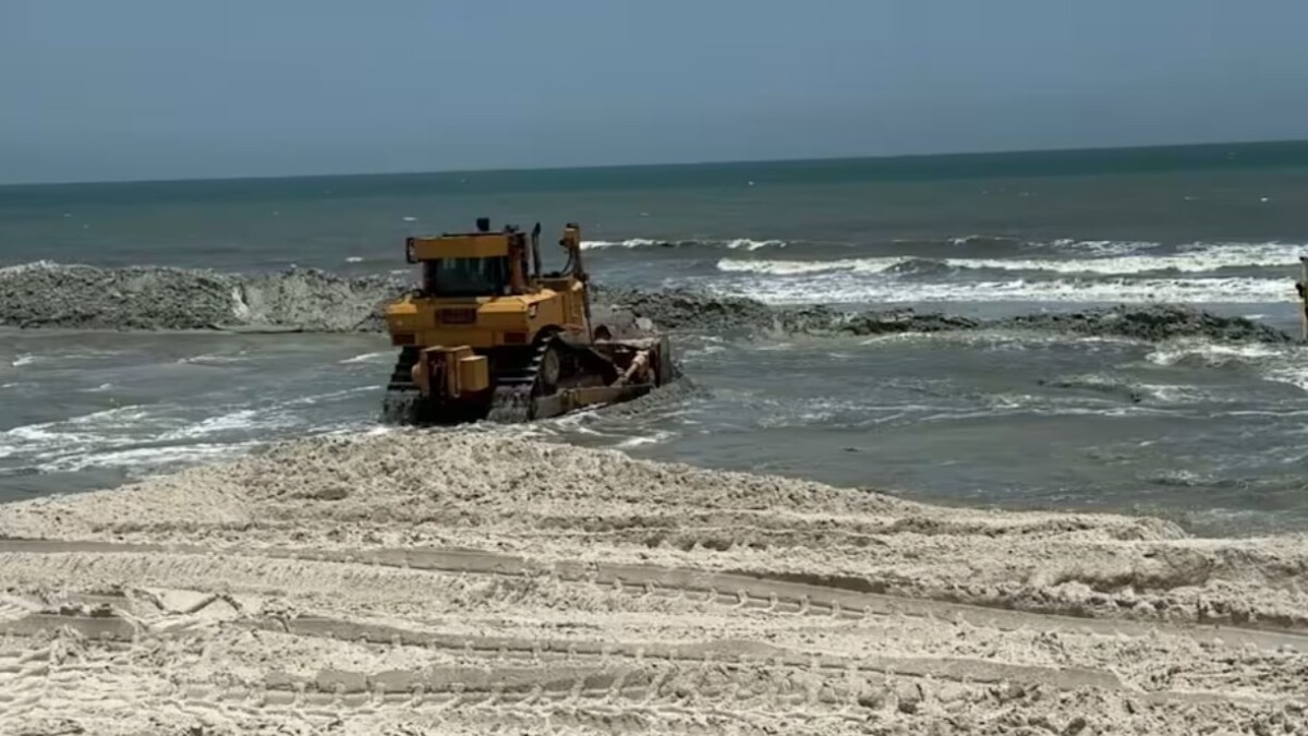
A weather system over North Florida, extending through the northwestern Gulf, has a 30% chance of tropical development over the next seven days, the National Hurricane Center says.
In the short term, there’s less chance for development. But as the week progresses, a weak low-pressure system will develop over the southeastern United States.
Jacksonville Today thanks our sponsors. Become one.
This disturbance should move off the coast of the Carolinas between Monday and Tuesday. As the Bermuda High strengthens and moves west, the low-pressure system will be pushed west, likely over Florida.

Once over the Gulf, the low-pressure system should begin to acquire a cluster of thunderstorms and perhaps a counterclockwise rotation. If a tropical storm forms, it will likely develop slowly.
Before this system develops, if it does, there will be plenty of moisture available in the atmosphere, which, combined with the heat, will allow for heavy rainfall to fall and affect much of the state, especially the southern half of Florida.


Jacksonville Today thanks our sponsors. Become one.
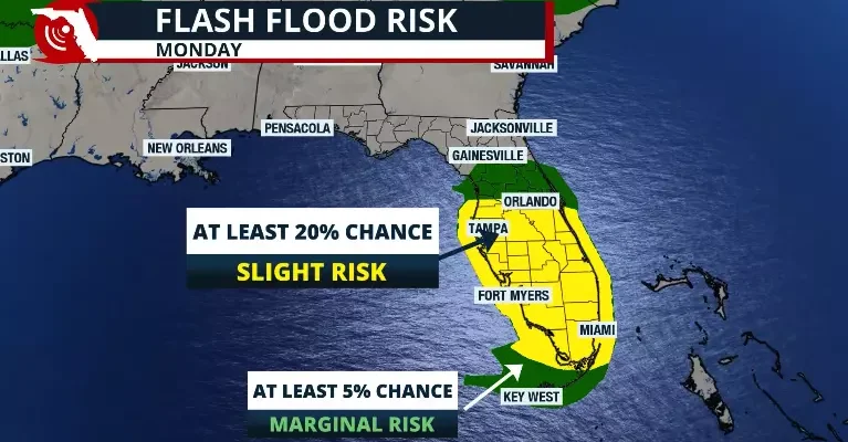
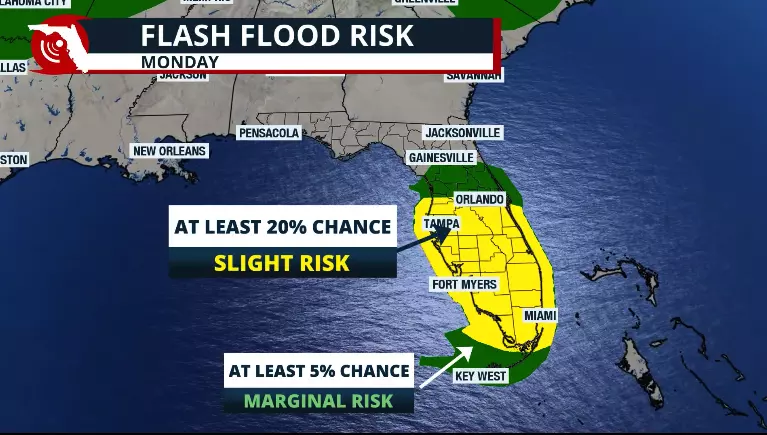
Monday seems to be the most active day, especially for South Florida, but keep in mind that the flash flood risk goes up one level (Level 2 of 4) and takes over Central and South Florida.
Models continue to show that Tuesday will be a soggy and stormy day, mainly across South Florida, with Palm Beach, Broward, Miami-Dade, Monroe, Lee, Hendry and Collier counties still under a slight risk of flash floods.

Rainfall will range between 2 and 4 inches across South Florida and 1 to 3 inches in Central Florida. But there could be isolated amounts above 6 inches through Tuesday morning.
The area that will likely receive the highest rainfall through the middle of next week also has a worsening drought. Southeast Florida worsened its drought from moderate to severe, and Southwest Florida went from abnormal drought to moderate.
When heavy rains fall over drought-stricken areas, flooding is more likely to happen as the ground is so compacted that it doesn´t allow for proper drainage. This makes the situation more worrisome.