Published on April 7, 2025 at 9:57 am
Free local news and info, in your inbox at 6 a.m. M-F. Sign up for the Jacksonville Today newsletter.
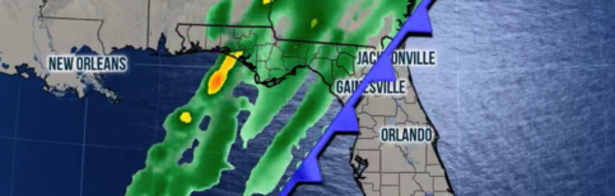
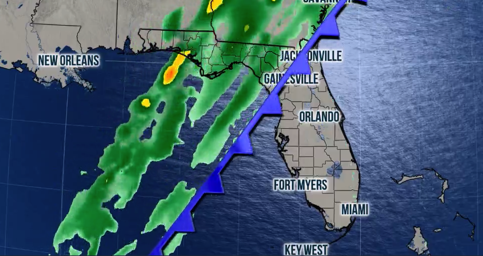
A cold front will continue pushing east across Florida early this week.
The chance for severe storms will diminish as the front sweeps through the state, but Floridians should monitor the weather closely because even South Florida will be impacted by some storms on Tuesday.
Jacksonville Today thanks our sponsors. Become one.
Showers will move in on Monday and Tuesday morning for Central Florida. The clouds will linger by late Tuesday, but the showers will end.
Across South Florida, Tuesday will be a wet day, with showers starting early in the morning and the chance for a few storms in the afternoon.
Colder temperatures
As April progresses, cold fronts will become more scarce, and the cold air that does make it to our state will be weaker and less cold. Average temperatures are on the increase, and more moisture is becoming available. Therefore, we are slowly saying goodbye to Florida’s dry season.


Jacksonville Today thanks our sponsors. Become one.
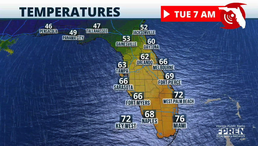
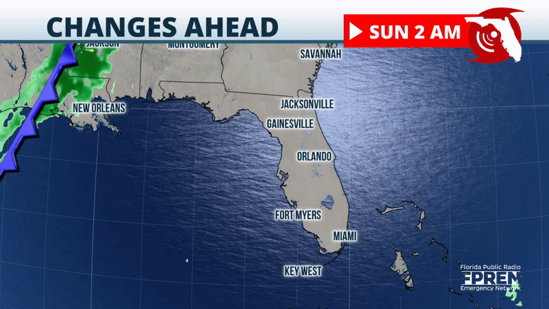
On Wednesday, temperatures across Florida will be below normal for the season. However, expect cold air to take over the Panhandle as soon as Tuesday morning.
Pensacola will wake up to temperatures in the low to mid-40s, and North Florida will be in the low-50s. The front will still be pushing through Central Florida, so warmer-than-average temperatures will still be across the peninsula’s southern half.
By Wednesday afternoon, the entire state will enjoy cooler and drier air. Highs will be between 8 and 10 degrees below normal, with highs in the upper-70s from Central Florida south and in the low-70s across the Panhandle and North Florida.
Copyright 2025 Storm Center