Published on May 9, 2024 at 3:00 pm
Free local news and info, in your inbox at 6 a.m. M-F. Sign up for the Jacksonville Today newsletter.
Several rounds of potentially dangerous thunderstorms are forecast for parts of Florida’s Panhandle and North Florida on Thursday and Friday.
According to specialists at the Storm Prediction Center in Normal Oklahoma, these storms could produce all modes of severe weather: straight-line winds in excess of 60 mph, large hail and tornadoes.
Jacksonville Today thanks our sponsors. Become one.
On Thursday morning, mid-level energy was exiting the Ohio and Tennessee River valleys to the east, after producing numerous supercell thunderstorms and tornado reports over the region Wednesday night. Several clusters of thunderstorms were tracking Thursday morning through parts of South Carolina, Georgia, and northeastern Alabama.
These groups of storms will continue to be steered southeastward throughout the day, and they could intensify as they approach the Florida Panhandle and North Florida during the afternoon and evening.
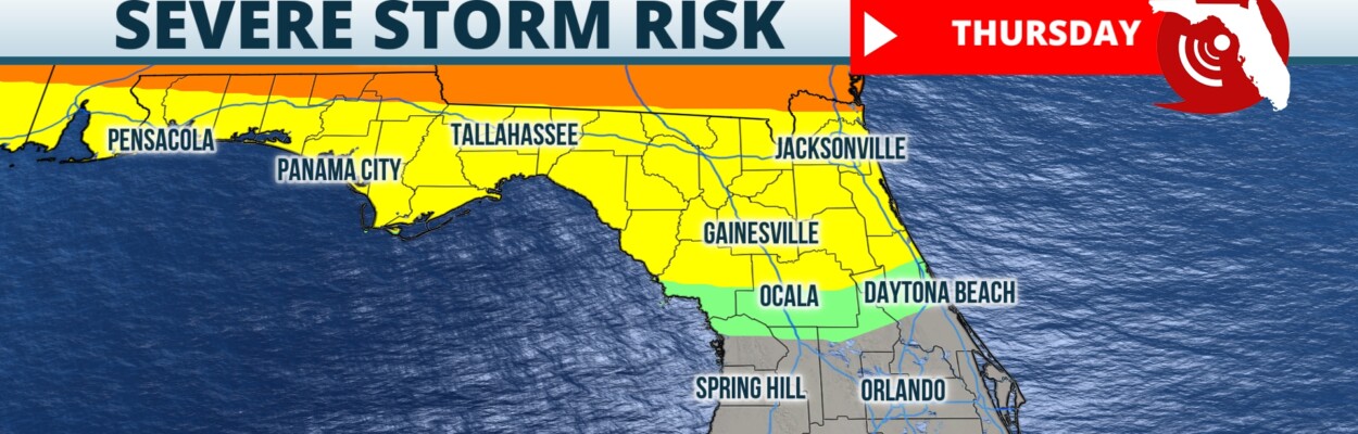
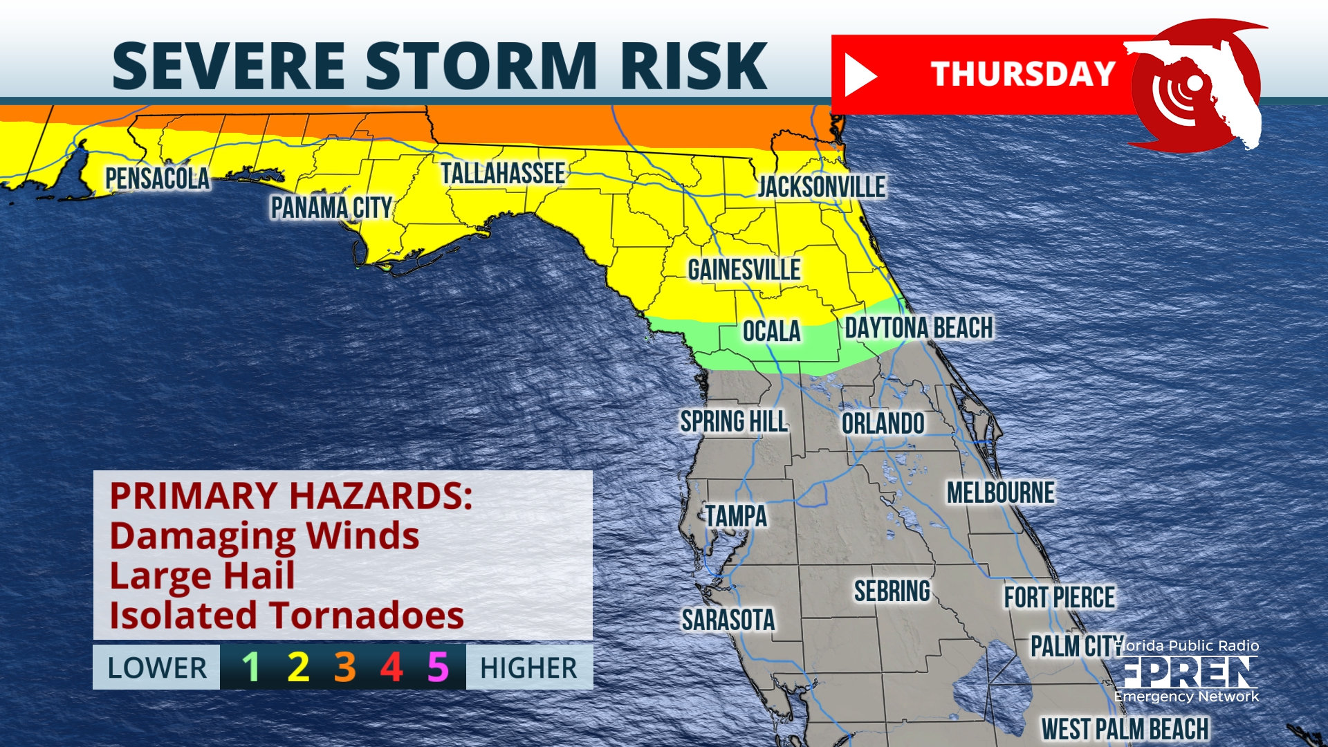
The Storm Prediction Center has outlined the entire Panhandle and most of North Florida under a slight, or level 2 out of 5, risk for damaging thunderstorms on Thursday. This means that ingredients will be in place to support scattered occurrences of large hail and damaging wind gusts.


Jacksonville Today thanks our sponsors. Become one.
In addition, isolated tornadoes will be possible. Storms should arrive to the Panhandle region during the mid to late afternoon, before pushing southward into the northern peninsula during the late afternoon Thursday into the evening. Storms are expected to weaken Thursday night as they push southeastward and eventually dissipate.
Additional rounds of strong storms are expected to threaten the same regions Friday. The first round should approach the western Panhandle after midnight but before dawn. Then, this first cluster of cells should push toward Tallahassee during the morning commute before tracking east toward Cedar Key, Gainesville, Ocala and the Jacksonville metro area.

Friday’s second round of thunderstorms is modeled to approach the western Panhandle during the mid-morning before quickly tracking eastward to the Tallahassee by the late morning and into North Florida during the early afternoon.
Storms on Friday also could produce damaging wind gusts in excess of 60 mph, hail and isolated tornadoes. The risk for these hazards, according to the Storm Prediction Center, is highest on Friday from Tallahassee to Jacksonville and southward toward Gainesville.
Interests in these areas are urged to remain weather aware on Thursday and Friday, as the forecast area of impact and timing could change.
If warnings are issued for your immediate area, take cover in the inner-most room of a sturdy building, away from windows.
Copyright 2024 Storm Center. To see more, visit Storm Center.9(MDEwNzczMDA2MDEzNTg3ODA1MTAzZjYxNg004))