Published on January 9, 2024 at 2:24 pm
Free local news and info, in your inbox at 6 a.m. M-F. Sign up for the Jacksonville Today newsletter.
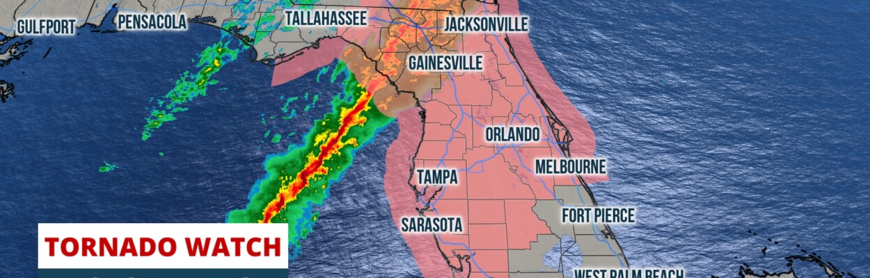
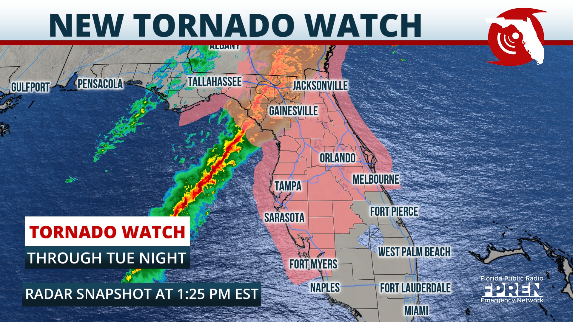
A storm system that spawned a likely tornado over Panama City early this morning has cleared the Panhandle and is entering Florida’s peninsula as of early Tuesday afternoon.
The squall line of thunderstorms should retain at least some of its strength through the early evening as it affects North Florida and nears the Interstate 4 corridor.
Jacksonville Today thanks our sponsors. Become one.
As of the latest observational and model data, the current forecast for impacts and timing is as follows: The line should arrive to Jacksonville, Gainesville and the Nature Coast between 3 and 5 p.m. Tuesday. Afterward it’ll track toward the I-4 corridor around the time of the evening commute. Storms should progress into South Florida around or after sunset tonight.

Tornadoes and straight-line winds between 60 and 80 mph remain possible from this line of storms. Interests in North Florida and Central Florida should remain especially vigilant, as these storms could affect those regions during high traffic hours.
Commuters are urged to check conditions before hitting the road. If storms are approaching or overhead, commuters should remain in place until conditions improve.

Jacksonville Today thanks our sponsors. Become one.
Copyright 2024 Storm Center. To see more, visit Storm Center.9(MDEwNzczMDA2MDEzNTg3ODA1MTAzZjYxNg004))