Published on September 22, 2023 at 9:55 am
Free local news and info, in your inbox at 6 a.m. M-F. Sign up for the Jacksonville Today newsletter.
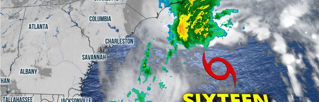
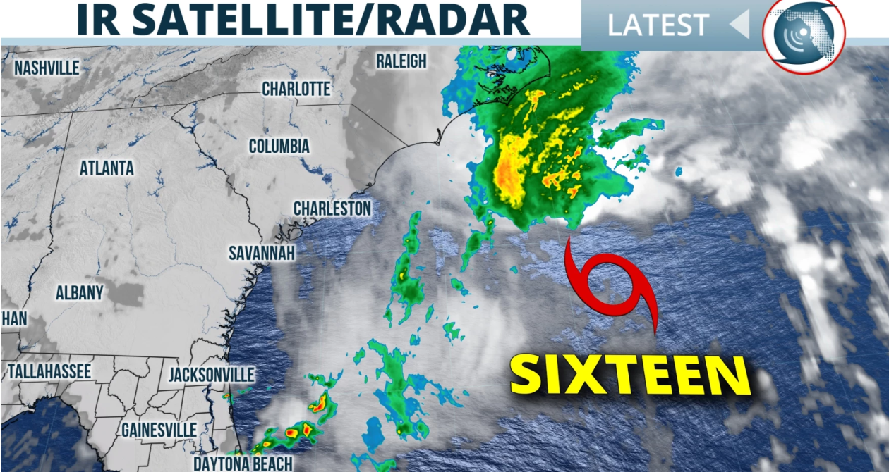
A potential tropical storm moving north off the coast could bring gusty winds, rough surf and a high risk for rip currents to Northeast Florida starting Friday.
Wind gusts of 20 to 30 mph are possible. This will cause offshore waves in the 5- to 10-foot range.
Jacksonville Today thanks our sponsors. Become one.
A small craft advisory has been posted until Saturday afternoon from the First Coast down through the Treasure Coast. The National Weather Service in Jacksonville has advised, “Inexperienced mariners, especially those operating smaller vessels, should avoid navigating in hazardous conditions.”
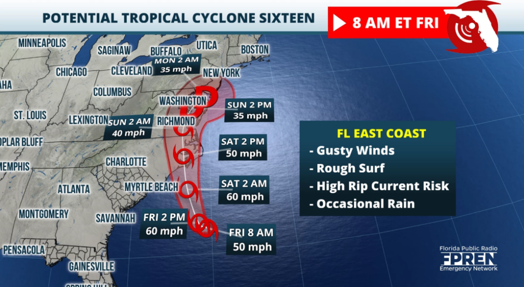
The National Hurricane Center has been monitoring the weather system the past few days for possible tropical development. The area of low pressure has been designated Potential Tropical Cyclone 16. It will likely become Tropical Storm Ophelia.
Regardless of development, this low is likely to bring tropical storm force winds, heavy rain, coastal flooding, high surf and life-threatening storm surge to parts of the southeast and mid-Atlantic U.S. coastline on Friday into the weekend. A tropical storm watch has been posted for the central and northern South Carolina coast. Tropical storm warnings have been issued for North Carolina heading northward.


Jacksonville Today thanks our sponsors. Become one.
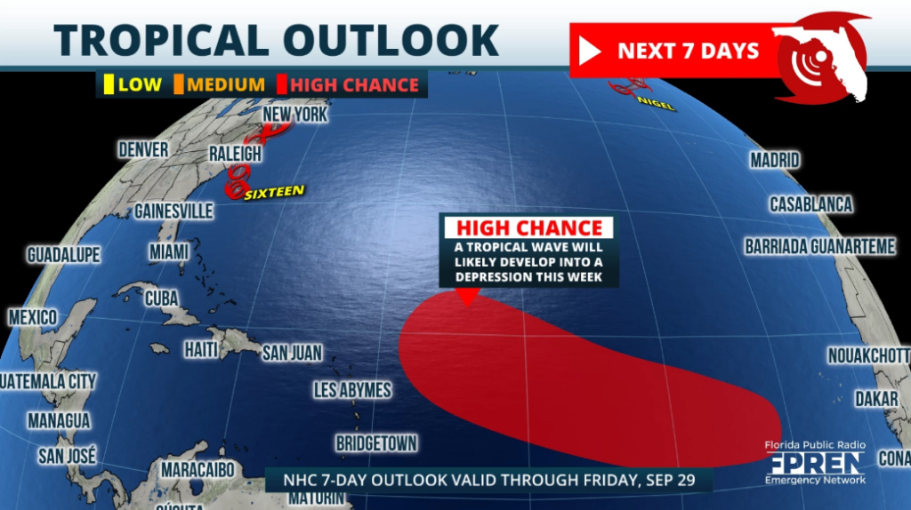
Much farther away in the eastern Atlantic, a tropical wave will likely become a depression over the weekend as it tracks westward. This system will need to be watched as it possibly approaches the Caribbean and Antilles next week.