Published on August 24, 2023 at 1:30 pm
Free local news and info, in your inbox at 6 a.m. M-F. Sign up for the Jacksonville Today newsletter.
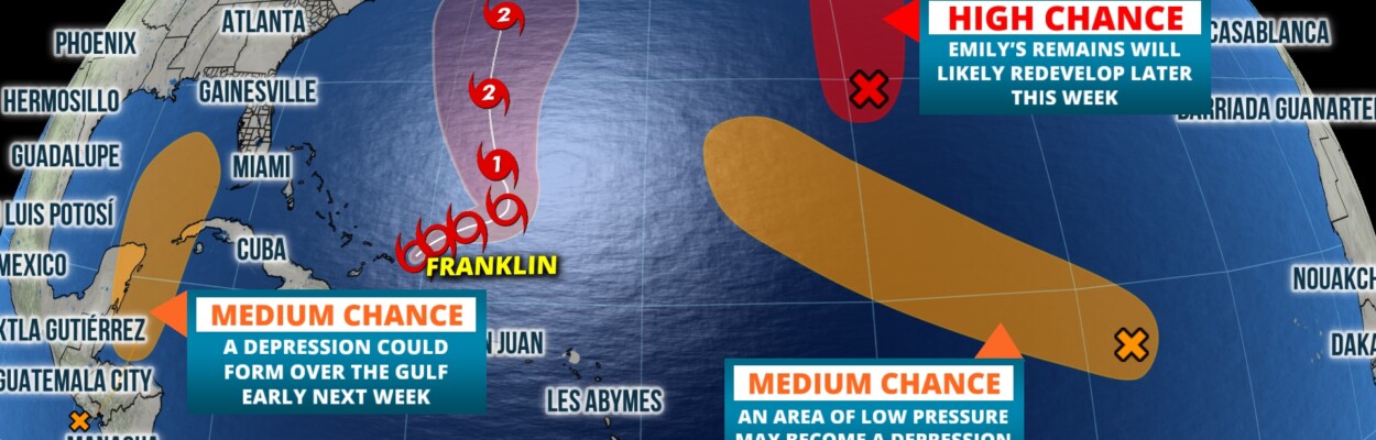
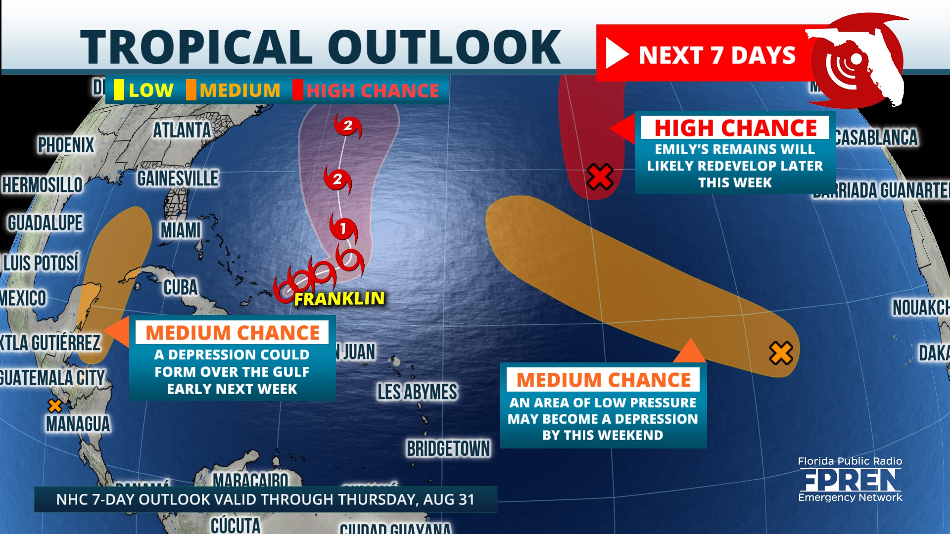
The National Hurricane Center is now marking a spot from the northwest Caribbean into the eastern Gulf of Mexico with a moderate chance for development. Current data and tropical models are signaling that an area of low pressure may evolve along the East Pacific coast of Central America.
It’s important to note this potential area of low pressure has not started developing just yet. Confidence is usually not high in tropical models tracking a system that does not yet exist, so expect much uncertainty to continue until these signals turn into an actual system.
Jacksonville Today thanks our sponsors. Become one.
For now, most reliable models are showing consistent signs for something to evolve and push into the northwest Caribbean this weekend, then possibly the Gulf next week. For preparation purposes, the Hurricane Center has appropriately highlighted this area as something to watch. And at this moment, that’s all we need to do.

Systems like Tropical Storm Franklin are well developed, so confidence is much higher in the track and intensity. Franklin is now becoming better organized after pulling away from the Greater Antilles and will likely become a hurricane over the weekend.
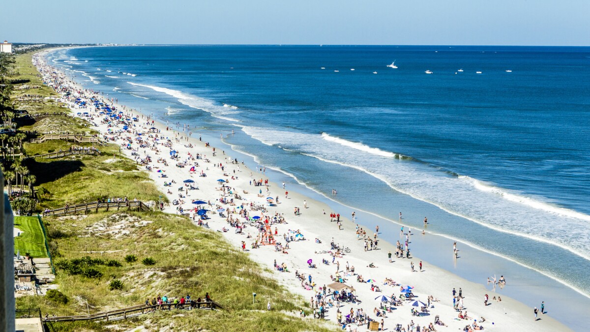
If conditions remain favorable, the storm has a good chance to strengthen into a Category 2 as it wobbles northward next week. Regardless of how much Franklin intensifies, it will not pose a direct threat to Floridians. However, the storm will cause rough surf and rip currents along Atlantic beaches.
Jacksonville Today thanks our sponsors. Become one.
The tropics are expected to stay active as peak hurricane season approaches the next several weeks. Whether that system develops and moves into the Gulf, it’s always a great idea to check your hurricane plan and supplies.
Copyright 2023 Storm Center. To see more, visit Storm Center.9(MDEwNzczMDA2MDEzNTg3ODA1MTAzZjYxNg004))