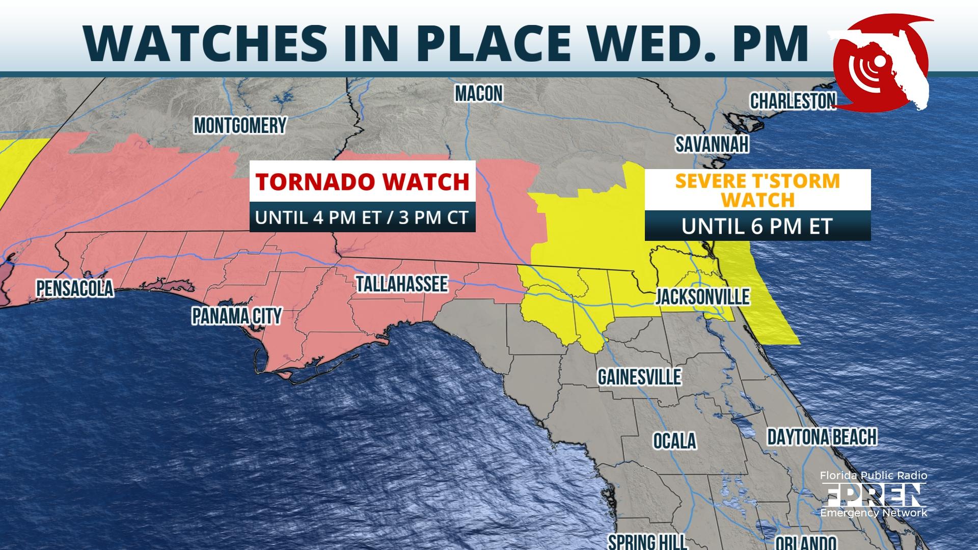
Tornado watches cover the entire Panhandle and a severe thunderstorm watch is in effect for North Florida through Thursday afternoon.
The unusual weather pattern responsible for more than 500 storm reports Wednesday will continue through Thursday evening across the Panhandle and North Florida. Radar data early Thursday afternoon depicted a squall line with a history of producing damaging winds approaching the Interstate 10 corridor west of Jacksonville. Amid abundant instability, additional lines of thunderstorms were developing across Alabama and Mississippi. These lines will continue moving southeastward through Thursday evening, bringing all severe weather risks to areas near and north of I-10.
Analysis of the mid- and upper-levels explains why the multi-faceted severe risks are at play in this area of the country in mid-June. Westerly winds aloft are howling at 50 to 70 miles per hour, while winds at the surface are generally out of the south. This change in wind direction, called wind shear, is prompting the elevated risk of tornadoes. The same strong winds aloft can also get pushed toward the surface as heavy rain falls, which explains the high wind potential across Thursday’s severe risk area.

High pressure anchored over Mexico is providing the mid- and upper-levels with warm and dry air, which helps to support the unusually large hail risk across the Deep South. Several reports were submitted to the National Weather Service Wednesday of hail in excess of 3 inches in diameter in Alabama and Mississippi, a region that doesn’t often see hail to this magnitude.
On top of the risk of hail, damaging winds, and tornadoes, slow-moving and repeating thunderstorms could lead to localized flash flooding. Several inches of rain have fallen across North Florida and the Panhandle in recent days, so continued rounds of heavy rain could be too much for the soil to handle. Some areas of the Panhandle remain under a Flood Watch until Friday evening, as additional rainfall totals could be between 2 and 4 inches with locally higher amounts.
Thursday features a nearly identical severe risk as Wednesday, though the most widespread severe weather is likely to occur across the Central Plains. Despite that, numerous watches are in place through Thursday afternoon from Pensacola to Jacksonville. Storms are forecast to come through in two rounds: the first round will impact North Florida through Thursday afternoon and the second round will impact much of the Panhandle Thursday evening. High-resolution models have done poorly in accurately forecasting the arrival time of these thunderstorm complexes, but storms that do arrive before sunset will likely have the benefit of daytime heating to provide an extra boost of energy.
This pattern is not likely to dissipate anytime soon. Friday’s risk of strong and severe storms will stretch across the same areas of Florida, with the highest potential found across the Panhandle.
9(MDEwNzczMDA2MDEzNTg3ODA1MTAzZjYxNg004))


