Published on April 26, 2023 at 12:03 pm
Free local news and info, in your inbox at 6 a.m. M-F. Sign up for the Jacksonville Today newsletter.
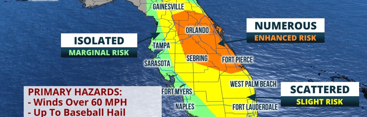
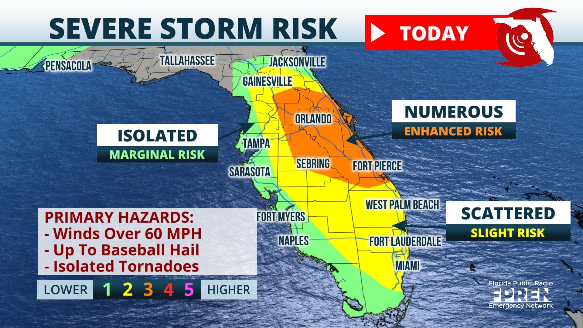
Strong and severe storms are likely in the peninsula late this afternoon and evening.
The Storm Prediction Center has placed most of the peninsula from Jacksonville down to Miami in a slight risk for severe weather. The greatest storm coverage is expected in the enhanced risk area from Ocala through Orlando and into Fort Pierce.
Jacksonville Today thanks our sponsors. Become one.
Very large hail up to baseball size and damaging winds are the main threats. Isolated, brief tornadoes are also possible, especially near the Atlantic Coast.

Flash flooding will be a concern with torrential rain at times. Some localized areas may pick up over 2 inches in a very short time. Please stay weather aware and watch for that high water.
A stormy weather pattern will continue across Florida straight through the weekend. Thursday, the severe risk shifts into the Panhandle then spreads into the peninsula on Friday.


Jacksonville Today thanks our sponsors. Become one.
A series of cold fronts will march through the state Saturday and Sunday bringing more rounds of rain and isolated to scattered severe storms. Please plan ahead and download the Florida Storms app to track the latest severe weather threats.

Copyright 2023 Storm Center. To see more, visit Storm Center.9(MDEwNzczMDA2MDEzNTg3ODA1MTAzZjYxNg004))