Another cold front will pass through the Southeast later this week, and it will pose a multitude of threats for parts of the Sunshine State — including frost in Northeast Florida and possibly temperatures below freezing.
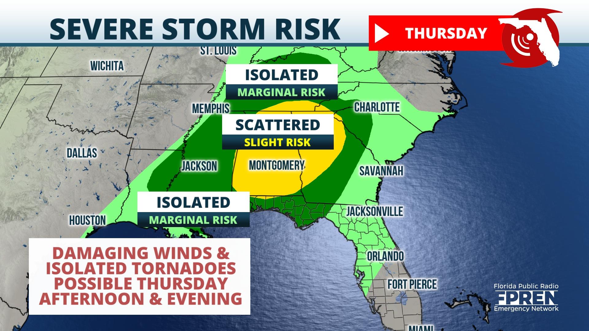
Thunderstorms capable of producing damaging straight-line winds are expected over the Panhandle on Thursday, and northerly winds will cause temperatures to drop on Friday.
On Tuesday afternoon, high pressure was building over the Mid-Atlantic and Central Gulf Coast, and conditions over these regions were calm and seasonably cool. However, over the eastern Pacific, yet another strong storm system was approaching the California coast.
Through the remainder of the week surface low pressure, aided by a strong disturbance in the mid-levels of the atmosphere, should intensify and propagate eastward into the Southeastward. A broken squall line of potentially strong thunderstorms should herald its arrival to our area.
By Thursday, a cold front extending from the center of this system should track from west to east across the Central Gulf Coast. Although exact details regarding timing are not certain, models are generally in consensus that downpours and thunderstorms should pass through the Pensacola area during the late morning on Thursday, through Panama City during the early afternoon, and Tallahassee during the evening Thursday.
Overnight Thursday into early Friday morning, a weakening squall line should approach North Florida markets, including Gainesville and Jacksonville. Although unlikely, a few cells within the line could retain their strength during the overnight hours.
The primary hazard from the strongest storm cells on Thursday will be damaging straight-line winds. Parameters will also be in place to support low level circulation and brief tornado spin-ups.

Behind the system, winds will turn northerly, ushering in a frigid airmass from the higher latitudes. Temperatures across the entire state should fall well below average, and by Saturday afternoon highs will range from the low/mid 50s over the Panhandle to the low/mid 60s over Miami and the Keys.
Widespread frost is likely early Saturday and early Sunday over Panhandle and North Florida locations. In rural locations and in areas along and north of I-10, lows could fall below freezing on Saturday and Sunday.
Interests across these regions are encouraged to continue monitoring weather forecasts over the coming days. Residents and visitors alike should know where they will shelter should a severe thunderstorm or tornado threaten their immediate location.
In addition, precautions should be taken when temperatures drop: Bring pets inside and cover sensitive plants. Prevent housefires by using space heaters in well-ventilated areas, away from other objects. For more information on how to remain safe in the cold, please visit the Florida State Emergency Response Team website.
9(MDEwNzczMDA2MDEzNTg3ODA1MTAzZjYxNg004))


