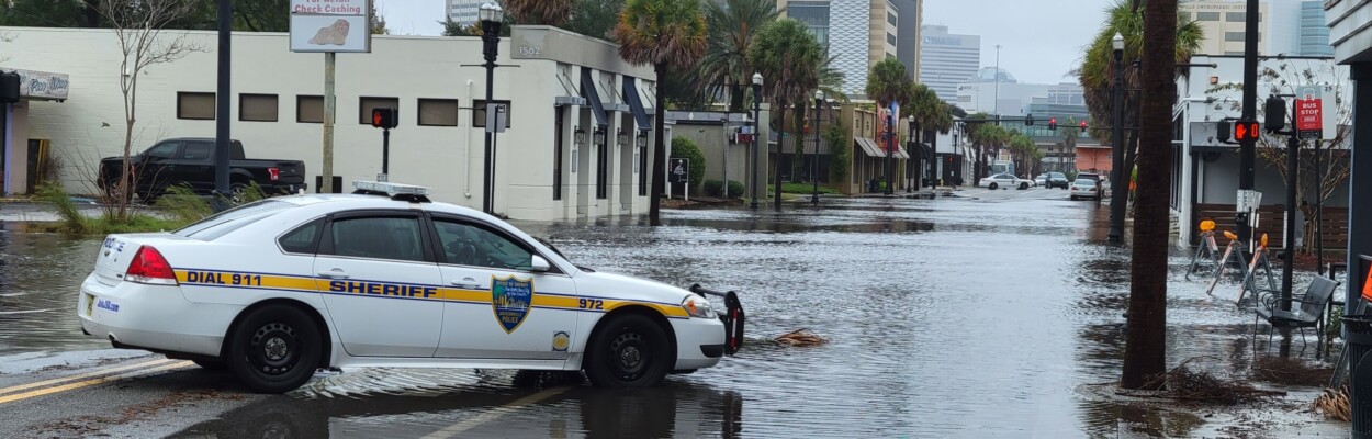
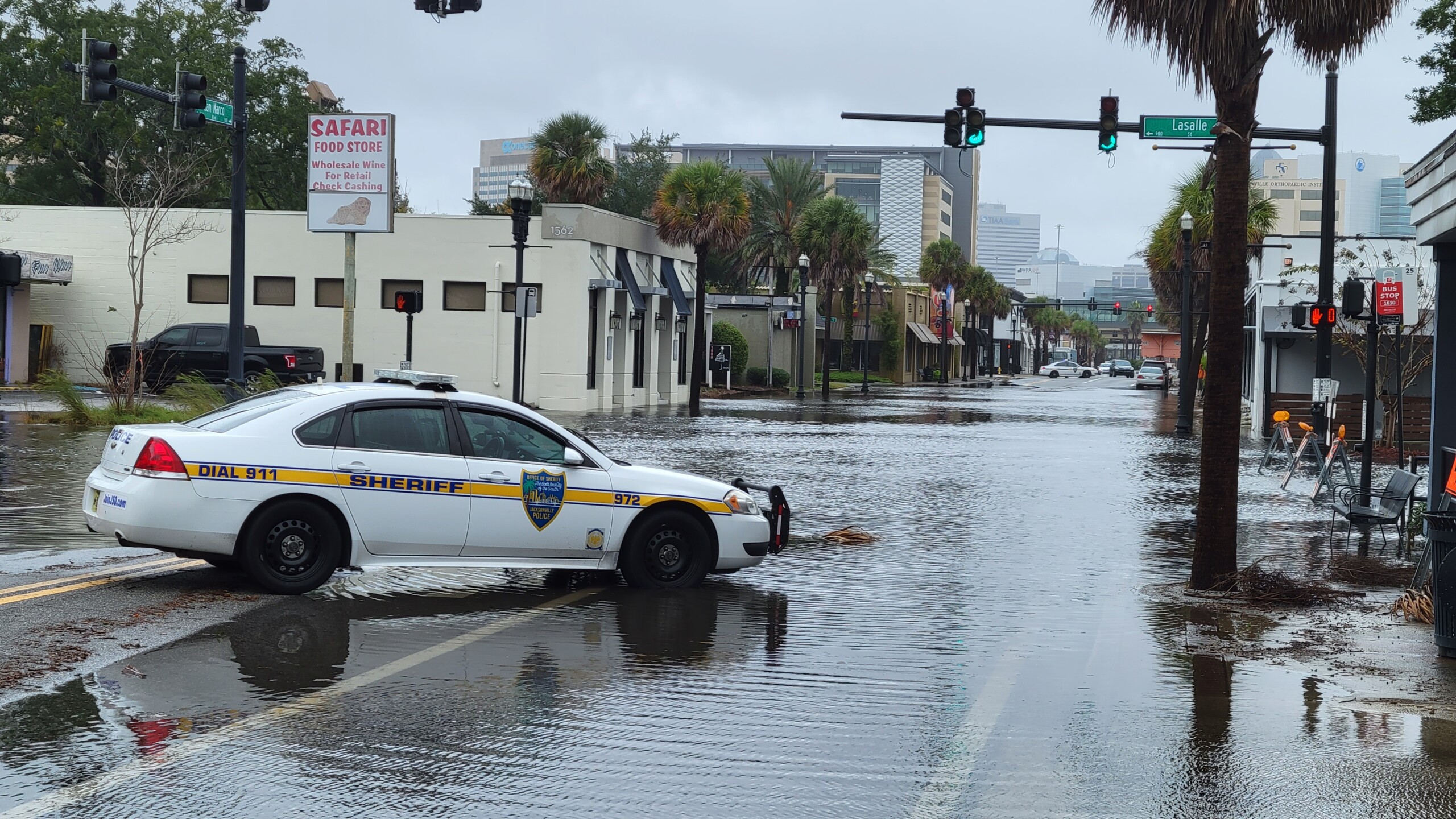
San Marco Boulevard was flooded at Lasalle.
Published on November 10, 2022 at 1:32 pm
Free local news and info, in your inbox at 6 a.m. M-F. Sign up for the Jacksonville Today newsletter.
Tropical Storm Nicole might have passed, but that doesn’t mean it’s safe outside.
Kevin Guthrie, director for the Florida Division of Emergency Management, warned people this morning to stay indoors and away from the coastline.
Jacksonville Today thanks our sponsors. Become one.
“The storm is very large. Even if the eye has passed over your area, it may still be unsafe to go outside due to the heavy winds, flash flooding and isolated tornadoes,” Guthrie said. “If there are flash flood warnings in your area, remember it is never safe to walk or drive through flooded waters.”
Jacksonville Mayor Lenny Curry warned residents to be aware of high tide Thursday night and Friday morning, when the risk for flooding at the beaches and along the St. Johns River is high, especially for those who live in low-lying areas.
Jacksonville residents are asked to stay out of the ocean and off roadways. If you encounter a flooded road, turn around; do not try to drive through it.


Jacksonville Today thanks our sponsors. Become one.
The Legends Center on Soutel Drive and Landmark Middle on Kernan Boulevard are both open as shelters for the general population, with the Legends Center also equipped for those with special needs.
Guthrie said that emergency personnel responded to a tornado in St. Johns County earlier in the morning and that major flood stages were occurring along the St. Johns River. A tornado warning was issued for portions or Duval and Nassau counties late in the morning.
Tornadoes, storm surge and tidal flooding are the city’s biggest concerns, Curry said.
In the case of a tornado, stay in the most interior room of your home, and protect your head and body from potential debris with a blanket, sleeping bags, a mattress or some kind of helmet.
For live updates, stay tuned to WJCT News 89.9 or download the Florida Storms app for live updates from the Florida Public Radio Emergency Network.
9(MDEwNzczMDA2MDEzNTg3ODA1MTAzZjYxNg004))