Founded in 1822, Jacksonville is home to 107 properties and districts listed on the National Register of Historic Places. Of this number, seven are officially recognized as National Register historic districts. The most recent addition, the campus of Edward Waters University, was listed on the National Register on Aug. 8th of this year. Here is a look into the history of all seven National Register historic districts within Jacksonville’s urban core.
Avondale
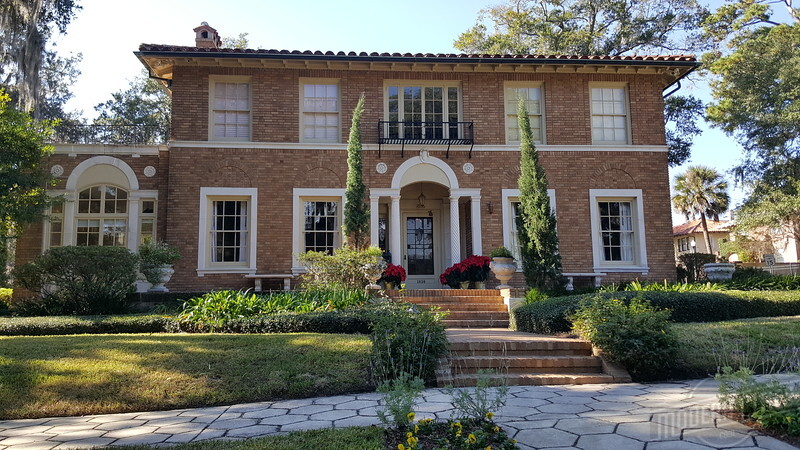
Originally advertised as “Riverside’s Residential Ideal,” Avondale was platted by Telfair Stockton’s Avondale Co. on the site of a failed 19th Century development called Edgewood. Acquired for about $500,000 in 1920, the 220-acre tract’s general boundaries were the St. Johns River, West Avenue, Demere Street (now Roosevelt Boulevard) and Talbot Avenue, and was served by a streetcar line to Ortega that was completed in 1908. Conceived during the height of the Great Florida Land Boom, the 4.5-block wide, mile-long development was envisioned to become an upscale, covenant-restricted community that Jacksonville had not seen before. The name Avondale came from James R. Challen’s former home in Cincinnati, Ohio. Challen was the former owner of Edgewood.
The Avondale Co. added another Ohio link by hiring William Chase Pitkin Jr., a well-known Cleveland-based landscape architect, to design the project. Influenced by the City Beautiful Movement and previous projects like Columbus, Ohio’s Upper Arlington, unlike the rigid grids associated with older streetcar suburbs, Pitkin designed a community with paved, curvilinear streets, larger residential lots, 16 parks, and access to water, sewer, gas and electricity. Similar to its older neighbor Murray Hill, Avondale’s properties were also built to include detached garages, accommodating the growing popularity of the automobile during the 1920s.
The neighborhood was popular from the very beginning, and initial buyers were attracted to properties between the riverfront and the Ortega car line. Within two years, 402 of the subdivision’s 720 lots had been sold and nearly 200 houses completed, with a large portion designed in the Mediterranean Revival style. By the time the Florida land boom fizzled, virtually all of Avondale had been developed.
On July 6,th 1989, the Avondale Historic District was added to the National Register of Historic Places. Along with neighboring Riverside, the American Planning Association named Avondale as one of the country’s top neighborhoods in 2010. A century after Stockton’s purchase, Avondale remains as popular today as it was during the Florida Land Boom.
Downtown Jacksonville
Platted by Isaiah D. Hart in 1822, the Northbank of Downtown Jacksonville developed at the north side of a ferry crossing that was located at the narrowest part of the St. Johns River. The ferry served the Old Kings Road that connected St. Augustine with St. Marys, Georgia. Incorporated 10 years later, the plat was a result of Hart’s proposing a town and convincing his neighbors to donate additional land for the venture. The settlement was named Jacksonville after Andrew Jackson, who had become popular among many Floridians for his actions in the First Seminole War.
The physical layout of the town is a standard grid of blocks divided into 105-foot by 105-foot square lots, with some blocks having eight square lots. This original street grid has been maintained, with the only deviations being North Market Street, terminating at the parcel of land occupied by the St. John’s Episcopal Cathedral, and 21st Century modifications to West Monroe Street in order to accommodate the new Duval County Courthouse.
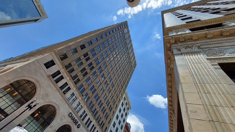
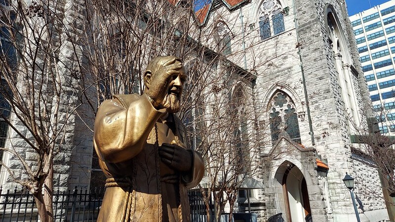
Listed to the National Register of Historic Places on May 2nd, 2016, as the Downtown Jacksonville Historic District, the Northbank’s period of significance is identified as extending from the Great Fire of 1901 through 1965. Encompassing 56 blocks, the 158-acre historic district contains 176 contributing buildings, one contributing site and two contributing objects. As a result of the rebuilding effort following the Great Fire of 1901, the Downtown Jacksonville Historic District is characterized by a rich mixture of residences, churches, schools, office and commercial buildings, government buildings and architectural styles.
Durkee Gardens
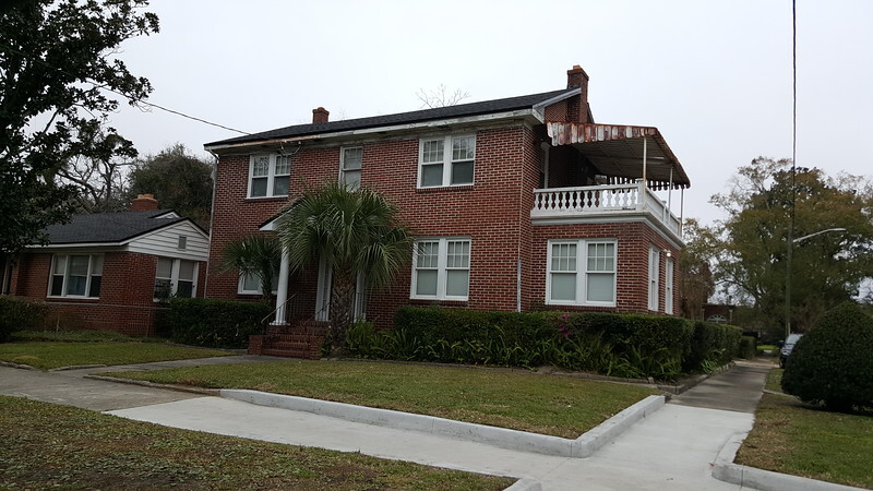
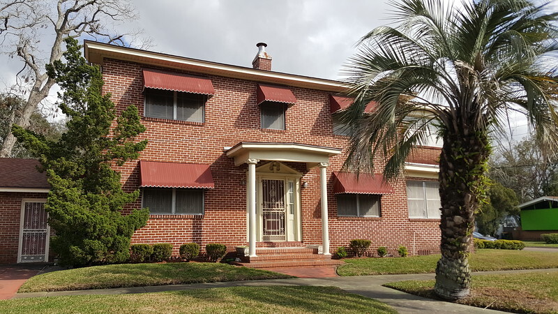
Durkee Gardens was added to the National Register on March 16th, 2020. This accomplishment makes it the first historic African American neighborhood in Jacksonville to be recognized as a National Register Historic District. Generally bounded by Myrtle Avenue, McConihe Street, Payne Avenue and 13th Street, the Durkee Gardens Historic District encompasses 49 acres and includes 209 contributing buildings completed between 1934 and 1969. Platted between 1934 and 1944, the district is dominated by the Minimal Traditional architectural style and a lasting reminder of the quality work of African American architects and builders.
The larger community of Durkeeville largely owes its existence to the establishment of the North Jacksonville Street Railway, Town and Improvement Co. in 1902. Called the “Colored Man’s Railroad,” this Black-owned streetcar system connected Northwest Jacksonville with Downtown. Opening ceremonies were held on August 24th, 1903, with several dignitaries, including Mayor George M. Nolan and former Mayor Duncan U. Fletcher, giving speeches. The streetcar routes grew to be one of the city’s most used, stimulating development along their path through the northwest side of town. By the end of the Florida Land Boom, both LaVilla and Sugar Hill were largely built out.
At the time, a significant plot of nearby land was owned by Dr. Jay H. Durkee. Durkee was a prominent real estate developer and son of Union military officer Joseph Harvey Durkee. Originally from New York, Durkee settled in Jacksonville after the Civil War. The Durkee family envisioned their property being used for industrial and railroad related uses adjacent to the new Seaboard Air Line Railroad. At one point, to stimulate industrial growth, a rail spur was extended to Myrtle Avenue just south of West 13th Street. After those plans failed to materialize, much of the property was developed to accommodate Jacksonville’s African American professionals and businessmen.
Edward Waters University
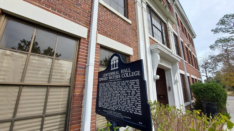
Edward Waters University was started by Bishop Charles H. Pearce in 1866 to educate the former enslaved, especially those desiring to enter the African Methodist Episcopal church ministry. Originally known as the Brown Theological Institute, it was located in Live Oak, Florida. After financial difficulties, the school was relocated to Mt. Zion AME in Downtown Jacksonville in 1889 and the name was changed to Florida Normal Scientific and Divinity High School. In 1892, the name was changed to Edward Waters College in honor of the third bishop of the AME church.
Situated on East Beaver Street in the Black Bottom, the original Jacksonville campus was destroyed during the Great Fire of 1901. This disaster led to Edward Waters’ acquiring the current site in 1904 and establishing a new campus there by 1908. During the first half of the 20th Century, several neighborhoods including New Town, Durkeeville and College Gardens grew up around the formerly rural school site. In 1960, it gained four-year college status and began to offer B.A. degrees. Notable alumni over the years include Civil Rights leader A. Philip Randolph, former Florida state Sen. Betty Holzendorf, D-Jacksonville, Negro League baseball player Buck O’Neil, former Jacksonville Sheriff Nat Glover and former U.S. Rep. Corrine Brown.
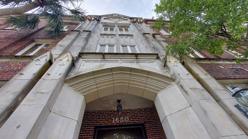
There are 1,025 enrolled students at Jacksonville’s only university with a historic urban core campus. Working to expand its undergraduate studies and offer master’s programs, Florida’s oldest Historically Black College recently became a university. Added to the National Register on Aug. 8th, 2022, Edward Waters University is located at 1658 Kings Road.
Old Ortega
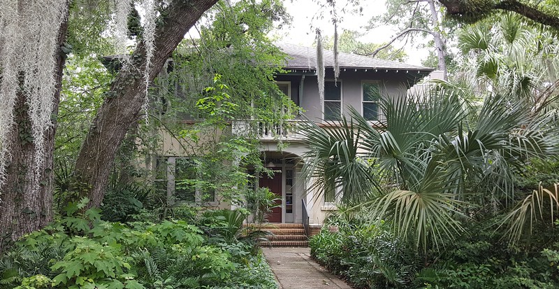
Built on a former Sea Island cotton, sugar cane and corn plantation, Ortega is named in honor of Josef de Ortega. Ortega was the judge advocate for East Florida, who approved the sale of the property to John H. McIntosh of St. Marys, Georgia, in 1804. Ortega was acquired by John P. Sanderson in 1857 and had largely become a vacant and heavily wooded peninsula by the turn of the 20th Century. With $50,000 borrowed from Gilded Age financier J.P. Morgan, U.S. Sen. Wilkinson Call’s Ortega Town Co. acquired the former plantation in 1902. Struggling with his health, Call sold the fledgling development to the Ortega Company in 1906.
By 1908, the Ortega Co. had completed a wooden bridge across the Ortega River, connecting the tract to Riverside and Downtown. Founded by John N. C. Stockton and Charles C. Bettes, in 1909 the Ortega Co. began development of Ortega as a streetcar suburb designed by prominent local architect Henry J. Klutho. Considered to represent an early manifestation of the City Beautiful Movement, Klutho’s design incorporated four circular parks named after New World explorers with radiating streets that ran to the peninsula’s waterfronts. Situated on a heavily wooded peninsula at the confluence of the St. Johns and Ortega rivers, Klutho created housing tracts that took advantage of the unusual terrain and land shapes. As an incentive to purchase home sites, the Ortega Co. promised no taxes and free water for a certain time period.
With the streetcar line running down Park Avenue (present day Baltic Street) between Grand and Corinthian avenues, Ortega’s original boundaries were largely defined by the Ortega River, St. Johns River, Verona Avenue and the Atlantic Coast Line Railroad (present day CSX). Street names consisted of a mix of Native American tribes, Ivy League schools and architectural columns.
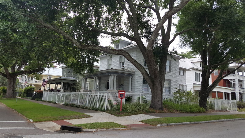
During the height of the 1920s Florida Land Boom, Ortega emerged as a popular residential destination. More than 95% of all buildings in the Old Ortega Historic District were originally constructed as single-family dwellings. It contains a wide variety of residential architectural styles, including Frame and Masonry Vernacular, Mission, Craftsman Bungalow, Mediterranean Revival, Colonial Revival, Minimal Traditional, Tudor Revival and Prairie. With 601 contributing sites, the Old Ortega Historic District was added to the National Register of Historic Places on July 14th, 2004.
Riverside
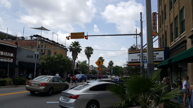
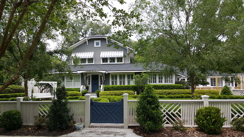
Riverside was platted in 1868 by Boston’s John Murray Forbes and Florida Times-Union editor Edward M. Cheney. Carved out of the former Dell’s Bluff Plantation, the land that became Riverside was acquired for $10,000 in gold. Riverside remained sparsely populated until the completion of a mule-drawn streetcar in the vicinity in 1886. Efficiently connected with Downtown, the neighborhood was engulfed by growth after the Great Fire of 1901 and the 1908 extension of the streetcar system to Ortega. During the height of the 1920s Florida Land Boom, residences around the intersection of Park, Lomax and Margaret Streets began to give way to commercial development now recognized as Five Points.
Riverside Avenue is home to one of the largest concentrated collections of Prairie School residences outside of the Midwest. Originating in Chicago, Prairie School was an attempt in creating an indigenous North American style of architecture related to the ideas and aesthetics of the Arts and Crafts Movement of the late 19th and early 20th centuries. Characterized by horizontal lines, windows grouped in horizontal bands, and flat or hipped roofs with broad overhanging eaves, the architectural style came to Jacksonville when young architects influenced by the likes of Frank Lloyd Wright and Louis Sullivan moved to the city to help rebuild after the Great Fire of 1901. Roughly bounded by the CSX railroad line, Riverside and Memorial Parks, the St. Johns River and Seminole Road, Riverside was listed on the National Register as a historic district on March 22nd, 1985.
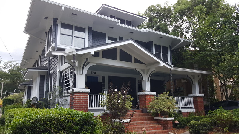
Springfield
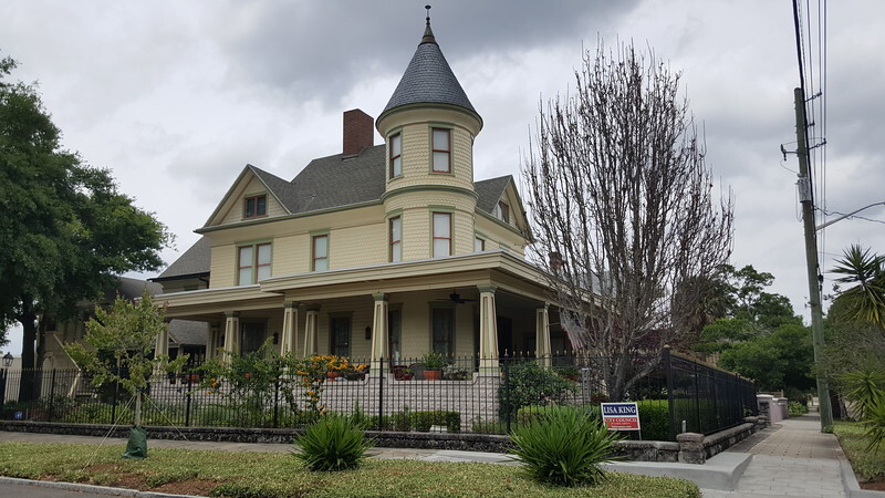
Dating to 1869, the Springfield Historic District is home to some of Northeast Florida’s best examples of 19th and early 20th Century architecture. Named after a spring that once flowed near present-day West 4th Street, Springfield was initially advertised as a planned Jacksonville suburb by John H. Norton, one of the city’s first professional developers. Development was slow to materialize until the 1879 construction of a horse-drawn streetcar line between Downtown and 8th Street and the formation of Samuel Hubbard’s Springfield Development Co. in 1882.
During the Gilded Age, Jacksonville became a popular winter tourist resort for the rich and famous. Springfield developed into a major benefactor, as its streetcar line resulted in the development of a skating rink, dinner halls and restaurant in 1884, followed by the 1888 opening of the Sub-Tropical Exposition and the city’s first zoo in 1893. However, disasters in the form of yellow fever and the Great Fire of 1901 laid the foundation of Springfield’s transformation from a tourism center into a walkable mixed use neighborhood.
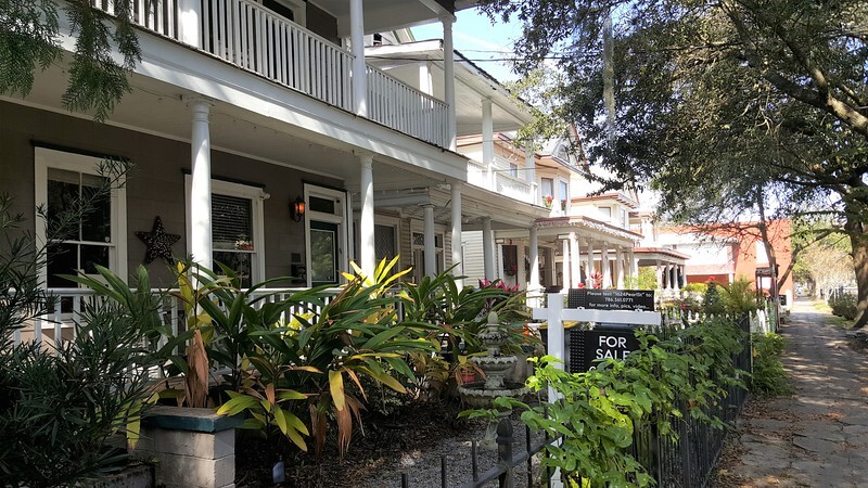
Spared by the fire by Hogans Creek and home to the city’s first electric streetcar line, residential construction boomed along the Springfield’s streets and industrial development sprouted up along its railroad lines. By the time of the 1920s Florida Land Boom, the neighborhood had already been built out, preserving its diverse collection of late 19th and early 20th Century architectural styles and mix of uses. On Jan. 22nd, 1987, the neighborhood was officially listed on the National Register of Historic Places. In 2010, Springfield was recognized by Southern Living Magazine as the No. 1 “comeback” neighborhood in the South, due to a resurgence of interest and redevelopment.
