A few rounds of heavy rain with embedded thunderstorms will move across the state, beginning Saturday afternoon.
The primary band of heavy rain is expected to reach the Florida Panhandle early Saturday afternoon before approaching the west coast of Florida near sunrise Sunday.
Showers and thunderstorms will continue across the state for much of Sunday. Some storms could be severe.
The Storm Prediction Center has placed much of south and central Florida, including Tampa, Miami and Fort Lauderdale, in the Marginal category for severe storms Sunday. The primary severe threat is damaging winds, with the possibility of an isolated tornado.

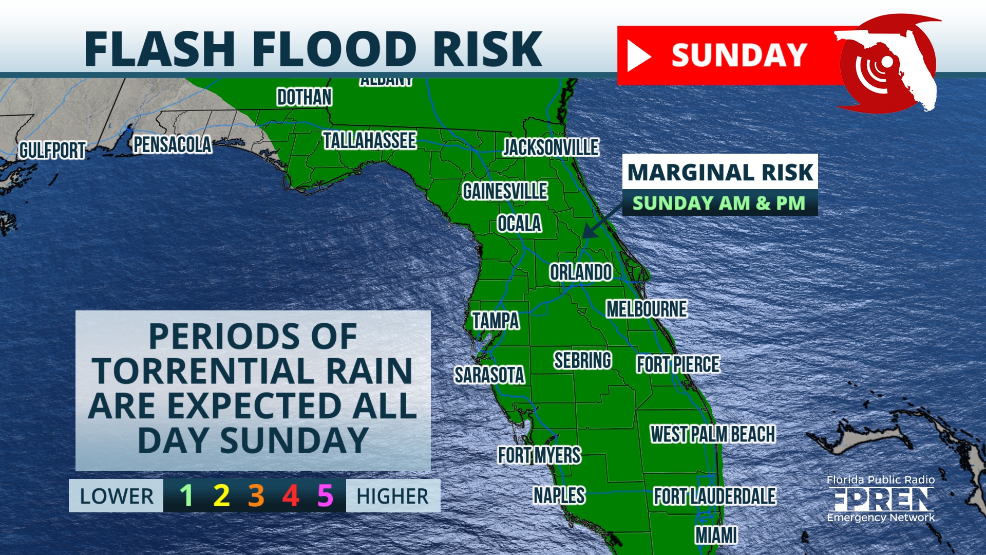
Flash flooding is also a concern. The Weather Prediction Center has placed the state in the Marginal category for flash flooding Sunday. Forecast models are suggesting accumulation of rain could be in excess of 1.5 inches.
Additional rain is likely Monday before this upper level low pressure system exits our area, but rain Monday is expected to be lighter and more intermittent.
9(MDEwNzczMDA2MDEzNTg3ODA1MTAzZjYxNg004))


