Published on April 20, 2026 at 9:35 am
Free local news and info, in your inbox at 6 a.m. M-F. Sign up for the Jacksonville Today newsletter.
Fire danger will remain high in Central and North Florida as a cold front pushes south, bringing cool, dry air
Winds on Monday will be mainly out of the northeast around 15 mph, but gusts will be elevated up to 30 mph. Relative humidity will be extremely low, between 15% and 25%.
Jacksonville Today thanks our sponsors. Become one.
Make sure to avoid open flames or sparks and park your vehicles off the dry grass. If you smoke, make sure to discard cigarettes properly, as they can quickly ignite fires, and the wind could make these fires become erratic quickly.
Remember, extreme drought continues to dominate most of the region, and we do not expect conditions to change much by the end of the week when the new drought monitor report is released.

Across Central Florida, temperatures will be much cooler to start the week. Highs will remain in the mid to upper 70s under partly cloudy skies. It will also be windy, with gusts up to 30 mph.


Jacksonville Today thanks our sponsors. Become one.
Across West-Central Florida, including the Tampa Bay area, temperatures will be slightly warmer and closer to average for this time of year, with highs around the mid-80s under mostly sunny skies. Winds will also be strong, with gusts up to 21 mph.
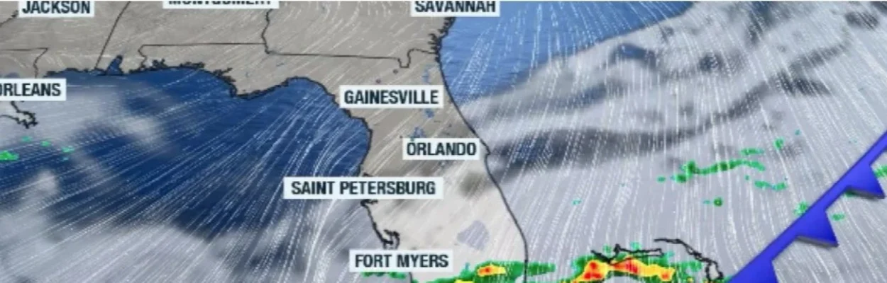
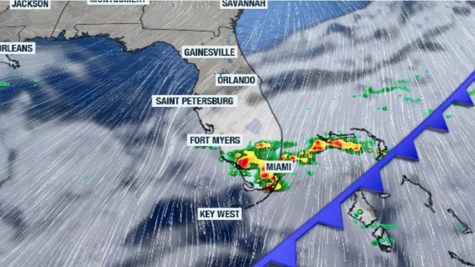
South Florida is where we can expect the weather to remain the most active. The cold front will continue pushing through, while a low-pressure system develops and moves across the region. This system will enhance shower activity.

Expect periods of heavy showers throughout the day, mainly in the afternoon into the evening, with isolated storms also possible. Clouds and showers will keep high temperatures around 83 degrees across South Florida, which is close to average for this time of year.
Tuesday is expected to bring much drier air, with sunshine returning. South Florida will see highs around the upper 70s, along with breezy conditions. Gusts on Tuesday could reach up to 30 mph, and gusty winds will continue at least through Thursday afternoon.