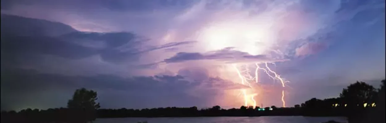
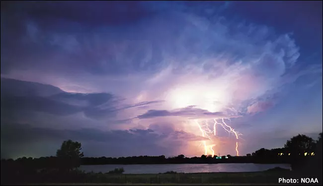
La Nina can reduce severe weather in Florida. | NOAA
Published on October 16, 2025 at 12:10 pm
Free local news and info, in your inbox at 6 a.m. M-F. Sign up for the Jacksonville Today newsletter.
The National Oceanic and Atmospheric Administration has declared that a La Niña is underway across the Pacific — an event that could have wide-reaching implications for weather patterns across the country through the remainder of fall and into the upcoming winter.
According to the agency, the negative phase of the El Niño-Southern Oscillation, or what is commonly referred to as ENSO, began in September when water temperature anomalies in critical parts of the central and eastern Pacific dropped below the threshold of -0.5 degrees Celsius.
Jacksonville Today thanks our sponsors. Become one.
The effects of La Niña across the country are well known, with the southern tier of the U.S. generally experiencing drier and warmer-than-normal conditions, while the northern tier often sees cooler and wetter weather.

The last La Niña event officially ended in 2023, and during the two years since, the world has either been in an El Niño or La Nada (neutral) state — both of which have contributed to heat waves, droughts and other disruptive weather patterns.
Additionally, reports of severe weather, including hail, tornadoes and damaging winds, have been generally above normal, a characteristic more in line with a La Niña pattern than the neutral conditions the world has been experiencing.


Jacksonville Today thanks our sponsors. Become one.
Research conducted by NOAA’s Storm Prediction Center also shows that severe weather outbreaks are more likely across the U.S. during a La Niña event, but Florida stands out as an exception.

During significant La Niña events, there tends to be a large drop in severe weather reports across Florida and the Gulf Coast, which can be influenced by the jet stream.
The jet stream is often displaced well to the north of the Sunshine State, limiting the dynamics needed for severe weather outbreaks.
The El Niño phase of the ENSO tends to make ingredients more favorable for tornado outbreaks, including a historic event that occurred in February 1998 that killed 42 people and injured hundreds more across Central Florida.
Forecasters caution that while a specific stage of the ENSO can tilt the odds in one direction, the climate pattern does not guarantee a particular outcome.
Conditions such as sea surface temperatures, the status of other oscillations and even disruptions of the polar vortex can play a role in the frequency and intensity of storm systems.
June and September are usually the two most active months for tornadoes in the Sunshine State, though they can be spotted year-round.
La Niña outlook
NOAA’s latest outlook calls for a rather weak La Niña event, with water temperature anomalies in the Pacific staying in the -0.5 °C to -1.0 °C range.
Long-term climate models show the event transitioning back to a neutral state by early spring 2026.
If that outlook holds, the weak event may not produce as dramatic a signal as stronger La Niñas have in the past.
Historically, stronger La Niñas have led to widespread warmth across the country, while moderate events tend to bring cooler weather.

With weaker events, it’s often a mixed bag — about half of the seasons trend warmer, while the other half trend cooler than typical.
Each cycle typically lasts around nine to 12 months, meaning the current La Niña will likely be relatively short-lived.
NOAA’s next ENSO update is scheduled to be released Nov. 13 and will give forecasters a better sense of how strong the event will become and how long it may last.