Published on October 7, 2025 at 11:25 am
Free local news and info, in your inbox at 6 a.m. M-F. Sign up for the Jacksonville Today newsletter.
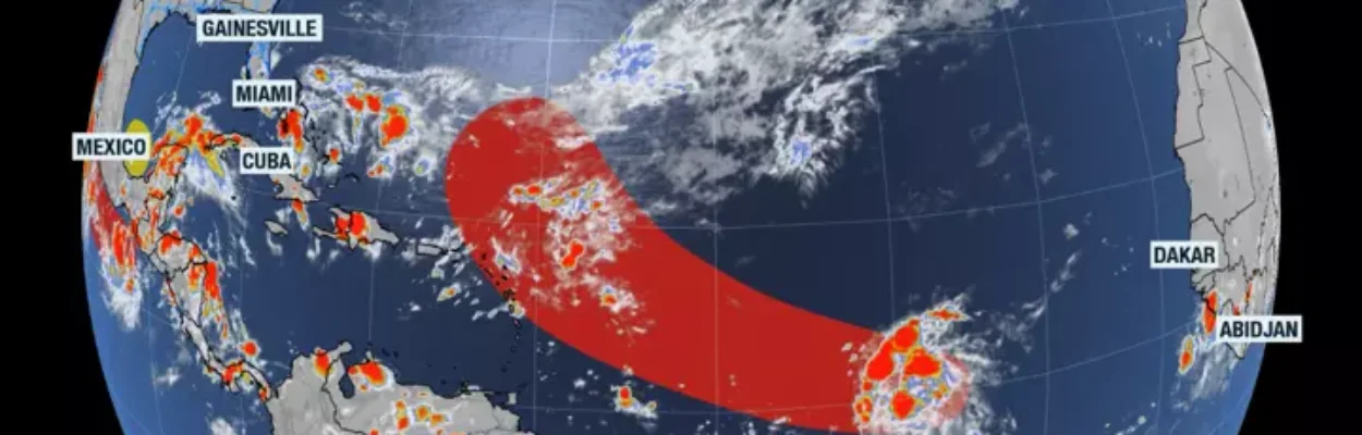
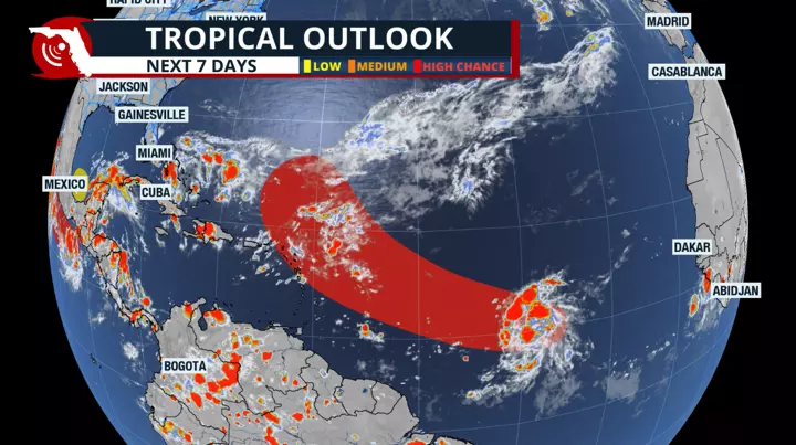
Tropical Storm Jerry has developed in the central Atlantic, the 10th named storm of the season.
The National Hurricane Center said at 11 a.m. that a system known as Invest 95L had developed into the tropical storm.
Jacksonville Today thanks our sponsors. Become one.
The storm was moving quickly westward Tuesday morning. By Thursday, it will be near the northeastern Caribbean and making a turn to the west-northwest.
Most models have this system staying a safe distance away from the northeastern Caribbean, over 400 miles away, and making a northward turn Thursday, remaining as a fish storm without affecting the United States.
Also, most of its convection and strongest winds will stay focused either north or to the right (after it makes the northward turn) of the center, which benefits the small Caribbean islands.


Jacksonville Today thanks our sponsors. Become one.
“The environmental conditions appear favorable for the system to strengthen during the next couple of days with the upper-level winds appearing light, waters quite warm, and abundant surrounding moisture,” the Hurricane Center said.
Besides Jerry
Besides Jerry, a disorganized tropical system was moving over the Yucatan Peninsula on Monday night into Tuesday. Once it emerges over the Bay of Campeche or the southern Gulf, it has a slight chance and a short window to develop into a tropical system.
Since the system has little time before it approaches the southern portion of the state of Veracruz, it will bring torrential rains, which may lead to landslides and flooding, even if the system doesn’t fully develop. It is not expected to turn toward the U.S.

Anything else coming?
There is a chance for more tropical waves to emerge from Africa in the coming weeks. Fortunately, we are noticing a pattern across the United States, where more fronts, possibly stronger ones, travel from west to east, which tends to sweep tropical systems away.
During this time of year, unless a front becomes stationary and leaves enough energy behind to develop a close-to-land tropical system, African waves that do get to grow tend to stay over the open Atlantic.
We should monitor any lingering front closely and be aware that if a system were to develop from a front, then we could potentially have less time to prepare.