Published on August 6, 2025 at 9:57 am
Free local news and info, in your inbox at 6 a.m. M-F. Sign up for the Jacksonville Today newsletter.
Prolific storms and seemingly endless rounds of rain are possible this week across the Panhandle and North Florida.
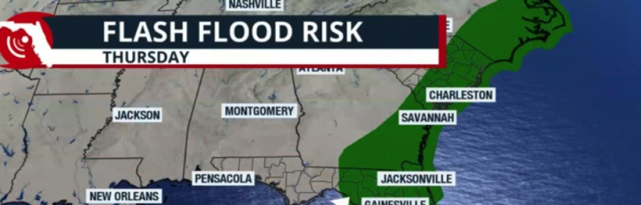
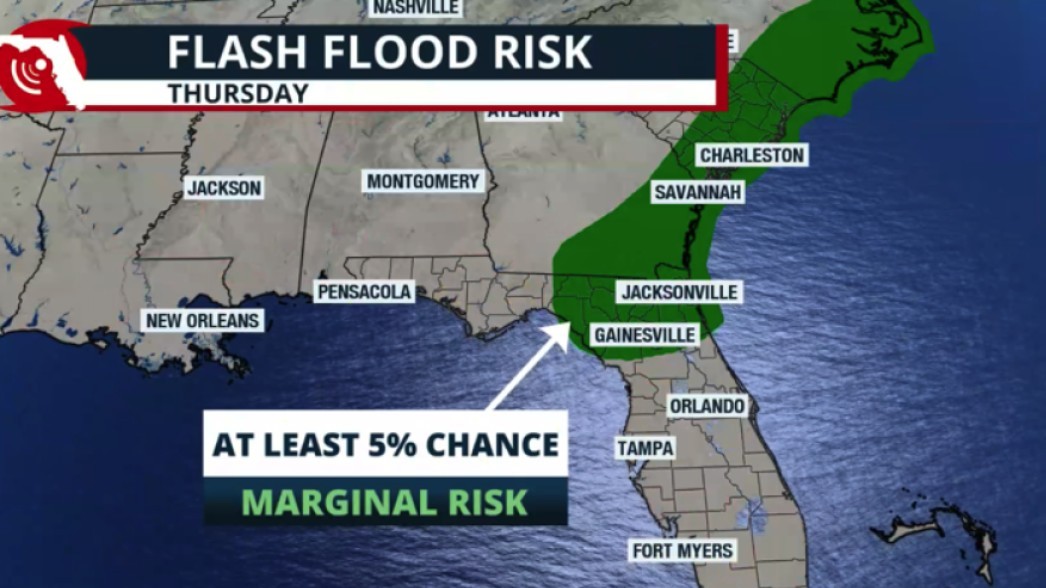
The Jacksonville area has a slight chance of flash floods on Thursday. For Friday into Saturday, the possibility of flash floods returns for a stretch of North Florida, from Jacksonville through the Big Bend.
Jacksonville Today thanks our sponsors. Become one.
Rainfall will range between 2 and 4 inches along parts of the Interstate 10 corridor and Interstate 75 through Gainesville. The Jacksonville area and surroundings also could experience rainfall of up to 4 inches, with some isolated areas getting over 5 inches through Friday night.
Although there are no flood watches, the ground will be very saturated after Monday’s rounds of rain. Flooding in some areas could occur, and there will be the typical flood-prone areas that would be at risk for more flooding through the end of this week and possibly through the weekend.
Flood advisories might be placed in effect, so make sure to stay weather-aware and avoid flooded streets. Remember, turn around, don’t drown. Six inches of water could cause your vehicle to stall, and 12 inches of water could make your vehicle float.


Jacksonville Today thanks our sponsors. Become one.

Tropics are active
From the same area that continues to bring heavy rains to northern Florida, a low-pressure system will emerge into the Atlantic, and here it has a chance to develop into a tropical system.
If this were to happen, it would likely be by the end of this week or during the weekend.
If a system develops, it will not be a concern to Florida as it will likely move, hugging the coast of the Carolinas, away from Florida.

The primary concern for Florida will be the typical afternoon thunderstorms that will continue to develop over the weekend. All the rain will be falling over overly saturated grounds, which will enhance the potential for flooding.