Published on May 30, 2025 at 9:24 am
Free local news and info, in your inbox at 6 a.m. M-F. Sign up for the Jacksonville Today newsletter.
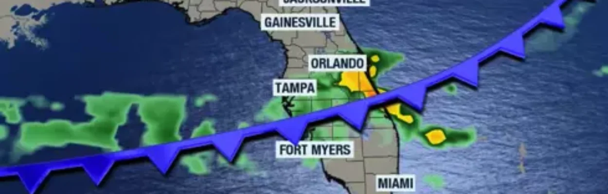
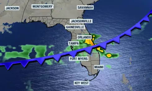
Florida is about to become much more active for more people as we head into the weekend and possibly throughout the weekend. A cold front is trying to push over the state, increasing the chances for thunderstorm activity throughout the weekend.
Expect the cold front to enhance shower and thunderstorm activity across the Panhandle and North Florida on Friday. As the cold front continues to move south, showers and thunderstorms will become more prolific throughout the weekend.
Jacksonville Today thanks our sponsors. Become one.
This means that thunderstorms will not just be confined to inland locations. The cold front will allow the atmosphere to mix and become more stable, developing thunderstorms with broader coverage.

There is a slight risk for severe storms to end the week, including storms that could produce damaging winds, hail and a tornado or two.
This past week’s thunderstorm activity will likely put a big dent in the drought. We will have to wait until next Thursday’s drought monitor to see how this week’s activity has improved the situation.


Jacksonville Today thanks our sponsors. Become one.
So far, the drought monitor shows improvement for areas across South Florida and Central Florida. North Florida has also seen an improvement, but this area also has had less severe drought conditions.

Reminder: June 1 is the official start of hurricane season.
Ensure you have a plan and take the steps necessary to prepare before a tropical system develops and threatens your area.

Having an emergency plan is always needed, and you can start buying nonperishable foods to stock up. This is also a good time to review your home insurance policy, make sure everything is in place, and make the necessary changes, as policy changes can take some time to take effect officially.