Published on March 18, 2025 at 11:42 am
Free local news and info, in your inbox at 6 a.m. M-F. Sign up for the Jacksonville Today newsletter.
Many people are starting spring break this week, and the beaches are the popular spots, especially between mid-March and mid-April. This week, after a cold front pushed through, the seas will be dangerous as the wind will continue to be strong at least through the first half of the week.
Let’s review what’s going to happen this week for those visiting our state or simply just having a “staycation.”
Jacksonville Today thanks our sponsors. Become one.
With severe weather exiting the eastern United States, we expect the northerly flow to continue along the Florida Peninsula to the start the week. Very dry and cool air filtering in will bring a Monday afternoon with slightly cooler temperatures than average.
Cold air will settle in place for Tuesday morning, especially across the peninsula’s southern half. Temperatures will be in the upper 40s across Central Florida and the low to mid-50s across South Florida on Tuesday morning.
Across North Florida, expect low temperatures to be around the low to mid-40s on Tuesday morning.


Jacksonville Today thanks our sponsors. Become one.
Fire warnings
The air is extremely dry. Red flag warnings are in effect, meaning the air is dry and winds are strong. Any fires that ignite could spread rapidly and become uncontrollable. Please avoid activities that involve flames or sparks.

Beach conditions
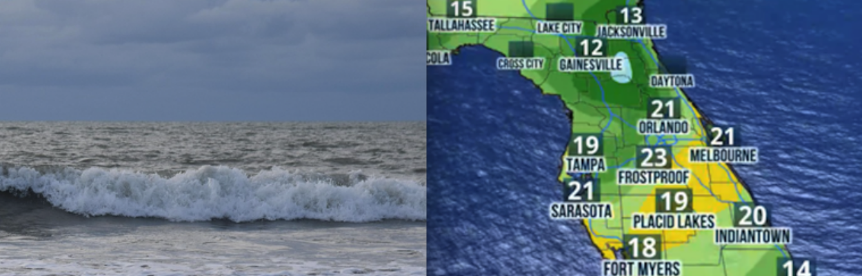
If you head to the beach, swim or stay near a lifeguard. Seas will continue to be rough, as the winds coming from the north will be on the strong side.
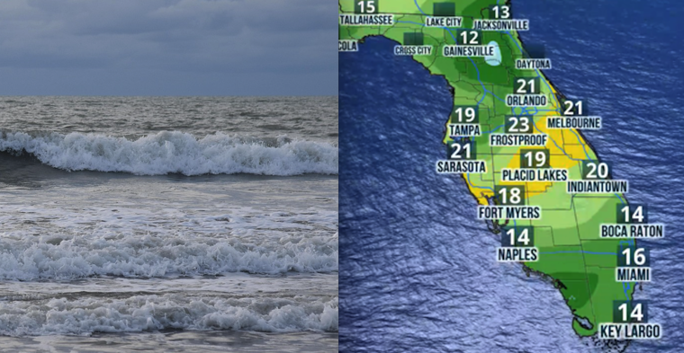
Small craft advisories will likely be in place along coastal areas, but especially across the East Coast for a bit longer. There could still be some advisories in place for the West Coast through Tuesday morning.

We expect the winds to subside slightly by Wednesday as the high-pressure system moves in from the west. By Thursday, the winds will shift and come in, mainly from the east, then a shift from the south, which could increase the risk for rip currents along the East Coast of Florida.
The next cold front
We expect the next cold front to push through the state on Thursday. This cold front does not come with the chance for rain or thunderstorms, which is disappointing as the state continues to deal with a worsening drought, especially along Central and South Florida, where the drought has worsened in recent weeks.

This cold front will give us another push of cold air just in time to finish this week, and temperatures will drop again closer to average temperatures.
Copyright 2025 Storm Center