We’re getting close to mid-November, and the tropics have continued to be prolific.
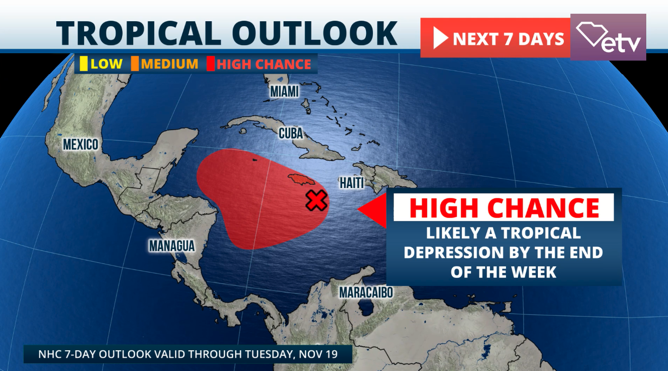
We have a tropical wave traveling over the Caribbean that has a chance to develop as it moves over the western Caribbean late this week.
Currently, the National Hurricane Center gives it a high chance for this disturbance to develop into a tropical storm and gradually, and possibly, into a hurricane within the next seven days.
Conditions will be favorable for the system to develop over the western Caribbean, with wind shear decreasing and the water temperatures still warm enough to fuel a tropical system, possibly enough to become a hurricane.
This tropical disturbance is labeled Invest 99L, but once it becomes a tropical storm, it will officially be named Sara.

We are confident that there will be at least a tropical depression by the end of this week or that it will be very close to tropical depression status.
The National Hurricane Center increased its chance of formation to 90% by Friday, as this disturbance is becoming more convective and organized. The big question remains: Where will this system head?
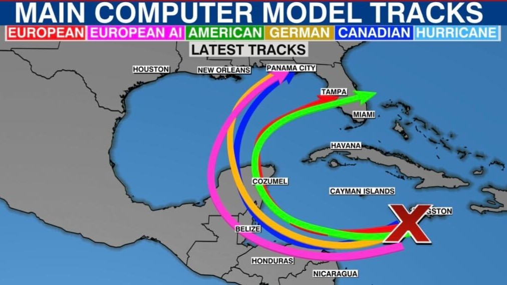
Currently, there is no definitive track as the disturbance does not have a well-defined center of circulation. The Big Caribbean Islands, from Jamaica, eastern Cuba, Haiti, and the Dominican Republic, must monitor this system due to its proximity.
Heavy rains will likely occur in these areas as the front that exits Florida on the weekend will extend over their region, increasing instability.
Florida residents should continue to monitor the situation closely. The season has not ended, and even once Nov. 30 comes around, the end date of hurricane season is just on the calendar, and Mother Nature doesn´t hold calendars.
There is a chance that timing does not play to our advantage with the parade of fronts moving through the United States.
By early next week, a strong low-pressure system will be moving over Texas, with a strong cold front attached; if this system and the upper-level low get in agreement, this could be enough to pull and curve future Sara toward Florida.
Take this with a grain of salt, as there could be timing changes. Remember that if Sara stays further south in the Caribbean, it will miss its pull north and likely meander over the Caribbean or the Gulf of Mexico for longer, as happened with Rafael.
There also could be changes if the front, low-pressure, and upper-level low move faster or slower. There will also be changes to Sara’s track.
Finally, if the system moves between Cuba and the Yucatan Peninsula, it will likely stay stronger than if it were to move through the Yucatan Peninsula. There are several days to watch this system and monitor all scenarios.


