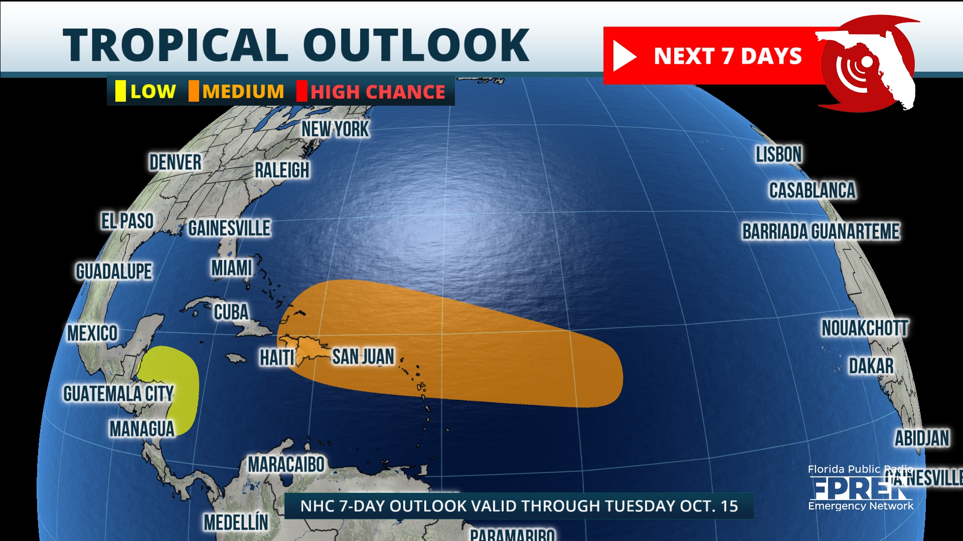
The National Hurricane Center on Wednesday continues to track two weather systems, one in the Atlantic and one in the Caribbean. Each has the potential for possible development.
The current tropical outlook has one system located in the central tropical Atlantic with a well-defined area of Low pressure.
However, this system is embedded in a dry air environment, and development is unlikely during the next couple of days. The area of low pressure is forecast to move generally westward, where conditions are expected to become a bit more favorable for gradual development later this week.
The National Hurricane Center says a tropical depression could form as it heads west-northwest and moves near the Leeward Islands. The odds are low for development over the next 48 hours, however the chance of development increases to 40% over the next seven days.
As with any possible tropical development, its path needs to be watched, but there are number of factors at this time that would keep it from being of concern to Florida or the southeast United States.
Second weather system
The second area the Hurricane Center is watching is a broad area of Low pressure over the southwestern Caribbean Sea.
The Hurricane Center says that some gradual development is possible if the system stays over water while it moves slowly west-northwestward, that movement would take it over northern Central America.
The system has only a 20% chance of developing over the next seven days.
The good news is we have a strong cold front moving through Florida over the next 24 hours. This will bring much cooler and drier air over the entire state.


