Published on August 28, 2024 at 10:37 am
Free local news and info, in your inbox at 6 a.m. M-F. Sign up for the Jacksonville Today newsletter.
It’s been a hot summer for Florida, and as much as we would love to say that Labor Day is the unofficial end to the summer, like our northern neighbor states say, well … it just doesn’t happen here.
The first few noticeable temperature dips don’t come until late October or early November, for most of Florida. There have been plenty of heat advisories happening, and we expect them to continue, especially throughout the holiday weekend across South Florida.
Jacksonville Today thanks our sponsors. Become one.
Forecast for Wednesday through Sunday
Local weather effects, such as the sea breeze and the day’s heating, will contribute to thunderstorms forming in the afternoon hours along both coasts and progressing inland. Once the day’s heating is lost, the storms will wind down. There is also the chance for a few isolated sprinkles overnight, but these will be very scattered.
The heat will continue to affect the Sunshine State. The winds will be predominantly from the east, which will push the warmest temperatures along the interior and west coast of the State. There is the chance for heat advisories to be issued as temperatures could feel as high as 110 degrees for some locations.

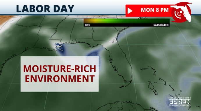
More moisture for next (short) week
Rain chances are likely to increase across the northern half of the state by Monday as a cold front approaches but loses its speed and possibly becomes stationary. Coincidentally there will be an influx of moisture from the tropics surging across South Florida, which will enhance showers and thunderstorm activity across much of the state.


Jacksonville Today thanks our sponsors. Become one.
The stationary front will continue to be draped along central Florida, slowly dragging southward toward the end of next week. This means that there will be a higher chance of showers and storms next week. Areas that have experienced recent flooding, like from the Tampa area southward toward Southwest Florida, could deal with more flooding as the next front drags on, making showers and storms more prolonged.

North Florida will experience not only drier weather but also less humid conditions, making temperatures feel more comfortable too.
Please stay weather-aware, we will continue to bring you updates about this setup as the wetter weather approaches.

Copyright 2024 Storm Center