Published on August 6, 2024 at 5:45 pm
Free local news and info, in your inbox at 6 a.m. M-F. Sign up for the Jacksonville Today newsletter.
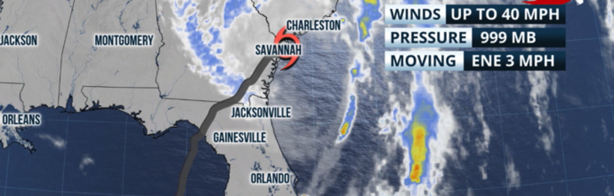
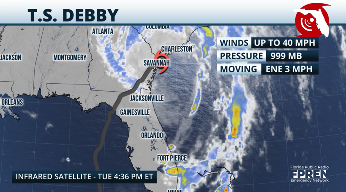
Debby will continue to affect parts of Northeast Florida and the Florida peninsula at times during the next 24 to 36 hours.
For Northeast Florida, expect rounds of thunderstorms that could sometimes be strong as rain bands associated with Debbie pass over the area.
Jacksonville Today thanks our sponsors. Become one.
Across the peninsula, rain will be weaker, but it will push through the state with some embedded pockets of dry air Wednesday.
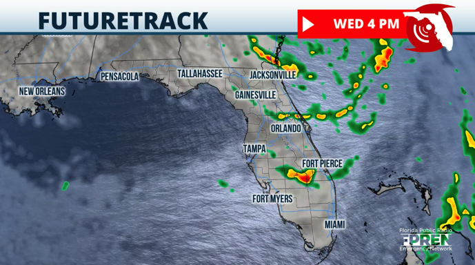
We are on the drier side of the storm. That means Wednesday will not be a complete washout. But since Debbie will still be close enough, there will still be some rain bands effect in Florida. We do not expect significant weather due to these rain bands but still breezy conditions at times.
Thursday will be a somewhat drier day, but there still will be some local effects and some of Debby’s weaker rain bands will push through. Debby will be moving back on shore over South Carolina and drier air will be pulled in from the north-northwest, which will also make it feel a tad less humid across much of Florida.


Jacksonville Today thanks our sponsors. Become one.
This will not last long. Expect the winds to shift Friday and arrive from the southwest, increasing the humidity and warmth once again.

On Friday and Saturday, there will be some storms, this time associated with local effects that will return to Florida. Most of the shower and storm activity will be focused across the interior and move to the east-central and northeastern coasts by the afternoon. Highs will return to the 90s but feel in the triple digits in the afternoon.
Copyright 2024 Storm Center