Published on July 29, 2024 at 9:46 am
Free local news and info, in your inbox at 6 a.m. M-F. Sign up for the Jacksonville Today newsletter.
The Saharan dust that arrived in Florida earlier this month is waning, meaning we could start seeing an increase in tropical activity.
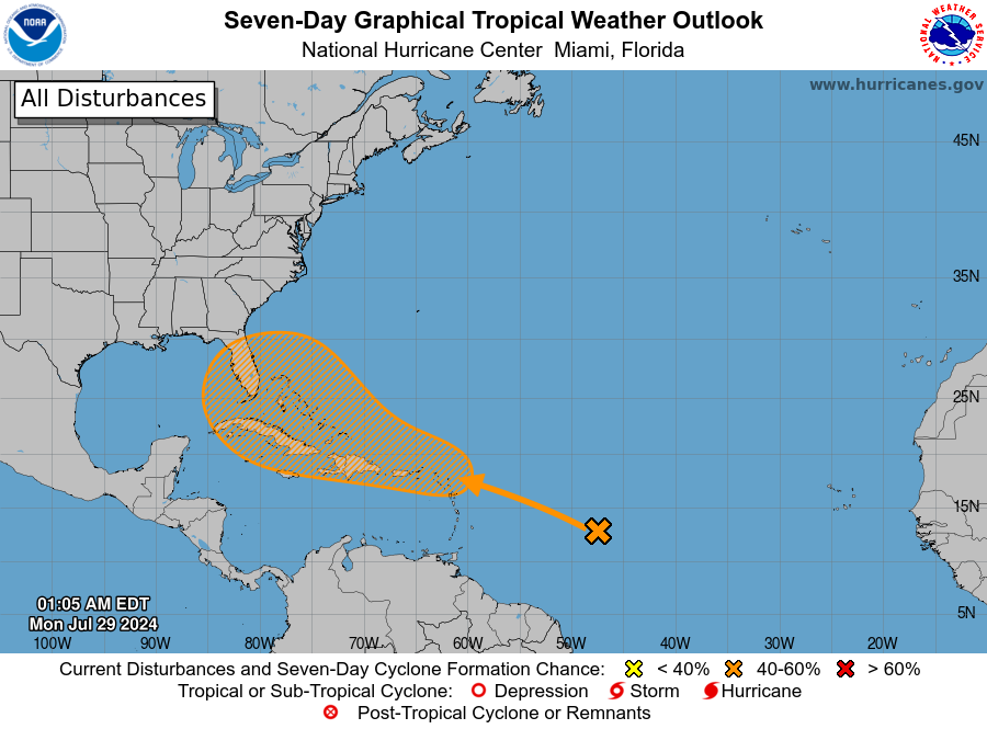
That’s the case now that the National Hurricane Center is monitoring an area of disturbed weather in the Atlantic that has a potential track toward Florida.
Jacksonville Today thanks our sponsors. Become one.
The National Hurricane Center says the area in the central tropical Atlantic, near the Leeward Islands and Greater Antilles, could interact with a tropical wave.
Forecasters give it a 50% chance of development over the next seven days, and it could become a tropical depression as early as the middle of the week as it tracks to the west-northwest.
The name for the next tropical storm will be Chris.
Jacksonville Today thanks our sponsors. Become one.
Copyright 2024 WUSF Public Media – WUSF 89.7


