Published on July 12, 2024 at 9:54 am
Free local news and info, in your inbox at 6 a.m. M-F. Sign up for the Jacksonville Today newsletter.
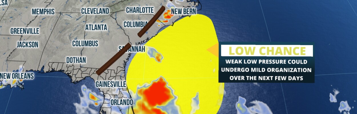
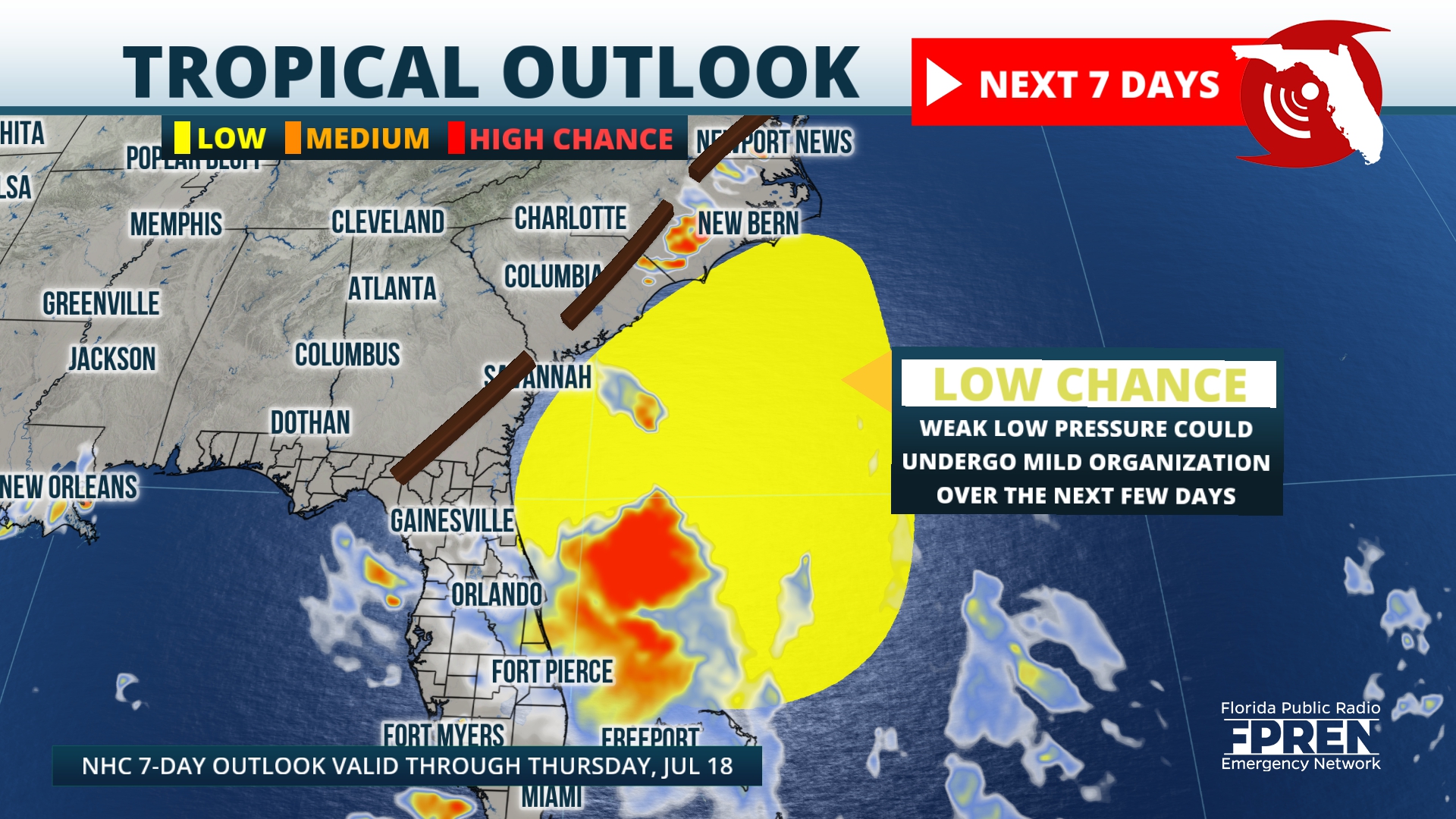
The next name on the Atlantic hurricane season list is “Chris,” and we are monitoring a weak and disorganized tropical disturbance located just east of Florida.
This system will continue to travel to the north-northwest and is likely to bring direct effects to the Carolinas onto the Mid-Atlantic throughout the weekend. For Florida, our weather pattern will be more associated with a stationary front meandering to the north.
Jacksonville Today thanks our sponsors. Become one.
It is typical for this time of the year to have tropical disturbances form either over the Gulf of Mexico or over the far western Atlantic adjacent to the Carolinas or Florida. The current weather pattern closes in a weak low-pressure system within its attached cold front draped over the southeast onto the Deep South.
Of course, this cold front is very weak and will continue to lose punch becoming stationary. The stationary front will increase the rain and thunderstorm activity across the southeast including Florida.

Florida has been dealing with Saharan dust that has exacerbated the heat, ramping the heat indices to over 105 degrees. Many places in Central and South Florida have been under advisories for days.
Jacksonville Today thanks our sponsors. Become one.
The heat will stay, but at least many more places will have intermittent relief as storms take over. Make sure to check your local weather forecast and plan accordingly. Some afternoon thunderstorms could be strong to severe and include some strong gusts and frequent lightning.
Will the tropical disturbance develop?
The tropical disturbance has a low chance of developing, but conditions will not turn favorable as it inches closer to the Carolinas. So it is not likely that “Chris” would be born from this system.
Regardless, the Carolinas should monitor this system closely as it will still bring heavy rains and storms. Rainfall between 3 to 4 inches with some areas accumulating higher amounts.
Copyright 2024 Storm Center