Published on April 2, 2024 at 4:56 pm
Free local news and info, in your inbox at 6 a.m. M-F. Sign up for the Jacksonville Today newsletter.
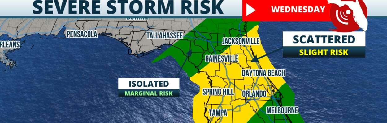
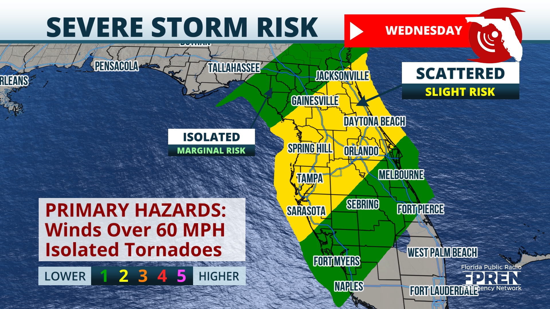
Scattered strong to severe thunderstorms are expected to move toward Jacksonville near sunrise Wednesday, with a slight possibility of 60 mph winds and isolated tornadoes.
A strong storm system is moving through the eastern half of the nation with severe weather likely from the Great Lakes down to the Gulf Coast.
Jacksonville Today thanks our sponsors. Become one.
Just north of the Florida border, the environment will be a bit more favorable for severe storms, with the Storm Prediction Center designating an enhanced risk area for severe thunderstorms. Storms that develop in this area Tuesday are likely to be rotating and capable of producing a tornado.
Storms are expected to arrive in the western Panhandle and affect the Pensacola area before midnight. At that time, storms could still be capable damaging wind gusts over 60 mph and an isolated tornado.

After midnight, the storms are expected to move eastward into the Capitol area, then progress toward Jacksonville and Gainesville near sunrise Wednesday. Storms through the night could be capable of spinning up a tornado, so it will be important to have multiple ways to get weather warnings through the night.

Jacksonville Today thanks our sponsors. Become one.
After sunrise Wednesday, strong to severe storms are likely to continue across the peninsula, roughly lined up along the Interstate 4 corridor. The Storm Prediction Center has placed this area of Florida in the slight category for severe storms Wednesday.
By the late morning Wednesday into early afternoon, the area of ongoing storms could intensify before a strong cold front pushes storms out to sea by Thursday.The main severe weather threats from Wednesday’s storms for damaging winds over 60 mph, but an isolated tornado can’t be ruled out. Some hail is also possible. Cooler and less humid air will push in behind the cold front with calm weather settling in through the weekend.
Copyright 2024 Storm Center. To see more, visit Storm Center.9(MDEwNzczMDA2MDEzNTg3ODA1MTAzZjYxNg004))