Published on March 27, 2024 at 10:01 am
Free local news and info, in your inbox at 6 a.m. M-F. Sign up for the Jacksonville Today newsletter.
A slow-moving frontal system will deliver the potential for some severe wind gusts over 60 mph and possibly an isolated tornado through Wednesday night.
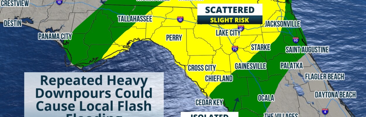
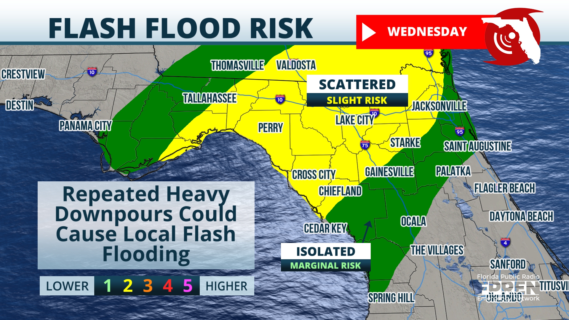
The system will affect areas of North Florida on Wednesday, generally around Tallahassee and eastward, including Jacksonville and Gainesville. The area of ongoing showers and storms will impact the Capitol early in the day, then into Jacksonville and Gainesville in the afternoon and evening.
Jacksonville Today thanks our sponsors. Become one.
Severe weather potential will be a bit higher in the warmth of the afternoon and evening. The Storm Prediction Center has north central Florida in a zone of “marginal” severe weather risk for Wednesday, with a few isolated stronger storms capable of severe hail and winds.

Areas of North Florida including Tallahassee, Jacksonville and Gainesville have been assigned a “slight” risk for flash flooding Wednesday. Showers and thunderstorms with heavy rain will be possible all day before showers move out of the area Thursday.
With the repeated rounds of heavy rain, there is a chance rain could overwhelm storm drainage at times and lead to flash flooding. The Weather Prediction Center is forecasting up to 4 inches of rain could fall in an area east of the state capitol.


Jacksonville Today thanks our sponsors. Become one.

Showers and storms will end statewide by Thursday evening. Dry weather will remain through the weekend, with our next chance of rain arriving by the middle of next week.
Copyright 2024 Storm Center. To see more, visit Storm Center.9(MDEwNzczMDA2MDEzNTg3ODA1MTAzZjYxNg004))