Published on March 8, 2024 at 11:35 am
Free local news and info, in your inbox at 6 a.m. M-F. Sign up for the Jacksonville Today newsletter.
Strong thunderstorms are forecast for parts of the Florida Panhandle and northern peninsula on Friday and Saturday. The threat arises from an early spring storm system that will track from the Plains into the eastern half of the United States.
Early Thursday afternoon, surface low pressure was developing over the Texas Panhandle and at the same time, an upper-level trough was digging into southern California, Nevada and Arizona.
Jacksonville Today thanks our sponsors. Become one.
Ahead of those two features, showers and thunderstorms were already impacting parts of the Central Plains. Through the rest of the day Thursday, the surface and upper-level disturbance were expected to track northeastward through the Plains into the Mississippi Valley.
Circulation around these features was likely to prime the environment for supercell thunderstorm development. Hail, amaging winds, and tornadoes will all be possible hazards from storms over the Plains were possible.

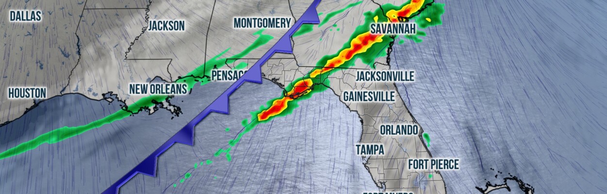
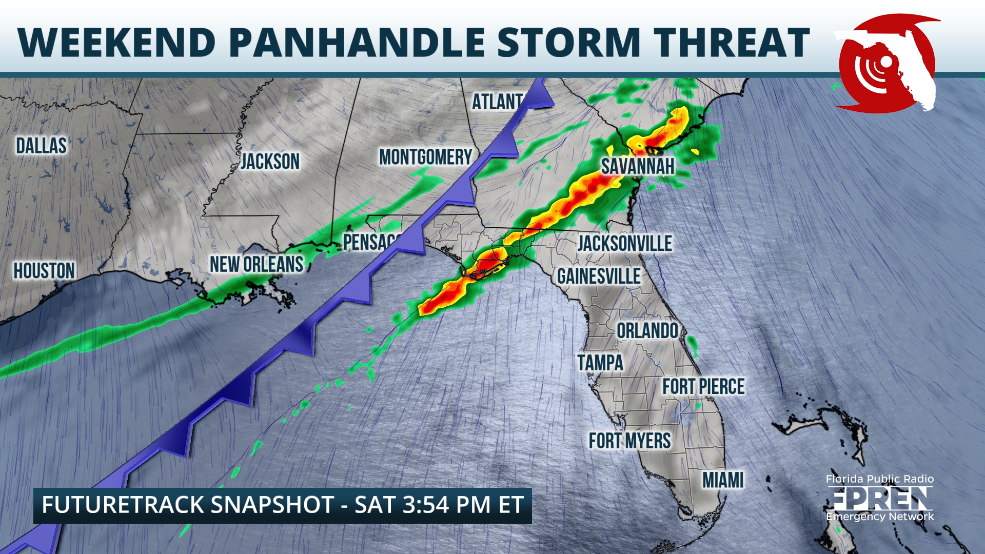
By Friday, the system and the threat for severe thunderstorms will track eastward into the Mississippi Valley and Central Gulf Coast. A warm front ahead of the area of low pressure should lift northeastward through Florida’s Panhandle and northern peninsula during the day on Friday.


Jacksonville Today thanks our sponsors. Become one.
Winds could occasionally gust to 30 mph, and temperatures should trend above average, despite an increase in cloud cover. Although a few stray strong thunderstorm cells will be possible over the Panhandle and North Florida during the day Friday, chances won’t increase until later in the day Friday.
The latest model guidance suggests that a broken squall line of strong thunderstorms will develop and track from west to east through the western Florida Panhandle overnight Friday into Saturday morning. The line should push through the Central Panhandle during the day Saturday, before reaching the Suwannee River Valley and North Florida Saturday evening.
 Specialists at the Storm Prediction Center have outlined the westernmost counties of the Panhandle under a Level 2 out of five (slight) risk for severe thunderstorms on Friday evening, and the area from Jackson County to Okaloosa County under a Level 1 out of five (marginal) risk.
Most of the Panhandle and the area of North Florida along and north of Interstate 10 is under a slight risk, and North Florida south of I-10 is under a marginal risk on Saturday. Small hail will be possible, but of greater concern the risk for damaging straight line winds and a few tornadoes.
In addition to the threat for severe thunderstorms, this system is expected to produce excessive heavy rainfall rates, which could lead to flash flooding in low lying, poorly drained, or urban areas. Forecasters at the Weather Prediction Center have outlined the Panhandle and North Florida under a low-end risk for Flash Flooding on Friday and Saturday.

By Sunday shower and thunderstorm chances should increase over the southern half of the Florida peninsula, however the risk for severe storms will steadily decrease. A cooler air mass should filter into the Sunshine State from north to south behind the weekend storm system, and by early Monday morning, lows from the Interstate 4 corridor northward could dip into the 40s.
Copyright 2024 Storm Center. To see more, visit Storm Center.9(MDEwNzczMDA2MDEzNTg3ODA1MTAzZjYxNg004))