Published on December 15, 2023 at 10:00 am
Free local news and info, in your inbox at 6 a.m. M-F. Sign up for the Jacksonville Today newsletter.
A developing nor’easter will affect most of the state of Florida this weekend. Heavy rainfall and wind gusts in excess of 35 mph are expected across portions of the peninsula Saturday evening through early Sunday.
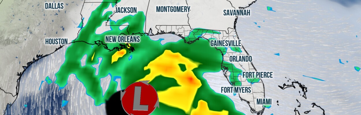
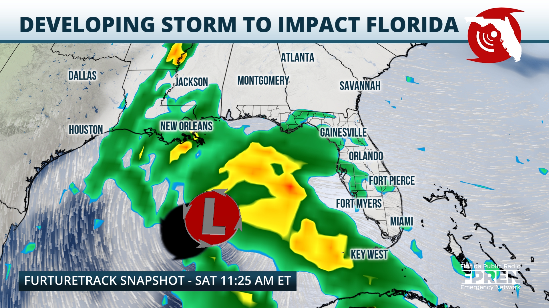
An area of low pressure is posed to develop over the Gulf of Mexico on Friday, ahead of a strong mid-level trough that will be digging into the Lower Plains. The low should track eastward throughout the day Friday, and during this period it will be supplemented by Gulf moisture and mid-level energy. The system will continue to intensify, and by Saturday models predict that a shield of heavy rain will have developed around the eastern half of the deepening low. Winds around the core of the storm could range between 45 and 50 mph while it is positioned over the water.
Jacksonville Today thanks our sponsors. Become one.
Models continue to waver on the exact track (and therefore the location of the most intense effects) of the system. However, residents across the entire peninsula and the eastern half of the Panhandle should prepare for impactful weather Friday and throughout the weekend.

Before the main storm arrives, winds will continue to be gusty across the peninsula, especially directly along the Atlantic coast. Wind, marine and coastal flood alerts are already in effect in these regions.
Early on Saturday, the core of the developing storm should remain centered over the eastern Gulf. Squall lines of heavy rain and a few strong thunderstorms should push onto the peninsula from west to east from the mid-morning onward. In areas where storms train, local flooding will be possible. Conditions could also support isolated severe thunderstorms: Damaging wind gusts and isolated tornadoes will also be possible during the day Saturday.


Jacksonville Today thanks our sponsors. Become one.
Saturday evening through Sunday morning, the core of the storm should track onto land. Models are not in consensus on the exact location of the track, but the latest forecasts have positioned the core of the storm between Apalachicola and Clearwater/St. Petersburg. In these areas excessive rain rates on the order of over 1 inch an hour are possible Saturday evening though early Sunday, and storm totals should range between 3-5 inches, with isolated accumulations over 7 inches. As such, forecasters that the Weather Prediction Center have classified all of Florida under a marginal (level 1 out of 4) or slight (level 2 out of 4) risk for flash flooding this weekend.

In addition, there is the potential for strong thunderstorms late Saturday through pre-dawn Sunday over the Florida peninsula. Therefore, there will be a risk for isolated nocturnal tornadoes. Residents in this region are encouraged to ensure that they have multiple ways of getting Tornado Warning notifications that will wake them up.

The storm should lift northeastward, away from Florida, on Sunday and conditions will improve from southwest to northeast. Behind the low, most of the state will experience a drop in humidity and a drop in temperatures. Skies should turn mostly sunny by Monday, and highs will range from the low 60s over the Panhandle to the low 70s over South Florida.
Copyright 2023 Storm Center. To see more, visit Storm Center.9(MDEwNzczMDA2MDEzNTg3ODA1MTAzZjYxNg004))