Published on November 21, 2023 at 2:48 pm
Free local news and info, in your inbox at 6 a.m. M-F. Sign up for the Jacksonville Today newsletter.
Downpours and gusty thunderstorms could affect Thanksgiving travel across parts of Florida. A cold front that extends from a stronger storm system over the Ohio Valley and Mid Atlantic is to blame for the unsettled forecast.
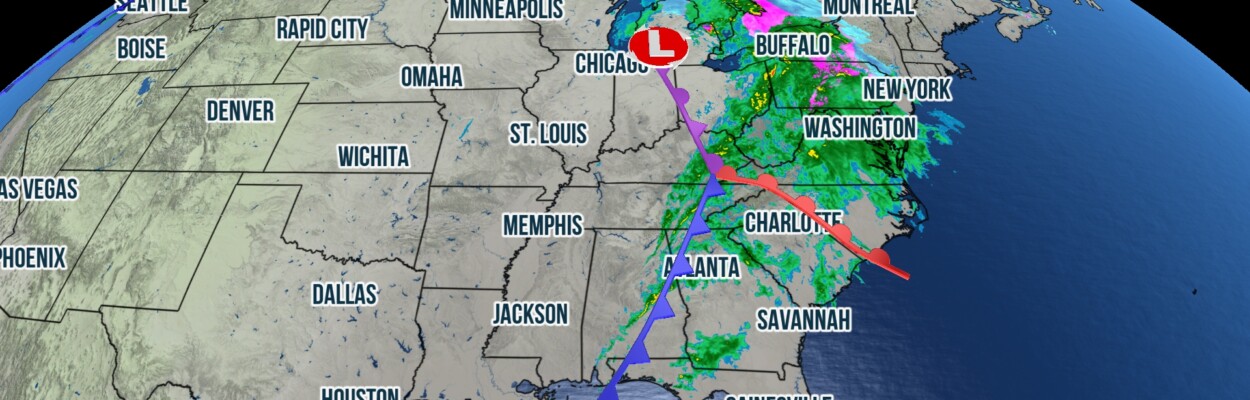
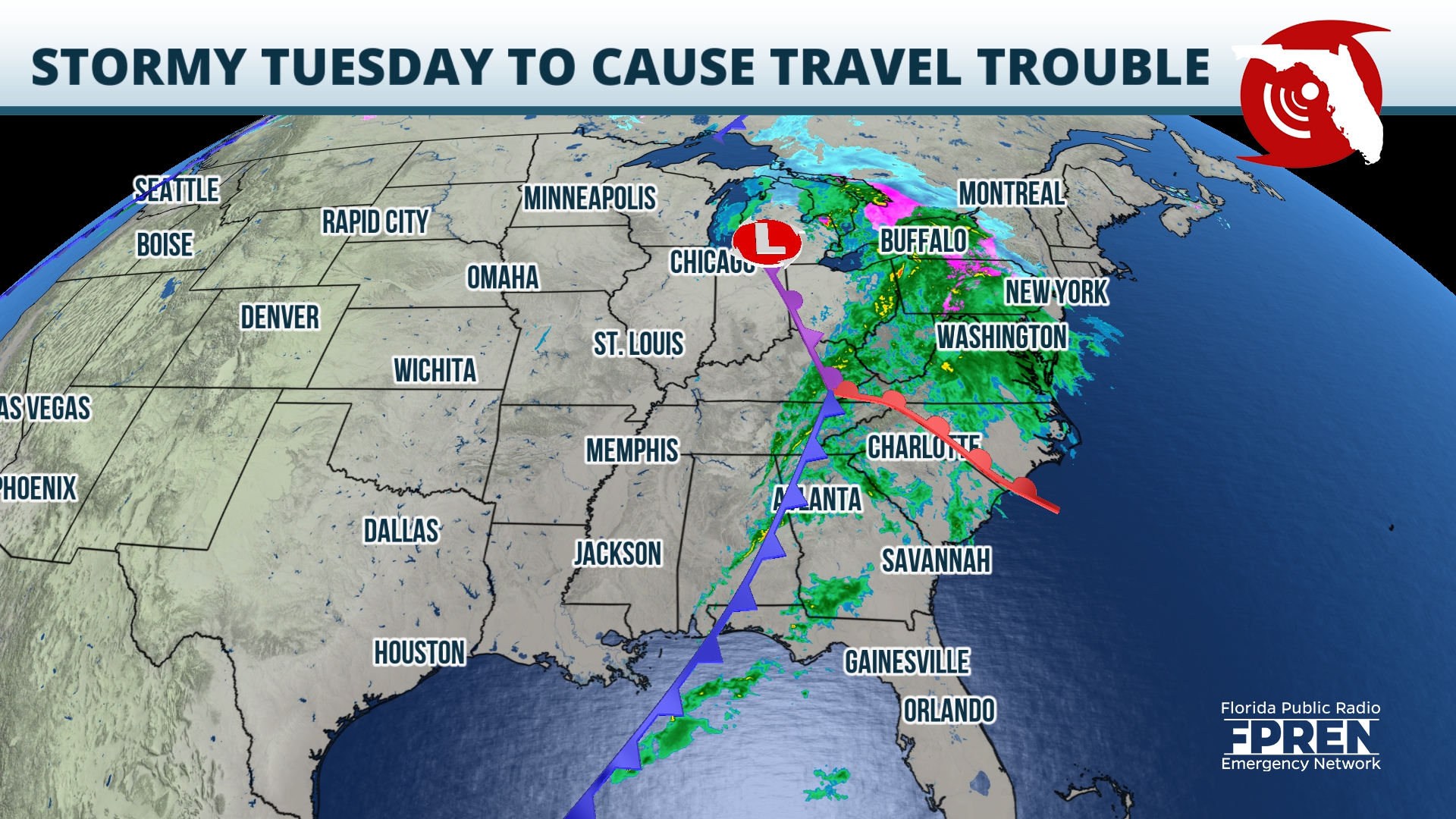
On Tuesday morning, a developing storm system was centered near Illinois and Indiana. A shield of moderate to heavy rates extended east of the system and affected locations from Upstate New York to Eastern Tennessee.
Jacksonville Today thanks our sponsors. Become one.
At higher elevations of Pennsylvania and New York, sleet and snow were falling. At the same time, the cold front associated with the storm system extended from the Tennessee Valley to the Central Gulf Coast. Lines of thunderstorms were being triggered directly ahead of the boundary.

Through Wednesday, locations across the Mid Atlantic and Northeast will face the brunt of the storm system: Heavy rain and gusty winds will be possible at some of the nation’s travel hubs including Washington D.C., Baltimore, Philadelphia, New York, and Boston.
Meanwhile, the system’s cold front is forecasted to track through most of the state of Florida before Thanksgiving. Heavy rain was already affecting the western Panhandle early Tuesday afternoon.


Jacksonville Today thanks our sponsors. Become one.
Storms should slowly migrate eastward toward the state capital by Tuesday evening, before approaching North Florida on Wednesday. Although parameters are not too favorable, a few rogue strong thunderstorms, capable of producing sporadic damaging wind gusts, are possible, especially closer to the Gulf Coast. A broken line of downpours and thunderstorms could reach the Interstate 4 corridor as early as lunchtime on Wednesday, before sagging southward toward Lake Okeechobee on Wednesday night.
Locally heavy rain rates could occur within some storms triggered ahead of the cold front, and these conditions could make travel difficult. In addition, the ground may still be saturated in some locations after the storm system that dumped inches of rain across the peninsula last week.
Additional rainfall could overwhelm drainage areas, and localized street flooding is possible. Travelers are encouraged to check conditions and the local forecast before embarking on their journey. In addition, they should check their routes to be sure roads are passable: Never drive through flooded roadways.

The front should stall over far southern Florida by Thanksgiving Day, and most of the state should remain rain-free. Behind the boundary, cooler and drier air should arrive from the north, and temperatures across the upper half of the state will feel cool for the holiday.
Highs along the I-4 corridor are forecasted to reach the upper 60s and lower 70s on Thanksgiving, whereas across the Panhandle and North Florida, temperatures may peak in only the upper 50s or lower to mid-60s on Thursday.
Farther south, the change in temperatures behind the front will likely not be too noticeable. Across the Miami metro, highs will likely peak near average in the lower 80s.

By Friday, a mid-level system should eject from South Texas and track eastward into the Gulf of Mexico. Mid and upper-level cloud cover will likely increase across most the state, and showers will be possible across the Panhandle overnight Thursday into Friday, then across the peninsula throughout the day on Friday.
If the forecast for the entire state through Friday were to be summarized in a few words: Cloudy, breezy and a chance for showers. A perfect invitation to stay inside with friends, family and loved ones to give thanks.
Copyright 2023 Storm Center. To see more, visit Storm Center.9(MDEwNzczMDA2MDEzNTg3ODA1MTAzZjYxNg004))