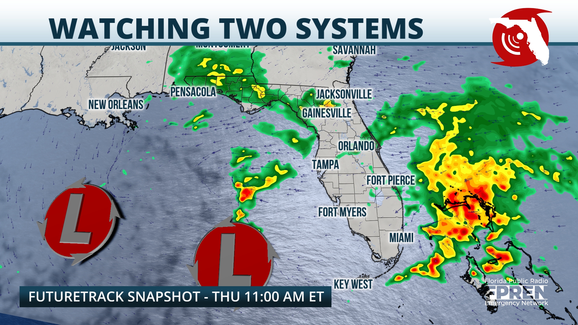
Strong winds and heavy rain are forecasted to impact most of Florida through the end of the week.
Two developing storm systems — one over the Gulf of Mexico, the other over the southwestern Caribbean — are to blame for the unsettled weather.

On Tuesday morning, an area of low pressure was located over the northern Gulf of Mexico. A swath of showers with light to moderate rain rates extended from the Louisiana coast eastward to the Florida Panhandle and northern peninsula. Additionally, strong winds were being reported in the vicinity of the system.
At the same time, meteorologists at the National Hurricane Center were monitoring a trough of low pressure over the southwestern Caribbean Sea. According to their forecast, this low has a high chance of developing into a tropical system over the next seven days. Both of these systems are expected to impact Florida with heavy rain and strong winds through the end of the workweek.

Periods of light to moderate rain were expected over the Panhandle through the evening Tuesday. Overnight into early Wednesday, thunderstorm activity was expected to blossom over the Gulf of Mexico, and those storms should approach the Panhandle on Wednesday morning and track inland through portions of North Florida on Wednesday.
Winds should remain stiff over the region, and gusts over 40 mph are possible directly along the Panhandle coast through late Wednesday. A wind advisory is in effect along the coast from Franklin County westward.

As low pressure lingers over the Gulf on Wednesday and Thursday, the Caribbean system will likely push into South Florida, intensifying as it does so. Multiple lines of heavy rain and thunderstorms are expected to wrap onto the Atlantic coast of Central and South Florida on Wednesday and Thursday, and excessive rainfall accumulations could lead to flash flooding.
Rough surf, beach erosion, and coastal flooding are also expected along the Atlantic coast through at least Thursday. A flood watch is in effect from Volusia County southward to Miami-Dade County.
By Friday, both systems should begin lifting northeastward away from the state. Shower chances and winds will taper off from southwest to northeast, and cloud cover should begin to break.
By the weekend into early next week, a drier air mass will be briefly introduced to the state. Skies should turn sunny by Monday before another system potentially arrives by midweek.
9(MDEwNzczMDA2MDEzNTg3ODA1MTAzZjYxNg004))


