Published on August 28, 2023 at 9:50 am
Free local news and info, in your inbox at 6 a.m. M-F. Sign up for the Jacksonville Today newsletter.
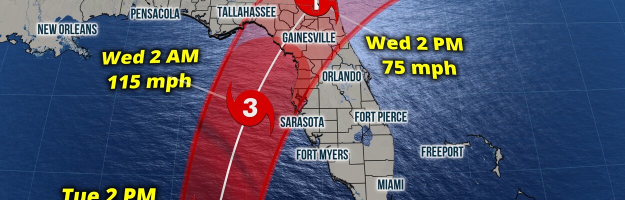
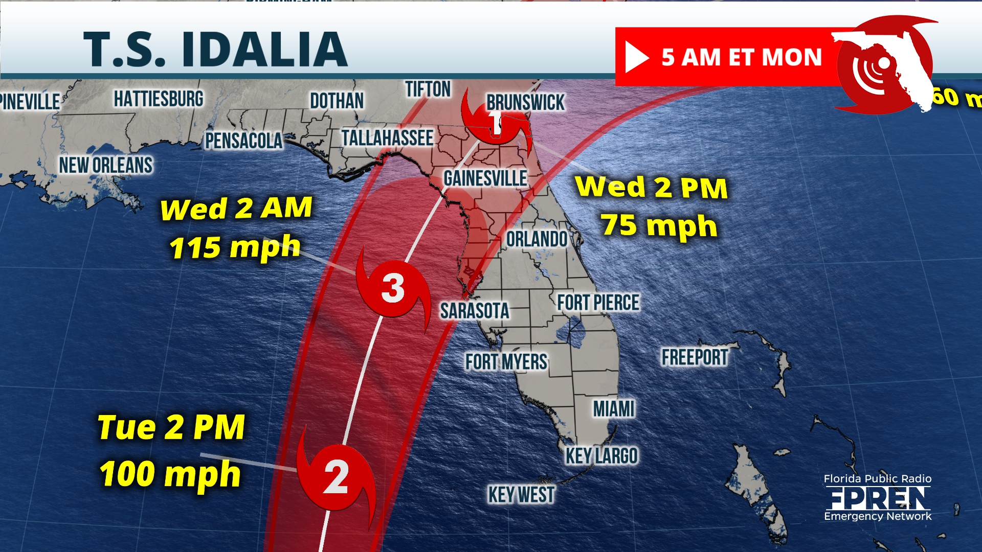
The National Hurricane Center is now forecasting Idalia to be a major Category 3 hurricane at landfall early Wednesday.
The most likely area for landfall is from Tallahassee to Sarasota, but to be safe, the entire Gulf Coast needs to prepare for high impacts. Hurricane watches and tropical storm watches are posted and will likely be upgraded to warnings later today.
Jacksonville Today thanks our sponsors. Become one.

Residents are encouraged to have hurricane preparations finished today as tropical storm conditions are expected to start hitting the Gulf Coast on Tuesday. Please keep in mind impacts will be felt well outside the cone, and that’s why everyone needs to keep prepping. For more on building a disaster plan and preparing emergency kits, go to: https://www.floridadisaster.org/planprepare/
If Idalia makes landfall as a Category 3 hurricane as expected, sustained winds of 111-129 mph are likely near the center of circulation along the immediate coastal areas. Idalia is expected to remain a Category 1 or 2 as it tracks across the state Wednesday. That means winds will range from 74 mph to possibly over 100 mph closest to the eyewall. Winds will decrease farther from the center, but strong gusts will likely cause power outages along with tree and structural damage. Isolated tornadoes are also possible in any of the outer rain bands across the state.

Life-threatening storm surge will be one of the greatest impacts, and watches are posted from the Panhandle to the south Peninsula. Across this area, inundations will average 3-7 feet to include Tampa/St. Pete. But the Big Bend Coast is much more susceptible and will need to plan for inundations possibly up to 10 feet.


Jacksonville Today thanks our sponsors. Become one.
Based on Idalia’s current track, areas closest to the path can expect 3 to 7 inches of rain on average, and locally up to 10 or more inches. Areas well inland across the Panhandle and Peninsula could possibly receive 2 to 5 inches of rain with locally higher amounts.

It’s important to remember that most tropical cyclone-related fatalities are due to the high waters caused by flooding and storm surge. Consider the following advice: Hide from the wind, run from the water. Evacuation orders are expected along the Gulf Coast today, and locals are urged to listen to all orders from county officials. As timing would have it, a supermoon Tuesday into Wednesday may increase the coastal flooding and storm surge threats.
Residents are highly encouraged to plan for the worst, hope for the best, and check the forecast at least twice a day. Those who are well-prepared have peace of mind and little reason to panic. Download the Florida Storms app to keep you safe and informed at all times.

Copyright 2023 Storm Center. To see more, visit Storm Center.9(MDEwNzczMDA2MDEzNTg3ODA1MTAzZjYxNg004))