A system in the Gulf of Mexico will bring periods of heavy rain and gusty winds to much of Florida in time for the official start of the Atlantic hurricane season.
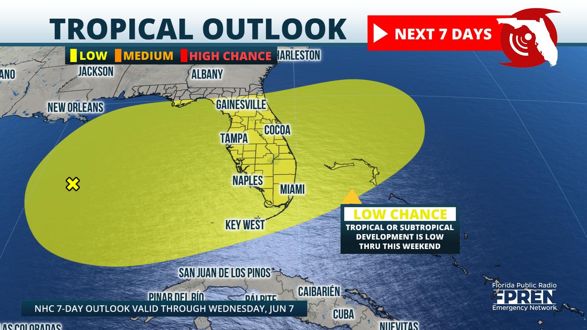
The National Hurricane Center continues to monitor a disturbance in the Gulf of Mexico that has a very low chance of development over the next seven days. As of Wednesday morning, an area of showers and thunderstorms associated with a mid- and upper-level trough is disorganized and lacking the time and ingredients for significant development. However, a surface low pressure may develop later today in the south-central or southeastern Gulf of Mexico, where sea surface temperatures are generally in the lower 80s.
The hurricane center anticipates the environment will become only minimally favorable for tropical development, thus leading to the low chance designation in the latest Tropical Weather Outlook. Uncertainty does exist regarding potential development, but impacts to the Sunshine State are expected later this week and into the weekend.

Model guidance indicates the low pressure lingers over the Gulf of Mexico through Friday before eventually pushing eastward toward Florida by the upcoming weekend. Moisture will be pulled into the state through late-week, resulting in more widespread shower and thunderstorm chances across the state. Rainfall totals could be heavy across portions of the state, especially areas in close proximity to the potential low pressure.
The Panhandle and North Florida are likely to see several inches, with higher amounts possible across Central and South Florida. Specifics will come into view as the week goes on, but the potential for flash flooding is present across much of the Peninsula on Thursday as tropical moisture gets pulled into the state.
Aside from the risk of heavy rains, strong wind gusts will likely produce dangerous surf and an elevated rip current risk into early next week as the system pulls away from Florida.
The official start of the Atlantic hurricane season begins Thursday, June 1. While this system may not develop into a named system over the next seven days, it is a reminder that hurricane season is around the corner. Residents are encouraged to use any tranquil stretches of weather to ensure hurricane preparedness work is completed before a tropical system is forecast to move ashore.
9(MDEwNzczMDA2MDEzNTg3ODA1MTAzZjYxNg004))


