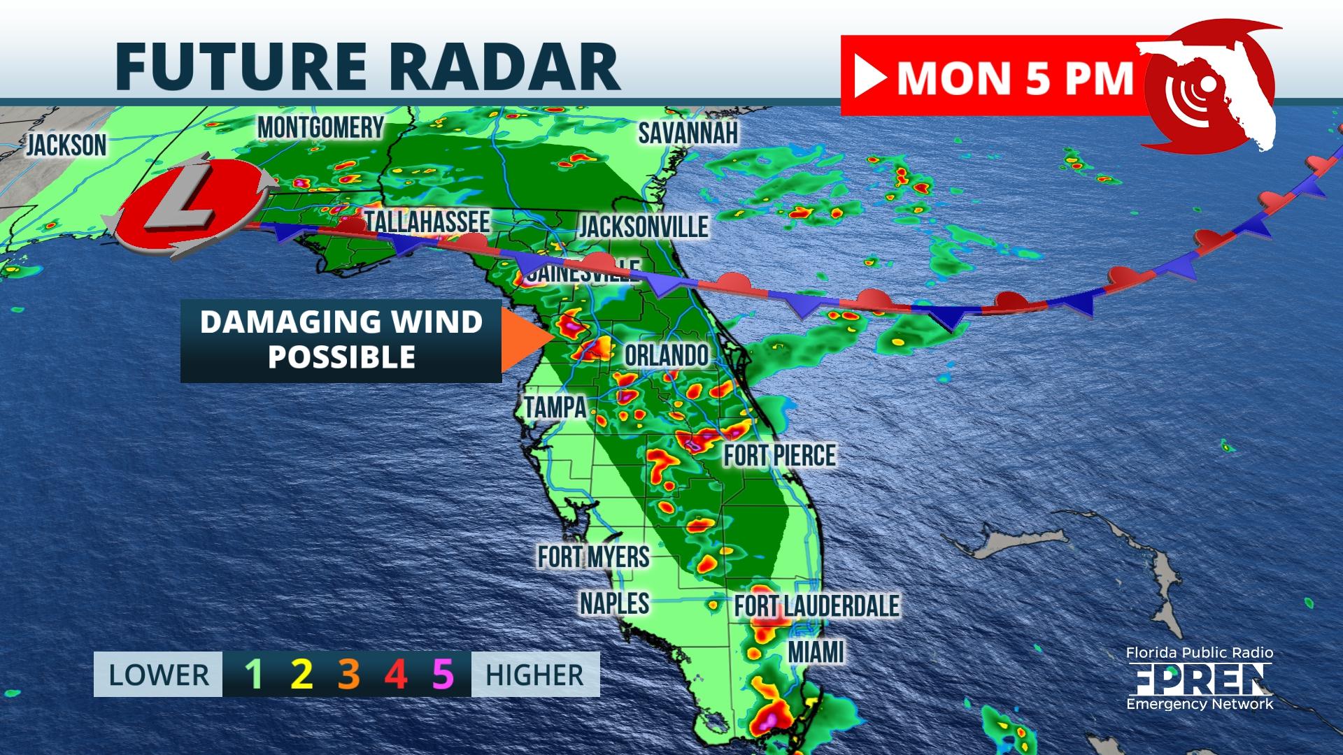
A slow-moving front and a developing area of low pressure will pull tropical moisture into the Sunshine State this week, resulting in a multiday flood threat.
Surface analysis Monday depicts a nearly stationary front straddling the Florida-Georgia border. This feature produced a few isolated severe thunderstorm warnings Monday morning and as daytime heating gets underway, this potential will expand across much of the state.
The nearby frontal boundary will work in tandem with routine sea breeze convection Monday afternoon to produce the risk of damaging winds and locally heavy rainfall. Dew point readings in the upper 60s to lower 70s will support the risk of localized flash flooding early this week, especially across North Florida where the flood risk peaks on Tuesday.
Model guidance suggests storms increase in coverage by early Monday afternoon, with storms likely to develop first along the First Coast and Space Coast. Storms are forecast to push inland by the mid-afternoon, arriving to the Interstate 75 corridor during the peak daytime heating.
The arrival time of storms coinciding with peak heating will result in the risk of severe storms mainly away from the immediate coastline, as indicated by the Storm Prediction Center’s outlook for Monday. The “marginal” risk of severe weather represents a 1 on a severe weather scale of 1 to 5 and means severe storms are likely to be more isolated in nature.
Storms able to tap deeply into the available instability will be capable of producing damaging winds. While the outlook Tuesday and Wednesday does not feature an official risk area in the state, a few strong storms are still possible through midweek given the available instability and nearby frontal system and low pressure area.
An influx of tropical moisture will increase the risk of localized flash flooding across much of the state through Tuesday. A “marginal” risk of flooding exists Monday, which is a 1 on a flash flood scale of 1 to 4 per the Weather Prediction Center. By Tuesday, this risk will increase to a “slight” across Northeast Florida, which is a 2 on the 1-to-4 flash flood scale.
The potential for flooding has prompted a Flood Watch from the Panhandle to the Nature Coast, where widespread rainfall totals early this week will likely fall between 1 and 3 inches, with locally up to 7 inches possible. As the slow-moving frontal boundary pushes toward Central Florida on Wednesday, rain chances in North Florida will drop to near average for late May.
All eyes will be on the potential development late in the week of a cutoff area of low pressure. Both American and European forecast models suggest this low pushes offshore by the upcoming Memorial Day weekend, resulting in the continued elevated risk of dangerous rip currents and coastal showers and thunderstorms.
This feature could require close monitoring into the weekend, as sea surface temperatures are well above average off the Southeast coast. Regardless of whether this feature takes on tropical characteristics, it is forecast to bring unsettled weather and dangerous surf to Florida’s east coast through the upcoming holiday weekend.
This week’s widespread rainfall should prove beneficial to drought-stricken areas of the state, with most of the state potentially receiving up to 3 inches of rain through Friday. Areas along the Gulf Coast under severe drought could unfortunately pick up the least rainfall through this week, with generally less than an inch forecast along the immediate coast.
The long-range pattern supports near-average rainfall chances and below-average temperatures. This verifies based on this week’s forecast, as statewide temperatures will be between 5 and 10 degrees shy of average.


