Published on April 27, 2023 at 1:18 pm
Free local news and info, in your inbox at 6 a.m. M-F. Sign up for the Jacksonville Today newsletter.
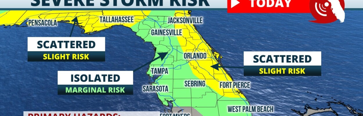
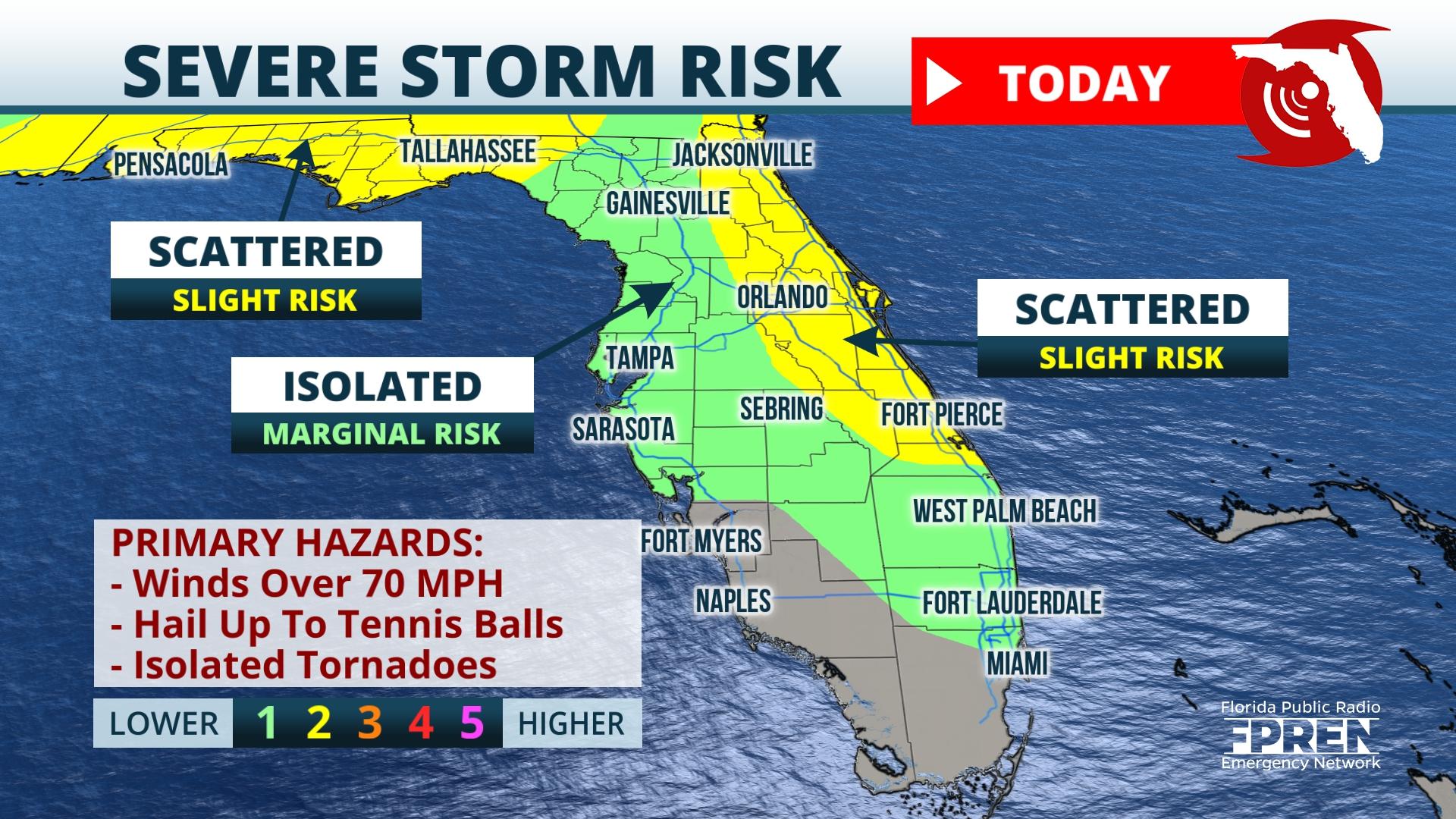
A thunderstorm watch has just been issued for Northeast Florida through 10 p.m. today.
Meteorologist Megan Borowski says storms are already bubbling up over the Florida peninsula and several lines of storm could affect our area tonight.
Jacksonville Today thanks our sponsors. Become one.
All modes of severe weather are possible around the state, including winds over 70 mph, golf ball-sized hail or larger, and isolated tornadoes.

.Widespread activity is expected today, and the Storm Prediction Center shows most of Florida — including Jacksonville — with a marginal to slight risk, meaning only isolated to scattered storms will hit severe levels. This also means although not everyone will see severe weather today, everyone has to be prepared.
The storm center is also forecasting severe weather risks for Friday and Saturday into possibly Sunday. Flash flooding will be another big concern with heavy rounds of rain moving over the same locations for several days. Most of the state will average 1 to 3 inches with localized areas picking up over 3 to 4 inches.

Jacksonville Today thanks our sponsors. Become one.
Threats for wind, hail and isolated tornadoes will continue Friday through the weekend. Stay weather aware and watch for that high water. Download the Florida Storms app to track the latest severe weather threats.Copyright 2023 Storm Center. To see more, visit Storm Center.
Copyright 2023 Storm Center.