Published on June 26, 2024 at 6:26 pm
The First Coast is home to some of Florida’s oldest roads and highways. Here is a look behind the development of five of Northeast Florida’s oldest roads.
The King’s Road

Originally a Native American trail paralleling the Atlantic Ocean, the King’s Road dates back to Florida’s 18th century period as a British colony. Stretching from the St. Marys River in Nassau County to south of Volusia County’s New Smyrna, the King’s Road was built with enslaved labor between 1765 and 1773 and named for King George III of the United Kingdom.
Jacksonville Today thanks our sponsors. Become one.
Where the road crossed the narrowest part of the St. Johns River became known as the Cowford. While the road had largely reverted back to wilderness by the time Florida became a United States territory, it was rebuilt by the United States Army between 1828 and 1831. Nearly 200 years later, portions of the 150-mile road still remain throughout the city, including Kings Road and Old Kings Road.
Dixie Highway

Constructed between 1915 and 1929, Dixie Highway was planned as an auto trail designed to connect the Midwest with the South. Carl Graham Fisher, an automotive industry magnate, owner of the Indianapolis 500 Speedway, and the developer of Miami Beach, was the highway’s primary early booster. Construction was overseen by the Dixie Highway Association. With the route marked by a red stripe with the white letters “DH,” the Dixie Highway helped fuel the real estate boom of the 1920s.
The road was eventually taken over by the federal government as a part of the U.S. Route system in 1927. Between Savannah and Jacksonville, U.S. Route 17 runs along the path of the Dixie Highway. Between Jacksonville and Miami, U.S. Route 1 runs along the path of the Dixie Highway. The Old Brick Road, located between Espanola and CR 204 near Hastings, is a brick section of the original Dixie Highway dating back to 1925.
Jacksonville Today thanks our sponsors. Become one.
Old Spanish Trail

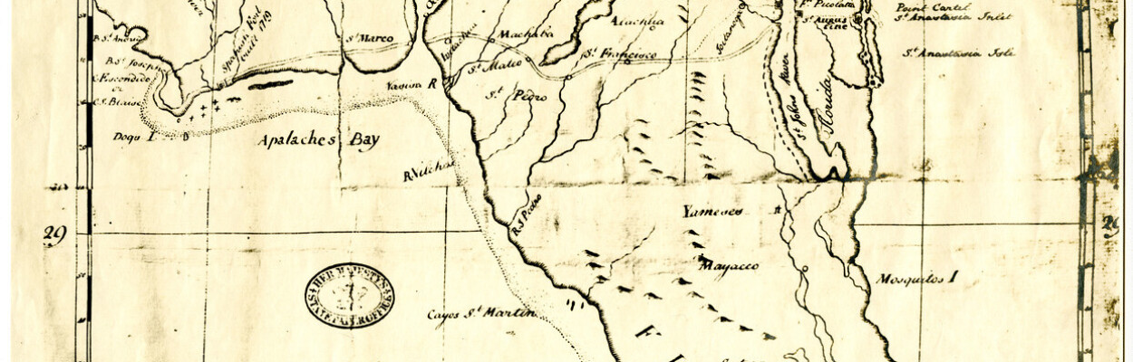
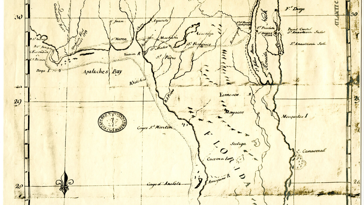
The Old Spanish Trail was an early 20th century auto trail that crossed eight states between Florida and California. An informal network of marked routes in the early 20th century, auto trails were intended to guide travelers during the early days of the automobile.
While promoters claimed the 2,750-mile route followed the path used by “Spanish Conquistadors” four hundred years earlier, much of the route was constructed after 1915. However, in Florida, it is believed that the 377-mile stretch was an authentic part of the original Spanish route built in the 16th century to connect the settlements of St. Augustine and Pensacola.
In 1927, most of the route between Jacksonville and San Antonio, Texas, was designated as U.S. Highway 90. In Jacksonville, Beaver Street is the historic local section of the Old Spanish Trail.
Bellamy Road

The Bellamy Road was the first federal highway in early Florida. Three years after Florida became a United States territory, Congress authorized construction on the road in 1824. Following existing Native American trails used by the Spanish to reach missions across the interior of Florida, the Bellamy Road stretched from St. Augustine to Pensacola. A large portion of the road was constructed by enslaved persons from John Bellamy’s plantation in Monticello. Completed in 1826, significant portions of the old road still remain in Clay County.
Originally an old Spanish trail from the San Luis Mission to St. Augustine. In the 1820s the Federal Government authorized an earthen road to be constructed from St. Augustine to Pensacola, with Tallahassee at its midpoint; this became the Old St. Augustine Road (still in use as a paved street in Tallahassee). The St. Augustine-Tallahassee leg of this road was constructed by a private contractor, John Bellamy; for this reason, the Old St. Augustine Road was also known as the Bellamy Road.
Talleyrand Avenue

Located in Jacksonville’s Eastside, Talleyrand Avenue stretches from Sports and Entertainment District north to Wigmore Street, just south of Longbranch Creek. Talleyrand Avenue was developed by New Yorker Jacob S. Parker in 1873 to connect Jacksonville to Panama Park. Originally a toll road, it was the second major paved street in Duval County.
Parker would go on to become the first mayor of the town of Fairfield, which was incorporated in 1882 at the southern terminus of the thoroughfare. The name of the street comes from the family of Charles Maurice de Talleyrand-Périgord, a French diplomat who brokered the Louisiana Purchase.