

heat-1494868_1280.jpg
Published on July 28, 2025 at 10:09 am
Free local news and info, in your inbox at 6 a.m. M-F. Sign up for the Jacksonville Today newsletter.
Heat advisories are in effect across North Florida with potentially dangerous temperatures that could feel like 115 degrees.
Highs will be between the mid to upper 90s across North Florida, Central Florida and the Panhandle, and several areas could set records.
Jacksonville Today thanks our sponsors. Become one.
The National Weather Service in Jacksonville warns of a heat index between 108 and 115 degrees.
Naples set a record high Sunday after the official local weather station hit 98 degrees. Tampa set an all-time record of 100 degrees on Sunday. (Records in Tampa go back 135 years.)
Contrary to what many coastal residents might be feeling, it is tough to reach 100 degrees near either coast of Florida. Coastal areas usually stay below 100 degrees due to sea breezes or onshore flow, while inland regions have time to warm up before the breeze arrives.


Jacksonville Today thanks our sponsors. Become one.
If they don´t develop storms, these winds warm as they travel over land, keeping the temperatures warmer. For example, Miami has reached 100 degrees only once, in 1942. Meanwhile, inland locations like Orlando have reached 100 degrees at least 20 times, and Gainesville has tied or exceeded this mark over 25 times.
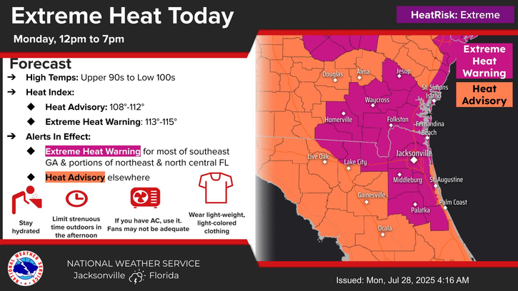
A heat advisory is issued when heat conditions are expected to reach a certain threshold, indicating that conditions could be potentially dangerous and may lead to heat-related illnesses if proper precautions are not taken.
An extreme heat warning is issued when dangerously hot conditions are expected, indicating a potentially life-threatening situation where heat stroke or other serious heat-related illnesses could occur.
If you need a place to keep cool, all of Jacksonville’s public libraries, community centers and public swimming pools are designated cooling centers. See the list. And JTA buses will take you to one for free if you tell the driver you’re going to a cooling center.
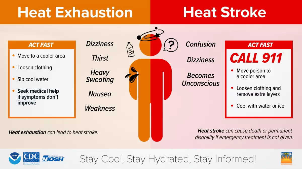
The heat exacerbates illnesses related to these extreme weather conditions. Make sure to drink plenty of water throughout the day. Do not wait until you are thirsty to drink water, as you could you could be dehydrated.
Limit your time outdoors, and take care of the elderly and kids, as they are more vulnerable to these extremely hot temperatures.
If you are outdoors, be sure to take breaks frequently in the shade or, even better, come indoors to air-conditioned areas.The heat continues through the last week of July.
When will the heat become … less intense?
Much of Florida will continue to experience heat advisories, with temperatures between 5 and 10 degrees above average at least through Thursday. The good news is that temperatures are on a gradual downward trend, slightly.
We are still in summer. But with the high-pressure system moving west, the winds will shift and a cold front will enter the Southeast, providing instability and allowing the sea breezes to return.
Across the Pandhandle, there is a chance for a low-pressure system to increase the storm activity on Tuesday night through Wednesday as it moves through. Storms are likely to move from east to west.
Central Florida will have a chance for storms each afternoon as sea breezes ignite storms, mainly after 2 p.m. Near-average storm chances are forecast for the rest of the week.
Southwest Florida will likely experience storm activity Tuesday and then drop to about a 30% chance of showers, below average for this time of year, for the rest of the week as a bit of Saharan dust returns to the area.
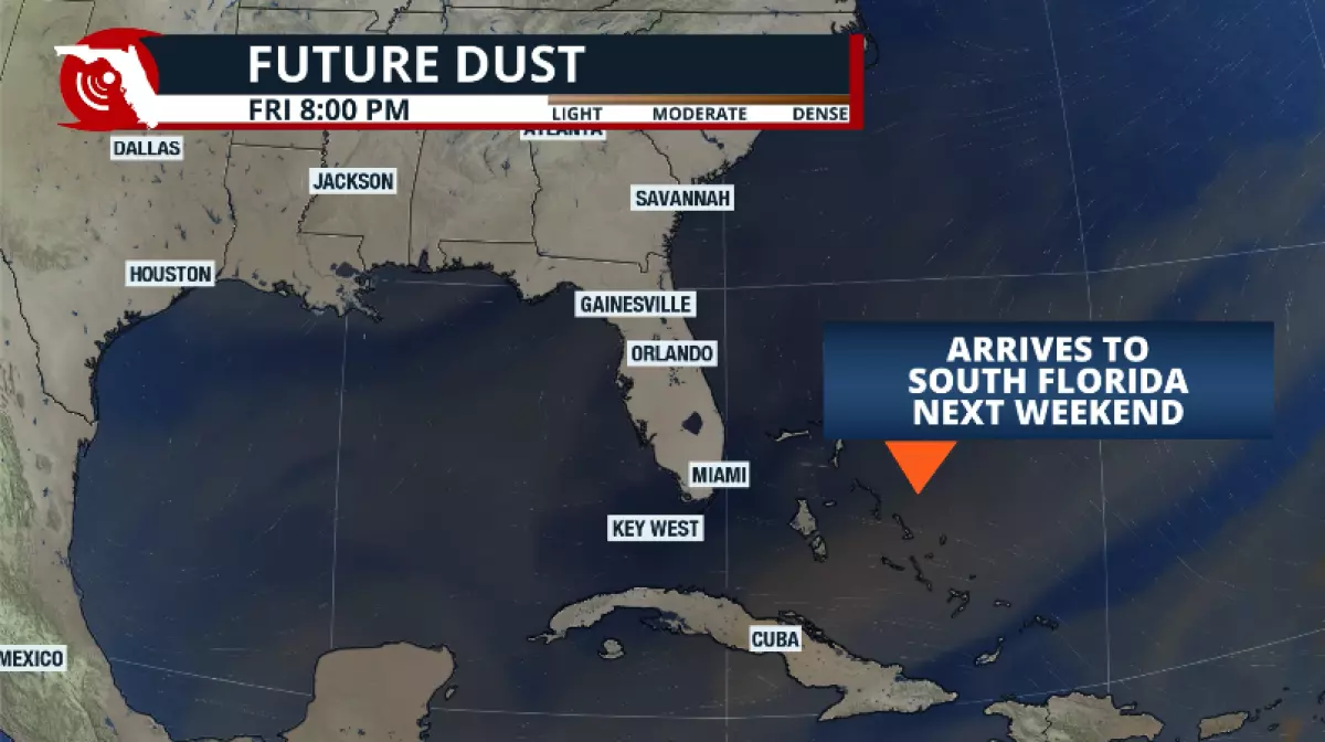
For South Florida, the Saharan dust is also dissipating, which will contribute to the slight decrease in temperatures. A thin layer of moisture could arrive in South Florida by Wednesday, which will keep rain chances to a minimum.
Tuesday appears to be the most active day for the Metro areas of southeast Florida, with some storms, but then rain chances drop to around 20% to 30% for the rest of the west.
The Keys could see more stray showers, but these are mainly due to pockets of moisture in the lower levels of the atmosphere and are unlikely to develop into significant storms.