
Published on November 10, 2025 at 10:34 am
Free local news and info, in your inbox at 6 a.m. M-F. Sign up for the Jacksonville Today newsletter.
A blast of unseasonably cold air is taking over Florida.
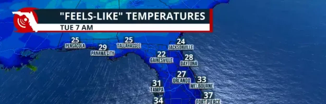
The cold front is expected to remain strong enough to sweep across the entire state, bringing frigid temperatures Tuesday morning. Veterans Day will be marked by temperatures that could be up to 20 degrees below normal in the morning and will also stay well below average for this time of year in the afternoon, and through much of the week.
Jacksonville Today thanks our sponsors. Become one.
The morning wind on Tuesday will make temperatures feel even colder.
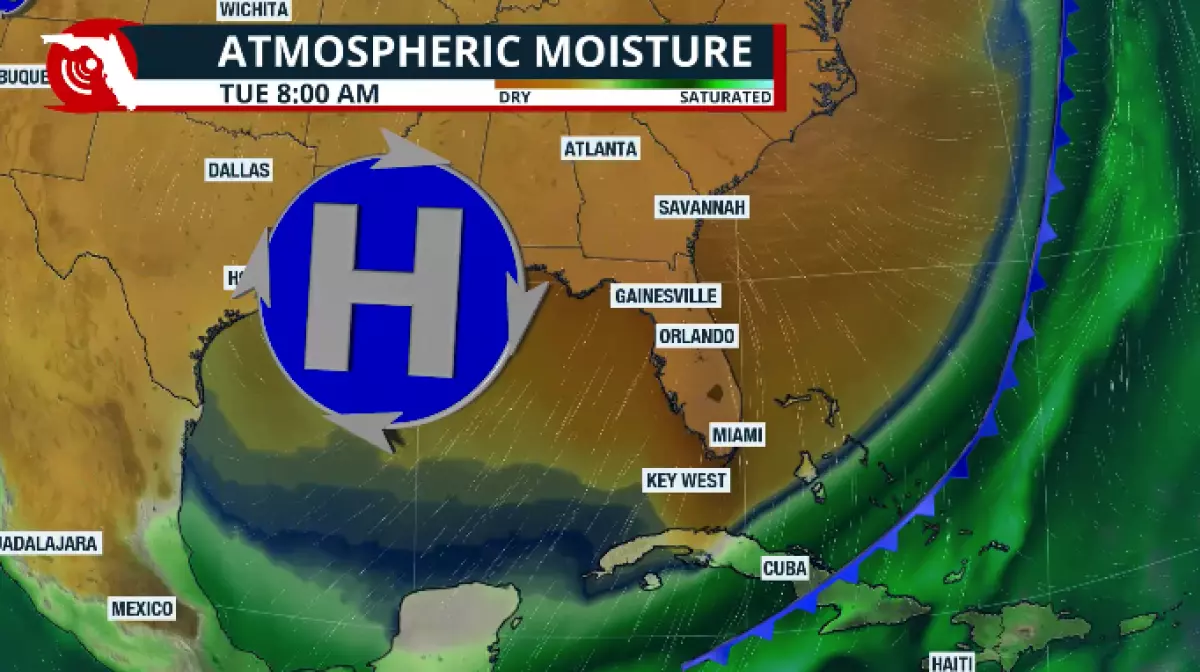
An arctic blast will continue to push across the southeastern United States. A pocket of frigid air will move into the southeast Tuesday, bringing record-low morning temperatures and cold afternoon highs.
Many locations have not experienced such a chilly Nov. 11 in over 100 years. This will definitely be the coldest temperatures we’ve had this season so far, and for many cities, it could be the most frigid temperatures since at least March 2025.

Jacksonville Today thanks our sponsors. Become one.
Temperatures turn cold
Freeze watches were in effect over the weekend across parts of the Panhandle, and a freeze warning was issued for southeast Georgia and portions of Greater Jacksonville.
Subfreezing temperatures are expected, with lows in the low to mid-20s across portions of the Panhandle, from the Interstate 10 corridor through Jacksonville.
Frost and freeze conditions could kill crops and other sensitive vegetation and possibly damage unprotected outdoor plumbing.
Appropriate action should be taken Monday night into Tuesday morning, as the cold temperatures could harm tender vegetation and outdoor pets. Young children, the elderly, and the homeless are especially vulnerable to the cold. Please take measures to protect them.
The temperature in South Florida will likely not drop below freezing. Still, it will stay very cold, especially given that these are the most frigid temperatures we’ve had in a while.
Temperatures across Central Florida will be in the mid- to upper 30s. Still, in parts of Orange County, Western Kissimmee, Sumter County and Lake County, temperatures could feel subfreezing for at least a couple of hours Tuesday morning.
Cross-sections of southwest Florida temperatures will remain around the mid-40s on Tuesday morning. At the same time, the Interstate 95 corridor between the Treasure Coast and Southeast Florida will stay between the upper 40s and low 50s. And then locations across Palm Beach County through Miami-Dade County will experience temperatures into the upper 40s.
When do we return to normal?
These temperatures will bounce back quickly. By Wednesday afternoon, temperatures will still be below average for this time of year, but not as cold or as likely to freeze as they will be on Tuesday morning across the other half of the state.
Highs by Wednesday afternoon will return to around the mid-70s across southeast Florida. They will remain below 70 degrees for Central Florida and North Florida, including the Panhandle.
The wind will slowly start to shift as the high-pressure system that will first provide northerly winds on Tuesday across much of the state will slowly shift over the state and then eventually east of the state, allowing the easterly wind to come in from the east, moderating the temperatures once again and bringing us closer to normal values for this time of year by the end of the week.